
Hiking Black Mountain Open Space Park
In the heart of rural San Diego there are over 2,352 acres of open coastal chaparral habitat rising over 1500 feet in elevation. This area is known as the Black Mountain Open Space Park. The park features nearly twenty-five miles of hiking trails and a peak similar to other peaks such as Cowle’s Mountain. The area is managed by the City of San Diego and is open every day from dawn to dusk.
Geologically, Black Mountain is part of an area called the Poway Quadrant. This area is known for a series of rocky peaks composed of volcanic and sedimentary rocks. These peaks make up several other popular hiking areas such as Mount Woodson (Potato Chip Rock) and Iron Mountain. The habitat surrounding black mountain is mostly coastal chaparral with a few riparian habitats that house more than 80 species of birds, mammals, and reptiles.
There are many hiking entrances available for hiking Black Mountain. This trail focuses on the nighthawk and miner’s ridge route which is 6.5 miles in length. The access point for this route begins in the Hilltop Community Park in Rancho Penasquitos. This is one of the longer ways up to the top of Black Mountain. Shorter options are available. For a complete list of trail entrances please check out the official trail map. For additional park information contact the County of San Diego at 858-538-8020.
On A Personal Note
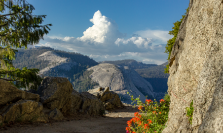
This hike is similar to most coastal peaks in Southern California. I’ve driven by this peak enough times that it was finally time for me to check out the views from the top of this trail. The longer trail options in this park make for some nice panoramic views surrounding San Diego County. From the top other nearby peaks can be seen such as Palomar Mountain and Cuyamaca Peak. On a clear day Catalina Island can be seen and during the winter months snow-capped San Gorgonio, San Jacinto, and Mount Baldy can be seen.
My trail distance ended up being longer than the posted distance. I thought that I could cut across the peak based off older map models. These trails have been closed and are no longer open. For more information please see the trail conditions tab.
Have you recently done this hike? Please post your photos in or leave an update to the trail conditions in the comments section.
- Overall Difficulty: 60%
- Overall Views: 70%
Black Mountain Peak Trail Quick Facts:
- Estimated Distance: 6.4 miles.
- My Distance: 7.1 miles.
- Total Elevation: 1,554 feet.
- Elevation Gain: 1,187 feet.
- Estimated Time: 2-4.5 hours.
- My Time: 2 hours 46 minutes moving; 3 hours 20 minutes total.
Black Mountain Peak Trail Directions:
Black Mountain Peak Trail Pictures:
-
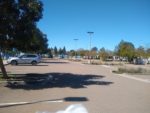
- The parking lot to Hilltop Community Park. Parking is quite ample but that could change based off any sporting events.
-
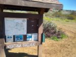
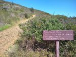
- Access for the nighthawk trailhead.
-
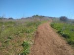
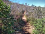
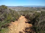
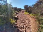
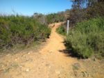
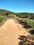
- Most of the trail is open. In the lower elevation the chaparral is more sparsely spaced.
-
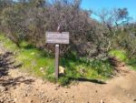
- The trail is clearly marked.
-
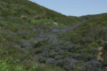
- Some blooming lilac seen from the trail. Large patches of purple are common during the spring.
-
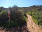
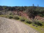
- Follow the trail to the right to end up on the miner’s ridge loop portion of the trail.
-
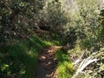
- This portion of the trail receives more shade so the chaparral is healthier.
-
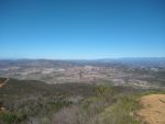
- Looking out towards Palomar Mountain from an opening on miner’s ridge.
-
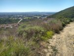
- One of the riparian areas on the northeast portion of Black Mountain.
-
- Follow the trail to the right to keep on track to complete miner’s ridge.
-
- You can take a route to the glider port but you will have to turn back on miner’s ridge. There is no peak access from the glider port.
-
- The trail leading up to the glider port.
-
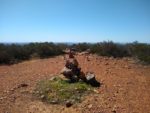
- The secondary summit/glider port.
-
- Black Mountain seen from the secondary summit.
-
- If you skip the secondary summit, miner’s ridge will take you back to the nighthawk. The nighthawk trail connects with the service road and leads to the peak.
-
- One of the final pushes past the service road to the top.
-
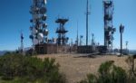
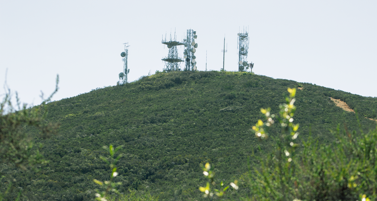
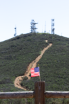
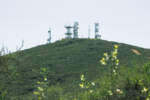
- The multiple towers seen from a distance a top Black Mountain.
-
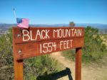
- A good spot for a photo op.
-
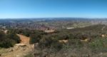
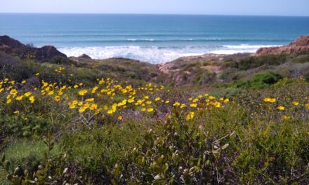
- Looking towards Del Mar and up and down the San Diego coastline. Catalina Island can be seen in the far distance.
-
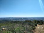
- Looking out towards Palomar Mountain. On a clear day the peaks of the San Bernardino Mountains and Mount Baldy can be seen.
-
- Looking towards downtown San Diego with Point Loma and the Coronado Islands in the distance.
-
- Heading back down the service road.
-
- Leading to some of the neighborhood heading back to Hilltop Community Park.
-
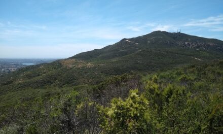
- The peak as seen from the miner’s ridge trail.
Who Black Mountain Peak Is For:
Advanced Hikers: For being so close to the city, the nighthawk and miner’s ridge trail is a good option for those who consider themselves advanced hikers. Black Mountain is a great city trail to check off the list of common San Diego peaks.
Expert Hikers: If you live anywhere near central San Diego County seeing this peak on a regular basis will undoubtedly draw you to hike this peak. Expert hikers won’t find this trail challenging by any means. However, it will leave you the satisfaction of completing a popular San Diego peak.
It’s always a good idea to be aware of what type of hiking level you’re at.
Best Time Of Year To Hike Black Mountain Peak:
During the summer, exceptionally hot days should be avoided on this trial. The distance is mild enough to do in the earlier hours or near dusk on most summer months. There is very little shade along the path.
It’s always a good idea to check the weather prior to hiking.
Black Mountain Peak Trail Conditions:
It is possible to hike Black Mountain in about three and a half miles. As mentioned, this trail focuses on the nighthawk and miner’s ridge route. This route is essentially formed by two loop trails for an approximate distance of 6.5 miles.
There are several older trails that wind through Black Mountain that are no longer useable. If you’re looking at the AllTrails app be sure not to think that you can shorten your route by taking a different route to the top. I thought that I could cut through the secondary summit and then go to the main peak after that. Those routes are no longer accessible. For this reason my actual trail distance was longer than what is posted as the trail distance.
On returning to Hilltop Community Park, this trail does wind through a neighborhood in Rancho Penasquitos. please be respectful of the people who live in the area.