
San Jacinto Peak is a beautiful out and back hiking trail in Southern California that offers willing hikers some of the most beautiful views that can be seen in this region. The out and back trail leading up to the peak is no easy feat but it will lead up to the second highest mountain range in Southern California.
Hiking Mount San Jacinto
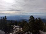
The San Jacinto Mountains are a series of several peaks nestled between Idyllwild and Palm Springs, California. The mountain range lies within the San Bernardino National Forest. The mountain range is the second tallest range in Southern California with San Jacinto Peak being the seventh tallest peak in the region. At 10,834 feet, the views from the top of the mountain can see as far as Catalina Island in the Pacific Ocean, far into the Sonoran Desert, and the Mountain Ranges Of San Diego. The peak looks down on all of Riverside County and has phenomenal views of the neighboring, San Gorgonio, San Gabriel Mountains (including Mount Baldy), Palm Springs, and The Salton Sea.
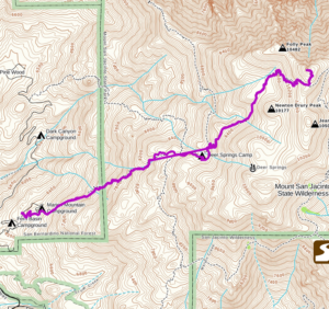
There are a few different routes up to the top of the peak. The shortest route to the top is up the peak’s eastern flank via the Palm Springs Ariel Tramway. There are also a number of backpacking routes that will lead to the top including a section of the famous, Pacific Crest Trail. This article is about the route up San Jacinto’s western side via the Marion Mountain Campground. This route is approximately thirteen miles of pure bliss that will give hikers bragging rights that they hiked up Southern California’s second tallest mountain range without taking a tram.
San Jacinto Peak History
Finding out history about the peak is almost as difficult as hiking this trail itself. I’m not exactly sure of how the range or peak got it’s name. However the name in the region originated from San Jacinto Rancho. This place was a ranch near the San Luis Rey Mission in Oceanside, California. Earliest recordings of the ranch date back to the early 1800’s. The name comes from the Spanish name, Saint Hyacinth. The most notable one was the Polish Saint Hyacinth in the 12th century who become a Dominican missionary.
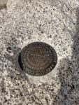
In 1901 the San Jacinto name became engraved in writing by the United States Geological Survey. These days the mountain range is managed by two different agencies: The United States Department Of Agriculture and the California State Park system. This trail leading up to the peak crosses through both the San Bernardino National Forest and the California State Park system. Hence, you’ll need an Adventure Pass or America The Beautiful Pass and a Wilderness Permit.
Once those are both secured, you’ll have your fill of oak and conifer forests, incredible views, and the opportunity to see some of Southern California’s most rare wildlife from bears, cougars, deer, and beautiful birds of prey (note: I did not see any).
On A Personal Note:
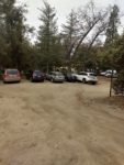
I found the parking situation to be a little difficult and several websites have outdated information out there. In the past, there was a quota for hiking up to the top. However, that is now outdated. There is no quota for hikers aiming to get to the top of San Jacinto. However, a Wilderness Permit is still required in order to hike this trail. Much like Cucamonga Peak, a Wilderness Permit can be picked up near the trailhead.
I honestly got a little confused when figuring out this permit situation. Here’s the deal:
- A permit can be picked up and filled out at the Fern Basin Campground 24/7 (see trail directions below).
- You either need an Adventure Pass or an America The Beautiful Pass to park at Marion Campground
My confusion was at the $10 fee that was required at the Fern Basin Campground when I filled out my Wilderness Permit. Shortly afterwards I figured out that Marion Campground was a short distance down the road. While I’m out $10, it was a learning experience and hopefully you won’t do it based off of my experience.
Have you hiked this trail recently? Please updates and/or pictures in the comments section below.
- Overall Difficulty: 100%
- Overall Views 100%
San Jacinto Peak via Marion Mountain Campground Trail Quick Facts:
- Elevation: 10,834 feet.
- Elevation Gain: 4,508 feet.
- Estimated Distance: 13.4 miles.
- My Actual Distance: 11.3 miles.
- Estimated Time: 7-10 hours.
- My Time: 6 hours 52 minutes (moving), 8 hours 45 minutes total.
San Jacinto Peak via Marion Mountain Campground Trail Directions:
Click here for driving directions. The actual parking lot for the trailhead to San Jacinto Peak is in a dirt parking lot just shy of the actual Marion Campground. This property is on National Forest land so you will either need an Adventure Pass or an America The Beautiful Pass. Now, here’s the tricky part: the forest inside the San Jacinto area is managed by two different agencies.
Part of the trail is managed by the National Forest Service and the other part is managed by the California State Park system. So, that means, in addition to the America The Beautiful Pass, you’ll also need a Wilderness Permit. These permits are free, there is no quota, and you can fill this out the day of the hike. The easiest place to obtain one is at the Stone Creek Campground. This campground is right at the base of the same road for Marion Campground. Fill it out, tear off the carbon copy and leave one at the registration site, and keep the other with you at all times.
The parking lot for Marion Campground is at six thousand feet elevation. During the winter months, it’s not uncommon for there to be snow here after a major winter storm. If you’re doing this hike during events like that, check the local traffic conditions to see if chains are required.
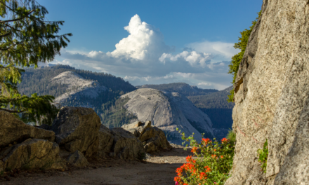
San Jacinto Peak Pictures:
-
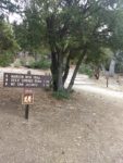
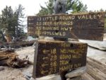
- Some noteworthy signs before heading out.
-
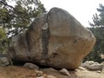
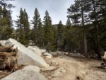
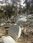
- There are some incredible granite boulders on the way up.
-

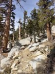
- The start of the ascent.
-
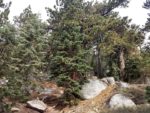
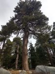
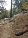
- Much of the lower portion of the trail starts out with beautiful conifer forests.
-
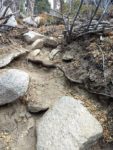
- Much of the lower portion of the trail consists of dirt/granite rock trails.
-

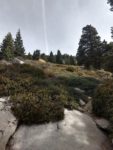
- A portion of this trail does bottom out before the final push to the top via a series of switchbacks. This area is a pleasant meadow with a campsite known as Little Round Valley.
-
- Little Round Valley.
-

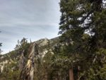
- Facing westward along much of the trail up.
-
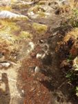
- This trail does get snow, so any old ice on the trail can make for muddy conditions.
-

- As the trail gains in elevation, conifer forests give way to a mix of pine and Manzanita landscape.
-
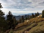
- Facing to the north of some of the trail views.

-
- The push up to the top of the peak is a series of switchbacks. The trail begins to get more exposed as the forest thins out here.
-
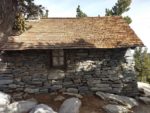
- This is an emergency shelter put in place for hikers that may become stranded in a storm. It’s fit with supplies and can bunk several people.
-

- Just leave it in better condition than you found it.
-
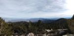
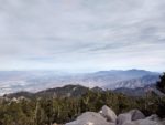
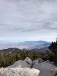
- Views from higher up looking west.
-

- There is a trail junction here that meets up with the trail from the Palm Springs Ariel Tram.
-
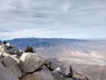
- Ah, the top!
-
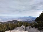
- Looking northwest towards Mount Baldy and the San Gabriel Mountains.
-
- Looking north to Palm Desert and San Gorgonio Mountain.
-

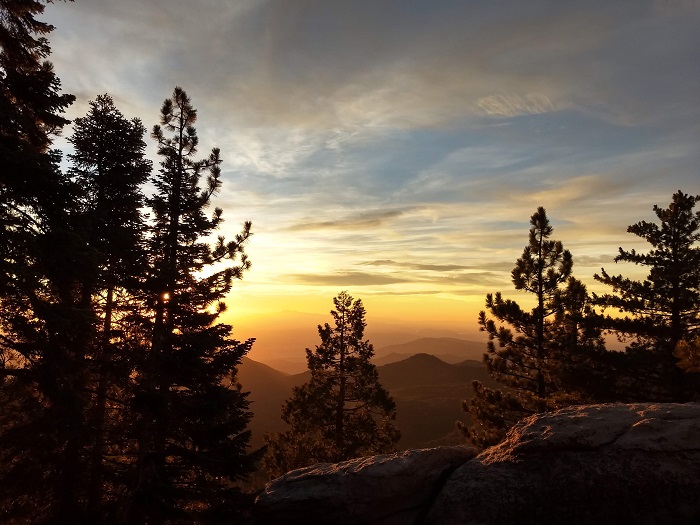
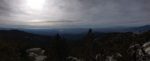
- San Jacinto offers up some incredible sunsets.

Who San Jacinto Peak Is For:
Novice Hikers: I do not recommend this trail for new hikers. This trail is long, steep, high in elevation, and has quite a bit of elevation gain in the short distance up. This peak can have variable weather conditions that can at times, be quite treacherous.
Advanced Hikers: This is a great hike for those who consider themselves advanced. This is a type of trail that will set you apart from other hikers. While it’s not the tallest peak in Southern California, it will still give you bragging rights. Heck, hiking up this trail skipping the aerial tram will bring you a sense of accomplishment in itself. This trail is not easy. So please have some hiking experience under your belt and a pretty good baseline level of physical fitness.
I would recommend having hiked some trails of similar caliber before this to get a feel for the elevation. If there is ice or snow on the top of the peak, I would not attempt this trail without some sort of winter mountain experience. In the very least, go with someone else who has had it if you do go. People have died on this trail, so use caution.
Expert Hikers: San Jacinto Peak is a perfect hike for expert hikers to experience some of the best views that can be seen in Southern California.
It’s always a good idea to be aware of what type of hiking level you’re at.
Best Time Of Year To Hike San Jacinto Peak:
The best time of year to hike San Jacinto Peak depends on what exactly you’re looking to get out of it. This is an area of Southern California that experiences all for seasons. If you don’t check the weather before this hike, you could potentially have a bad time.
Winters can frequently be below freezing. Because of the amount of orographic lifting and elevation of this mountain, this peak can be particularly sensitive to winter storms passing by. When other parts of Southern California are sunny, there could be winter like conditions at the summit. Snow is not uncommon at the peak during the winter. Cold, windy days can be common.
Spring can be cold but later into the spring ice generally melts at the peak making the trail easier. Temperatures start to become more mild than the colder winter months. At the trailhead it’s not uncommon for temperatures to be in the sixties and then near freezing at the top. Laying is a must on this hike.
Summer months can be quite hot at the base of the trailhead. This mountain also separates a coastal climate from the Sonoran Desert. Because of that, any sub-tropical moisture during the monsoon season makes this area susceptible to thunderstorms. In the afternoon storms can pop up out of nowhere and bring flash floods, winds, hail, and lightning.
Fall is my recommended time of year to hike San Jacinto Peak. After the summer months have passed, temperatures start to cool. Fall foliage starts to develop. The winter storms to the north generally haven’t started having an effect here yet. The mild weather make this peak a perfect time to experience it in the Fall.
San Jacinto Peak via Marion Mountain Trail Conditions:
The majority of the trail that makes its way up to San Jacinto peak is composed of loose granite rock and loose soil. The only exception to this is near the peak. The very last 0.3 miles or so consists of a little bit of boulder scrambling/hopping up to the peak. In the lower elevations of the trail there is a mix of both oak and conifer forests. The oak eventually gives way to just pine forests. As the elevation gains the undergrowth thins out and the trails become more exposed. On certain portions of the peak the trail winds through beautiful patches of Manzanita shrub.
Little Round Valley Campground
A couple miles from the peak the trail does bottom out and reaches a short flat portion. This area is known as the Little Round Valley Campground. It’s a great spot for backpackers to post up as there are several campsites including a composting bathroom located here. From this site, the trail features a series of switchbacks up the rest of the mountain. The switchbacks lead to where the trail intersects with the Palm Springs Aerial Tramway Trail. Here the trail gets a little more crowded where you’ll meet with other hikers who weren’t wanting to make the full trek.
San Jacinto Peak Emergency Shelter
About 0.3 miles from the peak of San Jacinto there is a stone emergency shelter. This shelter was built by the Civilian Conservation Corps many years ago. It’s purpose is to provide an emergency place of shelter to those who may need it if rough weather arrives. The shelter is large enough to bunk several people if need be. It’s also stocked with enough provisions to last until rescuers arrive if need be. All that’s asked of people is that they leave it in better condition than they found it.
San Jacinto Peak
The actual peak itself is quite small and you’ll have to be patient for your photo opportunity with the famous San Jacinto Peak sign. Right below the peak there is plenty of room to post up, rest, and enjoy a snack and the views. San Jacinto Peak has some of the most beautiful views in Southern California that I’ve ever seen.
On the day that we hiked, we were able to see as far as Catalina Island. The view was amazing. To the south you’ll have incredible views that look past the mountain ranges of San Diego. Out to the east you can see the Salton Sea, out to Joshua Tree National Park, and across the Sonoran Desert. To the north you’ll have incredible views of San Gorgonio. Straight out to the west you’ll have beautiful views of Mount Baldy and the rest of the San Gabriel Mountains. At the base of the peak you’ll have views of Riverside County, Lake Hemet, and as far as Santiago Peak in the Irvine Mountains.
As a reminder, rattlesnakes can commonly be seen along portions of this trail. Poison oak will probably only be seen on the lower portions of the trail.
