
Different Ways To Check the Weather Before Hiking
Whether or not a person considers themselves a novice or an expert hiker, one thing that’s wise for everyone to do is to always be prepared for the weather. This post will share different strategies hikers can use to determine what the weather will be like during a hike.
Tips On Getting Accurate Trail Weather Information
Being aware of what kind of weather conditions will be encountered is part of Hiking #101. It’s also great to try to have some kind of knowledge about the physical conditions of a trail. At times certain trials could be damaged after torrential rains or covered in feet of snow. Whatever the case may be, changing weather and trail conditions can dictate what kind of clothing need to be worn and what kind of other accessories may need to be brought along. Below are six simple and very practical ways hikers can find out accurate weather and trail information.
1. A Simple Weather Search
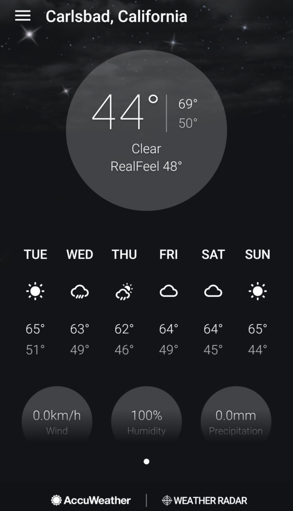
If the climate is very straight forward (like most of the year in Southern California), then a simple weather search is all that is usually needed. Try a weather service like The Weather Channel, AccuWeather, or Weather Underground from your mobile phone or computer.
Pro Tip: Don’t just pay attention to the high and low temperature of the day. Many weather services offer an hourly weather forecast. Looking at the hourly weather can save a person from uncomfortable hiking conditions in excessive heat during the middle of the day. It can also help prepare for changing weather or colder morning conditions.
2. Check The Forecast Area Discussion
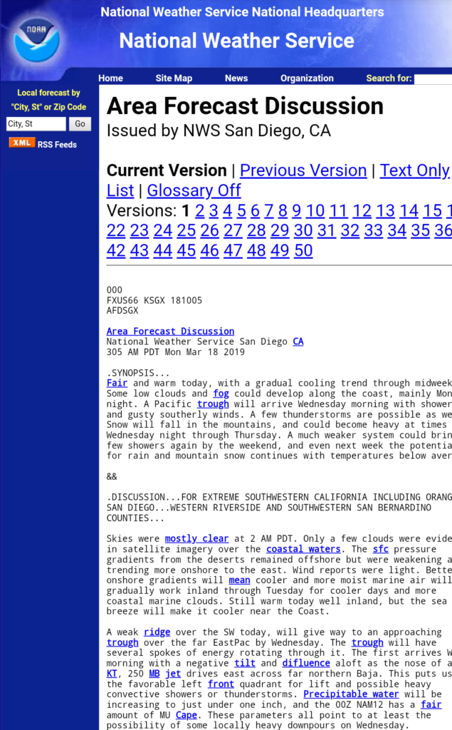
One of the best ways to get an accurate and detailed weather forecast is to check the Area Forecast Discussion or AFD. An AFD is put out by the National Weather Service and is the forecast for which weather apps on your cell phone get their weather from. Why not get a better forecast straight from the source?
Pro Tip: Checking an AFD is my favorite way of viewing the weather report. I find cell phone weather forecasts to be inaccurate and the AFD put out by the National Weather Service paints a better overall picture.
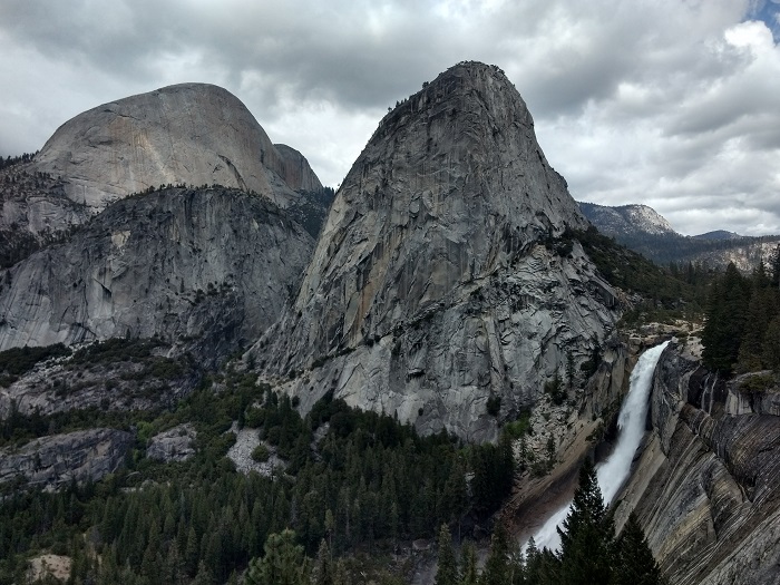
AFD’s are based on region. The specific region I use most frequently is the San Diego National Weather Service AFD. The easiest way to find an AFD near you is to Google the city of your projected area followed by National Weather Service Forecast Discussion. For example: “Yosemite Valley National Weather Service Forecast Discussion.”
3. Visit Mountain Forecast
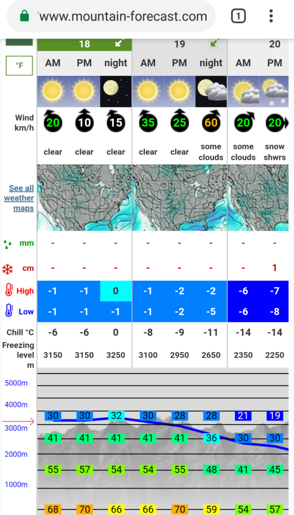
Hiking a peak? I highly recommend Mountain Forecast. This website provides weather forecasts for over 11,000 (and growing) summits including temperature intervals at different elevations, hourly weather forecasts, and wind speeds.
Pro Tip: There are times when a trail will have different weather at different elevations. This website is my go to weather site if I’m planning on hiking a peak. Their forecasts help me to plan ahead for what the weather will be like at different elevations through the hike. If you can’t find a specific peak, search for a nearby one to get a similar weather forecast.
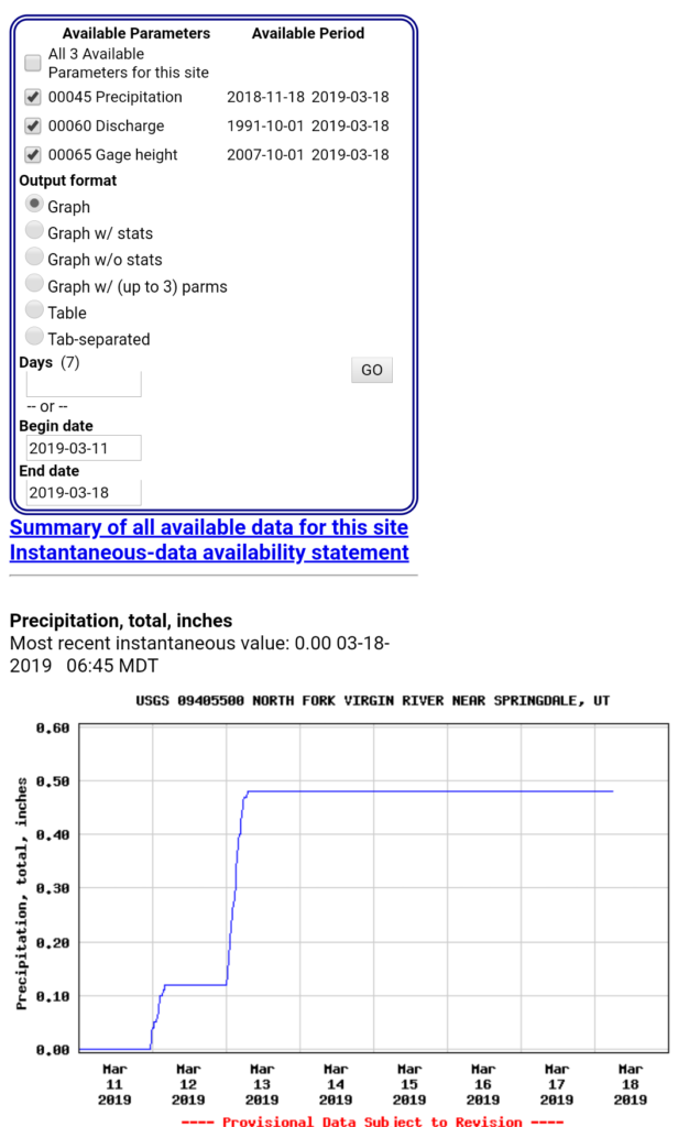
4. Check The USGS Current Water Data
If the hike includes a trail through a river such as that like The Subway in Zion National Park, check the USGS Current Water Data. The USGS monitors certain rivers for their flood stages. If water levels are too high, consider another trail.
Pro Tip: The easiest way to find a location is to search with the map function on the USGS website. Simply select the geographical location and try to find the creek, stream, or river you’ll be going through.

5. Search A Hashtag
Searching trails or peaks by hashtags are a great way to find current trail conditions. For example, a severe storm could’ve just gone through the area making the trail difficult to hike. Using a hashtag on Instagram can help provide recent pictures of a peak/trail conditions as well as connect you with others who recently went on the trail for tips or advice.
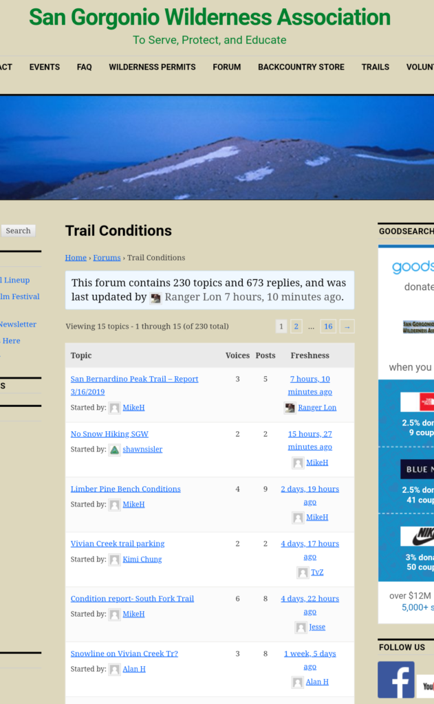
6. Try A Forum
Sometimes you might need a little more information than a hashtag can provide. Some locations have forums that offer tips as well as recent trail conditions. Two examples of this are Whitney Zone and the San Gorgonio Wilderness Association. People regularly post trail conditions to trails as well as hiking tips in these forums.P
Pro Tip: The easiest way to find a forum for an area is just with a little bit of research on Google. I came across these two while going through a search to find out more information about trails.
Knowing Trail Weather
Being aware of the weather forecast and any potential weather hazards can help one properly prepare for a hike. As demonstrated in this post, there are several ways to go about figuring out what the weather will be like. Knowing ahead can also help with planning what kind of gear to bring along.
After working in critical care for several years, I have seen first hand hikers who have needed to come into the emergency room after a failure to prepare for the conditions. Sometimes it’s best to avoid hiking altogether during excessive heat, extreme cold, or stormy weather conditions. Don’t let yourself be caught unprepared.
What other ways do you check the weather before going hiking? Share them in the comments section below.


