
Cuyamaca Peak Hiking Trail Guide
San Diego isn’t exactly known for having much of a winter. However, during a handful of times throughout the year, San Diego’s tallest peaks can get a moderate amount of snow. The mountain locations also receive ample amounts of rainfall. The location and elevation of these mountains provides for experiencing San Diego’s full four seasons.
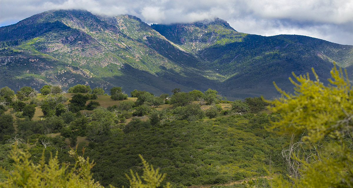
Sitting at 6,512 feet, Cuyamaca is San Diego’s second tallest behind Hot Springs Mountain near the small town of Warner Springs. The peak is located in Cuyamaca Rancho State Park within the Cleveland National Forest and the highest point in the Cuyamaca Mountains. There are a few different ways to hike to the top of Cuyamaca Peak. For the purpose of this article, the hiking guide focuses on the route via the Azalea Glen Loop Trail. This route is the most common route and also part of the Southern California Six Pack of Peaks.
There will be some pretty indredible views from the top of the peak. The coastline of San Diego can be seen as well as the Coronado Islands off of northern Baja California. The desert of Anza-Borrego extending eastward to Arizona and northern Baja can be seen. Other ranges such as San Gorgonio, San Jacinto, Mount Baldy, Palomar, and Volcan Mountain can also be seen. Across the street is another fun hike, Stonewall Peak.
CUYAMACA RANCHO STATE PARK HISTORY
Altogether there are 24,700 acres of land and over one hundred miles of hiking trails in Cuyamaca Rancho State Park. The history of this state park predates any European settlers. For thousands of years the Kumeyaay band of Native American’s utilized the fresh water springs and abundance of food in the area.
It wasn’t until the late 1700’s when the first Spanish Conquistdors started to arrive to the region. For decades native Kumeyaay resisted missionization and were reluctant to give up their independence. By the mid-1800’s land was sold of by the Kumeyaay and few of the native people’s remained in the area.
In 1869 gold was discovered and quickly led to a gold rush in the area. A series of mines were constructed and several the remnants can stili be seen while hiking today. Financial problems eventually led to the closures of the mines by 1906 and the area continued as a mountain resort for several years.
In the 1920’s a capitalist by the name of Ralph Dyar bought the ranch with plans for the development of a resort on Lake Cuyamaca. Luckily for the sake of preservation, The Great Depression ended the bid for a lakeside hotel. Instead, Dyar sold the land to the State of California for its newly developed State Park System. In 1962 the area officially was inducted into the State Park System.
On A Personal Note
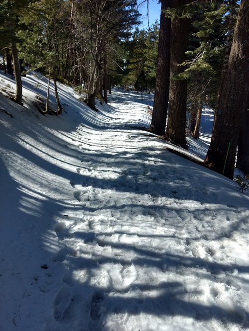
Cuyamaca Rancho State Park is fun to explore and the views from the top of the peak are hard to beat in the county. The trail can be fun to explore while there is snow on the ground. I caught this trail after a winter storm had blown through. The snow higher up on the trail gave a pleasant winter vibe not often experienced in San Diego.
Generally speaking, this area is a good place to view much of San Diego’s wildlife including mountain lions, deer, coyotes, and various raptors. Keep in mind, this trail is in a state park. There is a parking located behind the park gate as well with an entrance fee. Camping is also available. Additional information can be found in the trail directions.
Do you have an update to the trail conditions or any pictures that you want to share? Please post them in the comments section.
- Overall Difficulty: 70%
- Overall Views: 85%
Cuyamaca Peak Quick Facts:
 Elevation: 6,565 feet
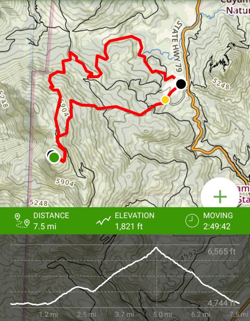
- Elevation Gain: 1,821 Feet
- Estimated Distance: 7.7miles
- My Actual Distance: 7.5 miles
- Estimated Time: Three hours
- My Time: 2:49
Cuyamaca Peak Trail Directions:
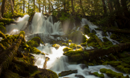
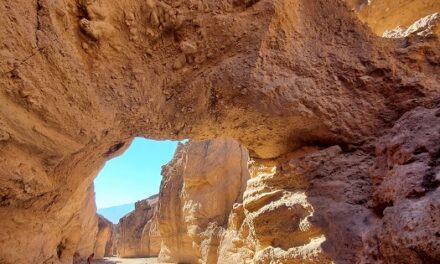
Cuyamaca Peak Trail Pictures:
-
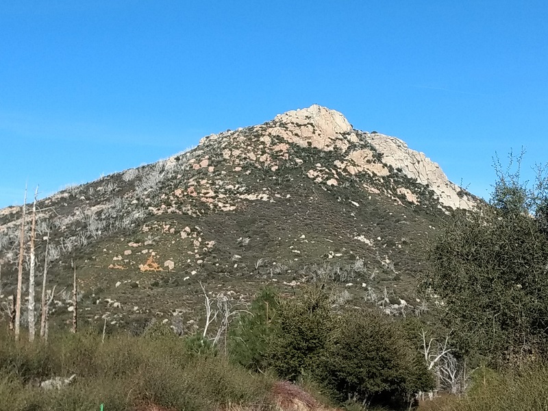
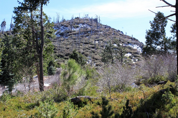
- The of Stonewall Peak from across the way.
-
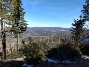
- Looking towards the north.
-
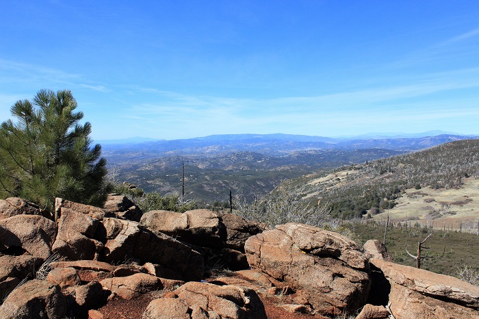
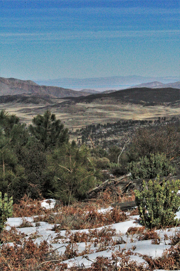
- Looking north towards Palomar Mountain from near the top.
-
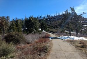
- The trail eventually turns into a utility access road.

-
- Looking out towards the Northeast.
-
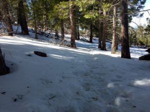
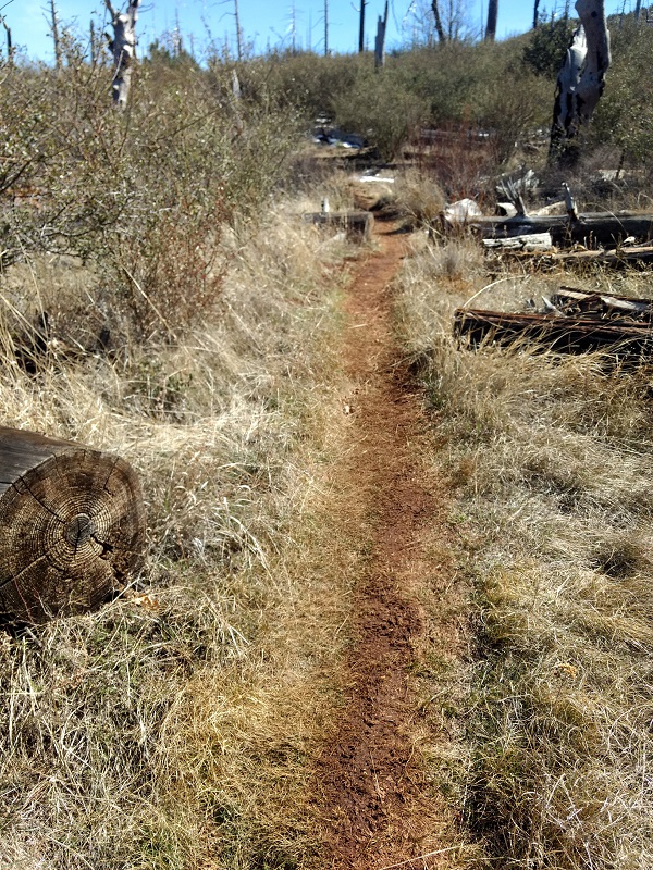
- Snow completely covering the trail.
-
- The top of Cuyamaca Peak.
-
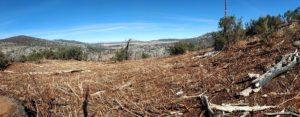
- Looking east to the Salton Sea.
Who Cuyamaca Peak Is For:
Advanced Hikers: For advanced hikers this is a perfect hike. The length of the trail will leave you feeling accomplished but not completely gassed. For advanced hikers looking for a more difficult challenge, try the Arroyo Secco and West Mesa Trail.
Expert Hikers: This trail will be a moderate workout but the views will still be very enjoyable. There is a fourteen mile peak option via Arroyo Secco and the West Mesa Trail if you’re up for a longer day and more of a challenge.
It’s always a good idea to be aware of what type of hiking level you’re at.
Best Time Of Year To Hike Cuyamaca Peak:
Temperatures stay mild until summer gets under way. During the summer months temperatures can be hot if you’re not off the trail by mid-morning. Summer also brings the threat of thunderstorms. If you hear thunder seek shelter to avoid being caught in the open while lightning is present. By the time fall comes around temperatures cool down again. The portion of the trail near campground does offer an opportunity to see some fall colors.
It’s always a great idea to check the weather before a hike.
Cuyamaca Peak Trail Conditions:
The way I took was the Cuyamaca Peak Loop. The trailhead starts in the parking lot and makes a right onto the Azalea Glenn loop. The loops goes to the right to the Conejos Trail and eventually meets up with the fire road which takes you to the top. The Cuyamaca Peak loop descent is along the utility road and is much quicker than the way up.
The trail is reportedly moderately trafficked, although I only saw four people on a Tuesday during the middle of the day. That being said, the trail is maintained and in great condition. Rattlesnakes can be seen during the warmer months. Poison oak may be possible in some of the shadier portions of the trail that receive the most rainfall.
