

Hiking Boucher Trail and Palomar Mountain Loop
If you do enough hiking through the San Diego valleys and mesas, you will eventually notice that after a while things start to look the same. That is until you come to Palomar Mountain State Park. Palomar Mountain offers up scenery that not too many San Diego areas have. Much of the Palomar Mountain Range is over 5,000 feet (6,140 at it’s highest point) and gets rainfall similar to some areas of the Central Sierra Nevada mountain ranges. The generous yearly rainfall allows Palomar Mountain to offer up forests full of conifers, green meadows, and annual wildflowers.
Palomar Mountain State Park has approximately 1,862 acres and over 11 miles of trails for people to explore, camp, fish, and relax in. There are several trail systems within the park, but for the purpose of this article I’ll be talking about the Boucher Trail and Palomar Mountain Loop. These trails travel through eight plus miles of the park, interconnects many of the park’s smaller trails, and takes hikers through many of the park’s main features.
Palomar Mountain Fun Facts
Palomar Mountain was referred to Sierra de Palomar by initial Spanish colonists to the area in the late 1700’s. In my opinion, the small mountain range is one of San Diego’s most beautiful areas. One of the park’s highlights that I highly recommend to people is to check out the Boucher Hill Fire Lookout Tower. The tower was initially constructed in 1935 and has since been rebuilt two other times. The neat thing about it is that if the tower is currently being staffed, they will be more than happy to take visitors on a small tour of the area. At 5,400 feet in elevation the views are stunning.
On a clear day a person is able to see downtown San Diego, the rest of San Diego’s mountain ranges, the San Gabrieal Mountain ranges of Los Angeles, the San Bernardino Mountains in Riverside, Catalina Island in the Pacific, and the Coronado Islands off the coast of Mexico.
On A Personal Note:
Boucher Trail and Palomar Mountain Loop are also a great way to see some of San Diego’s beautiful wildlife and plants. The amount of rainfall that Palomar Mountain receives is enough for mixed conifer pine forests. In the spring beautiful wildflowers and green grassy meadows are abundant. The luscious plant life also attracts a healthy bird population with bald eagles in recent years, mule deer, foxes, coyotes, bobcats, snakes, and even mountain lions.
Palomar Mountain is definitely one of San Diego’s areas that experiences four different seasons (by Southern California standards). During autumn leaves will put on an amazing display of typical fall colors. I highly recommend hiking Boucher Trail and Palomar Mountain Loop. For more information about hiking, camping, and fishing, please check out the park’s website. On a side note: with the exception of service dogs, dogs are only allowed on paved paths.
Do you have any updates to the hiking trail or want to share your hike/pictures? Please leave a comment below.
- Overall Difficulty: 65%
- Overall Views: 100%
Boucher Trail and Palomar Mountain Loop Quick Facts:
- Elevation: 5,461 feet.
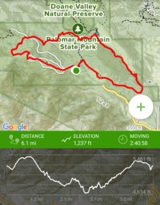
- Elevation Gain: 1,237 feet.
- Estimated Distance: 8.7 miles.
- My Actual Distance: 6.1 miles.
- Estimated Time: 2-4 hours.
- My Time: 2 hours 40 minutes moving. 2 hours 29 minutes total.
Boucher Trail and Palomar Mountain Loop Directions:
Although Palomar Mountain is in the Cleveland National Forest, the state park operates independently of the U.S. Forest Service. For that reason, and adventure pass or America The Beautiful Pass is not accepted here and you will need to pay the $10 daily park fee. On arrival to the visitor center, pick up one of the park pass envelopes, insert your cash, fill out the required information, tear off a slip and put the slip in your car, and return the envelop to the cash box.
Boucher Trail and Palomar Mountain Loop Pictures:
-
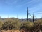
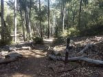
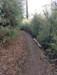
- Starting out near the parking lot – old burn scars from prior wild fires.
-
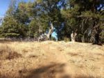
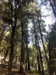
- Heading up along Boucher Trail to the fire tower.
-
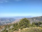
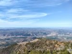
- Beautiful views looking west.
-
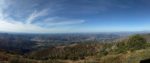
- A panoramic view of the coastline.
-
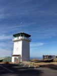
- Boucher Hill Fire Lookout Tower. Tour this if you have the opportunity.
-
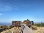
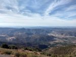
- A great vantage point with informational boards about the surrounding views.
-
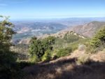
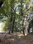
- Headed away from Boucher Hill towards the Cedar Grove Campground.
-
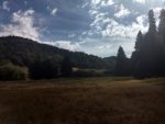
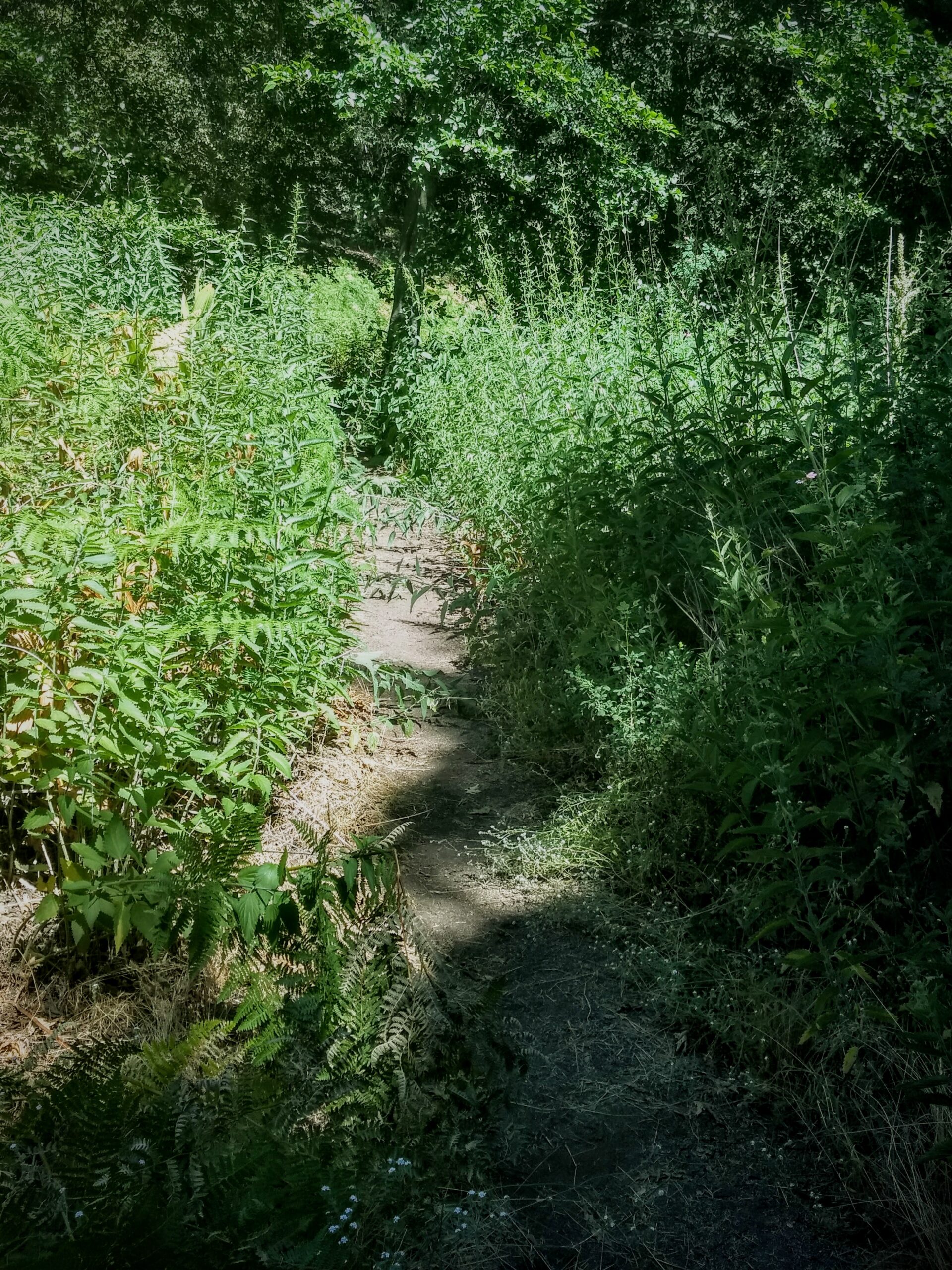
- Headed through the many meadows that Palomar Mountain has to offer.
-

- Doane Pond in Doane Valley – where you can camp, fish, hike, and enjoy the views.
-
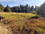
- Headed through the meadows of Doane Valley.
-
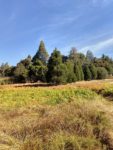
- Near Doane Valley
-
- Headed up out of Doane Valley
-
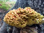
- During the fall, keep an eye out for interesting fungus on the trees.
-
- Keep an eye out on the trails for poisonous plants such as this: stinging nettle.
-
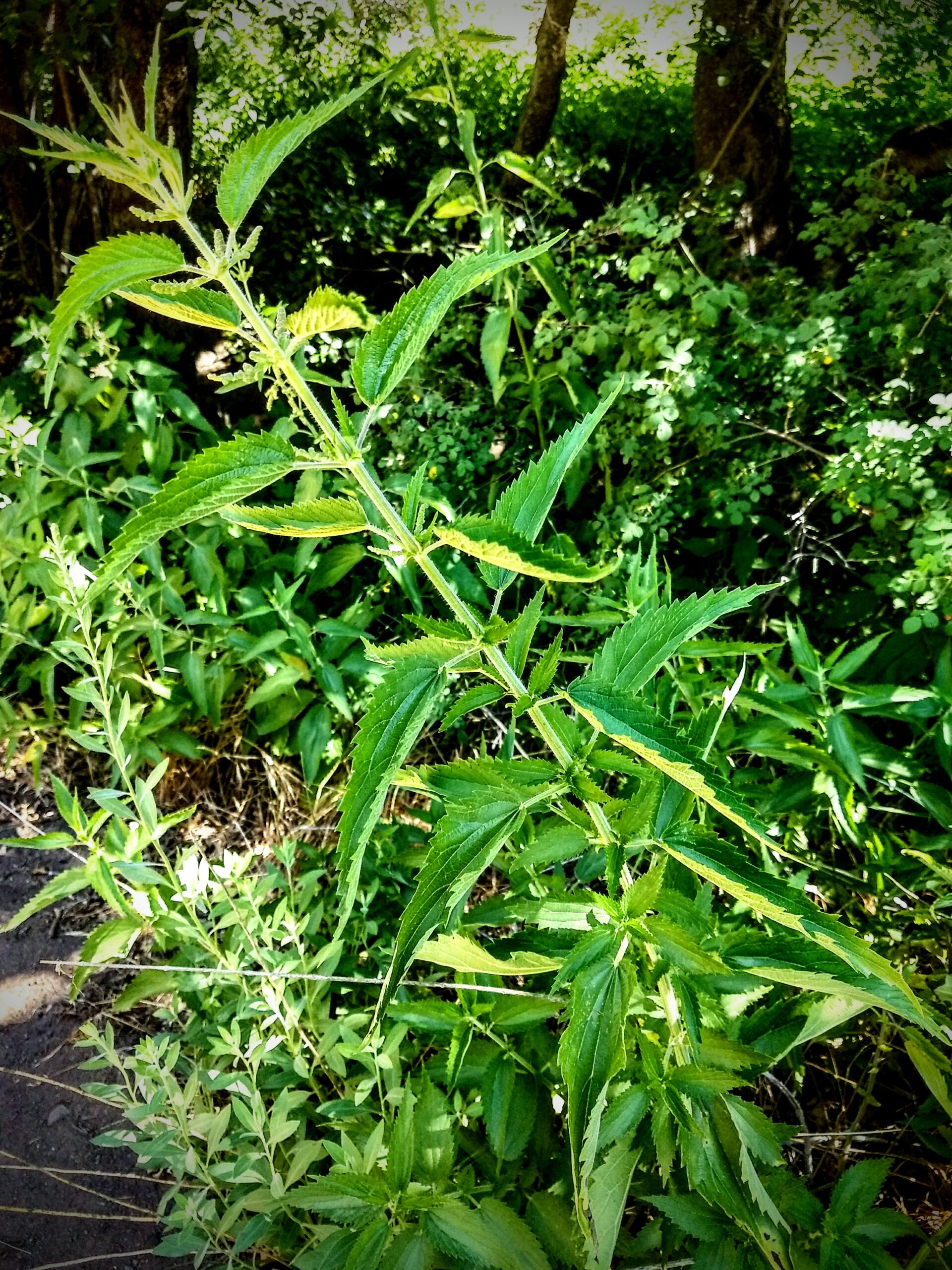
- Stinging nettle.
Who Boucher Trail and Palomar Mountain Loop Is For:
Advanced Hikers: This is a beautiful loop trail that I would highly recommend to all advanced hikers. The park is beautiful and should not be missed if you’re exploring San Diego’s hiking trails.
Expert Hikers: Same.
It’s always a good idea to be aware of what type of hiking level you’re at.
Best Time Of Year To Hike Boucher Trail and Palomar Mountain Loop:
Fall: Fall can be a beautiful time in the park. The higher elevation will cause the hot summer temperatures to give way to cool mornings and evenings with mild day time temperatures. The amount of fall color that can be found here compared to other parts of San Diego County is plentiful. Many areas of the park are rip with shades of orange, red, yellow, and brown.
Winter: Winter can be a beautiful time to experience winter-like conditions in Southern California. It’s not uncommon for winter storms to bring up to a foot of snow per storm to the peak. Don’t get caught in winter conditions if you’re not prepared, but definitely check out the trails after a recent snowfall.
Spring: Spring can give way to abundant green budding plants, green meadows, and spring wildflowers. Local birds and animals will likely be found enjoying the fresh new growth.
Summer: Summers have a tendency to be mostly mild in the higher elevations but there can still be weeks of hot temperatures. Use caution when hiking in the heat and be prepared to skip it on days where temperatures are over 100 degrees. With that said, the park’s meadows often stay green well into the summer. This area also can also receive thunderstorms during the summer. Summer rainfall can lead to lasting green and second wildflower blooms. However, use caution in thunderstorms for harsh weather and seek shelter in the event of lightning. As a general rule of thumb, check the weather before you go hiking. Summer can have incredibly hot days and winter can have winter weather. Fall can bring high winds during Santa Ana events.
Boucher Trail and Palomar Mountain Loop Trail Conditions:
From the parking lot to the Northwest (to the left) along Boucher Trail which continues to Boucher Lookout. Boucher Lookout is where the fire tower is located. Here you can have some jaw dropping views of Southern California including Mount Baldy, Catalina Island, Coronado Islands in Mexico, and San Gorgonio Mountain. If the tower is staffed, they will happily take you on a tour and explain a brief history about the tower and point out notable views.
From the lookout, Boucher Trail continues to the north along a ridge and eventually crosses Nate Harrison Grade Road. Here the trail turns into Adams Trail and continues through a grove of conifer down to the Cedar Grove Group Campground. Follow Adams Trail through the Cedar Grove until it becomes the Cedar Trail which eventually leads to Doane Pond.
Doane Pond is a small pond that offers people the opportunity for trout fishing. Here you have two options: you can continue to the north on the Doane Valley Nature Trail which is a small loop in itself or turn to the south on the Thunder Spring Trail. The nature trail will take you through more meadows and the Doane Valley Campground. Whichever way you chose, you’ll end up back on the Thunder Spring Trail to complete the loop.
While you’re along the Thunder Spring Trail you’ll continue through more meadows and cedar groves. As you walk through this area, any elevation that was lost on the way down into the valley will be gained. The trail continues to the Chimney Flats Trail and back to the main parking lot.
Things To Look Out For
Keep an eye out for poison oak – it is commonly seen along the trails. I highly recommend not to touch anything green if you’re not familiar with what poison oak looks like. Stinging nettle also grows along some of the portions of the trails through the meadows. I walked into this on accident myself and experience it’s burning, stinging sensation.
With plenty of smaller game animals like squirrels and rabbits in the area, that means there is plenty of food for rattlesnakes. Be watchful for snakes along the trails. If that’s not enough, don’t exclude the possibility of coming across a mountain lion. But do know that attacks are extremely rare. If you’re interested in exploring the park’s trail map to explore smaller portions of the trails, check out their brochure.