
Hiking San Gorgonio Peak via Vivian Creek
For all serious hikers, San Gorgonio Peak represents the alpha and the omega of all trails in Southern California. At over eleven thousand feet, the way up to the top of the peak offers a challenging yet incredible day hike. The wilderness in which San Gorgonio lies gives hikers the opportunity to see some of Southern California’s rarest wildlife like bears and mountain lions. The peak also offers backpackers an excellent training ground for higher elevation or long distance trails. There are a couple known routes of getting to the top. The shortest route is through the Vivian Creek trailhead and is the one this article will focus on.
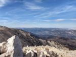
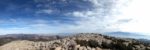
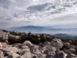
The actual peak of San Gorgonio lies within the San Bernardino Mountains and is part of the San Gorgonio Wilderness and the San Bernardino National Forest. From the top of 11,503 feet, on a clear day a person can see far into the Colorado and Mojave Deserts, the southern mountain ranges of San Diego, The San Gabriel Mountain Ranges of Los Angeles, and Catalina and San Clemente Island in the Pacific Ocean. Because of the high altitude, San Gorgonio is usually capped with snow and ice for a few months during the winter. In fact, it’s white capped peak can easily be seen from as far away as Mexico and Mount Whitney.
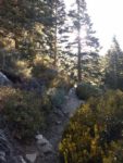
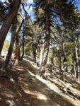
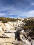
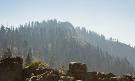
Hikers willing to take on San Gorgonio Peak will experience some beautiful terrain throughout the trail. The trail starts off with a mix of oak and chaparral forests before giving way to dense conifer forests. As the trail increases in elevation, conifer forests thin to a barren sub-alpine surface along the mountains broad peak. In fact, the peak is the only mountain in Southern California to show signs of glaciers from the previous Ice Age. The enormous structure of the mountain also draws in quite a bit of yearly rainfall. Along the trail hikers will experience three creeks suitable with water suitable for drinking at Vivian Creek, Halfway Camp, and High Creek.
San Gorgonio Camping
There are a few different camping sites to choose from: Vivian Creek Camp, Halfway Camp, and High Creek Camp
. To my knowledge, it’s also possible to set up camp at San Gorgonio’s actual peak as well. All three campsites are near sources of water. The water source for Halfway Camp is approximately two hundred yards prior to reaching the camp. These camp sites make San Gorgonio peak a popular training grounds for those seeking backpacking experience. Please make note to not camp within 200 feet of a water source.
For those that are seeking to backpack this trail and plan on staying overnight, a wilderness permit is required. Additional camping and permit information can be found through the San Gorgonio Wilderness Association who issues wilderness permits. Day hikers to San Gorgonio Peak do not need a wilderness permit. What’s required of all visitors who use the Vivian Creek Trailhead parking lot is either an Adventure Pass or an America The Beautiful Pass for being inside the San Bernardino National Forest.
On A Personal Note:
I hiked San Gorgonio Peak on a Fall day prior to any major snow storms. This peak was one of the hardest trails I had ever been on. Once the trail became more barren around 10,500 feet or so the effects of the altitude were painstakingly obvious. I could definitely feel my body working harder to push to the top of the peak. I was more prepared with enough water and food but looking back, I probably should’ve eaten more. We had salty snacks but I probably also could’ve benefited from a Gatorade to replace some lost potassium. Don’t underestimate the amount of nutritional requirements for this trail.
I would not recommend this peak for anyone who hasn’t done a hike of similar caliber in a day. Take into consideration the amount of daylight in a day. Winter days can be short. My fiance and I spent an hour and a half hiking down in the dark. We were also prepared for that possibility by carrying flashlights. For me the worst part of the trail was the 1,000 foot elevation loss at the end of the trail. After hiking all day the elevation loss in just one mile was tough on the knees. For those not wanting to make the trek up to the actual peak because of elevation or other various reasons, the Vivian Creek Trail can still be a beautiful trail to experience even if it’s not the whole thing.
Have you hiked this trail recently? Please updates and/or pictures in the comments section below.
- Overall Difficulty: 100%
- Overall Views 100%
San Gorgonio Peak via Vivian Creek Trail Quick Facts:
- Elevation: 11,503 feet.
- Elevation Gain: 5,449 feet.
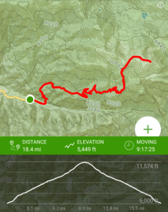
- Estimated Distance: 17 miles.
- My Actual Distance: 18.4 miles.
- Estimated Time: 9-12 hours.
- My Time: 9 hours 17 minutes (moving), 11 hours 37 minutes total.
San Gorgonio Peak via Vivian Creek Trail Directions:
Click here for driving directions. Parking for the Vivian Creek Trailhead is near the very end of Falls Road. The parking lot is a decent size with a restroom. I have read that it can fill up at times so it’s best to parking there early in the mornings. Otherwise street parking will have to be found. We got there right at sunrise and had plenty of parking. The rest of Falls Road is closed to the residents in the area. From there you’ll have to start your hike from the parking lot down Falls Road along Mill Creek to the trailhead.
This property is on National Forest land so you will either need an Adventure Pass or an America The Beautiful Pass. For those who are doing overnight backpacking trips, you will need to contact the San Gorgonio Wilderness Association to obtain a Wilderness Permit.
San Gorgonio Peak via Vivian Crreek Trail Pictures:
-
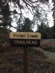
- There is a descent sized parking lot at the trailhead to hiking this trail.
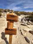
-
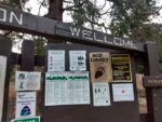
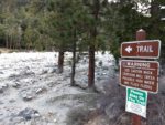
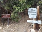
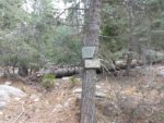
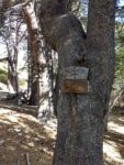
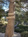
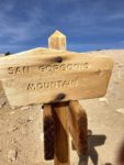
- Some visitor information.
-
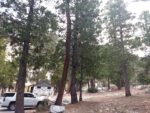
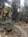
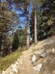
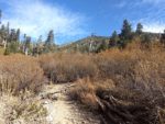
- The beginning of a very long day.
-
- The first part of the Vivian Creek trail leads up a small dirt road for local residents.
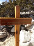
-
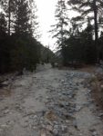
- Cross here along the flood plain.
-
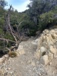
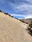
- At the end of the flood plain you’ll be greeted with 1000 feet elevation gain in about one mile.
-
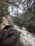
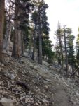
- The switchbacks going up out of the canyon.
-
- Looking down into the Vivian Creek parking lot where the trailhead is.
-
- The top of the switchbacks.
-
- The trail takes a sharp left and leads along Vivian Creek for a bit.
-
- Vivian Creek is one spot to tank up on water for those with proper supplies.
-
- Wrapping a round to the east in some nice meadows out of Vivian Creek. I spotted a deer near here.
-
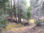
- Nearing one of the other campsites. This area is along a small creek and the last place to tank up on water.
-
- Headed through the campground.
-
- After the campground there are a series of switchbacks leading up to a ridge.
-
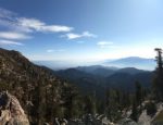
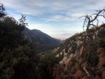
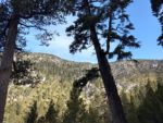
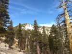
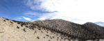
- At the top of the ridge there are some incredible views of San Jacinto Peak.
-
- San Jacinto Peak in the distance.
-
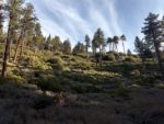
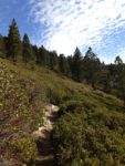
- At the top of the ridge the forests begin to thin.
-
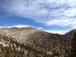
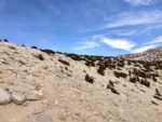
- As you climb the terrain starts to look more familiar of San Gorgonio’s bare peak.
-
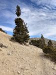
- At this point the thin air made the the hike seem harder and harder as it took more energy to move.
-
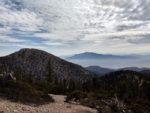
- Much of the trail cuts across the side of the ridge that leads to the peak.
-
- A view of the trail cutting across the ridge.
-
- Looking up as the trail leads higher.
-
- Here the trail intersects with another one. These are good markers to remember for the way back to ensure you take the right course back down.
-
- From here the trail heads straight east and winds to the top of San Gorgonio.
-
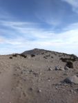
- Almost there; looking at the peak.
-
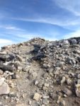
- Finally at the peak.
-
- Looking to the northwest you can see Big Bear Lake in the distance.
-
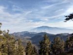
- Looking to the west with Mount Baldy in the far distance.
-
- Achievement.
-
- Looking directly to the east towards Coachella Valley.
-
- Looking towards the south with San Jacinto again in the distance.
Who San Gorgonio Peak via Vivian Creek Is For:
Advanced Hikers: This is a great hike for those who consider themselves advanced hikers. However, I do not recommend this hike for hikers that have not been on a trail of similar caliber to this one. I highly recommend spending some time on hikes above ten thousand feet to see how your body handles elevation. Please also make sure you’re in decent shape because this hike is very difficult in one day. Do not do this hike if you’re not prepared to do significant miles. I recommend hiking some other trails that are part of the Six Peak Challenge to work yourself up to this trail.
Expert Hikers: Hiking San Gorgonio is a perfect peak for those that are on the higher end of advanced hikers or consider themselves an expert hiker. This is a great trail for those who are seeking some backpacking experience. For those looking for winter mountaineering conditions, winter can be a great time of year to do this trail.
Please read up on the best time of year to hike this trail.
It’s always a good idea to be aware of what type of hiking level you’re at.
Best Time Of Year To Hike San Gorgonio Peak:
Winters can frequently be below freezing. Because of the amount of orographic lifting and elevation of this mountain, this peak can be the most sensitive of all Southern California mountains to winter storms passing by. When other parts of Southern California are sunny, there could be winter-like conditions at the summit. Snow and ice are not uncommon at the summit during the winter. Cold, windy days are common. Because of the elevation, snow and ice can last for a few months near the peak even into early summer. Only those with adequate winter gear should attempt this hike during those times.
Spring can be cold but later into the spring ice generally melts at the peak making the trail easier. Temperatures start to become more mild than the colder winter months. At the trailhead it’s not uncommon for temperatures to be in the sixties and then near freezing at the top. Laying is a must on this hike.
Summer months can be quite hot at the base of the trailhead. This mountain also separates a coastal climate from the Sonoran Desert. Because of that, any sub-tropical moisture during the monsoon season makes this area susceptible to thunderstorms. In the afternoon storms can pop up out of nowhere and bring flash floods, winds, hail, and lightning.
Fall is my recommended time of year to hike San Gorgonio Peak. After the summer months have passed, temperatures start to cool. Fall foliage starts to develop. The winter storms to the north generally haven’t started having an effect here yet. The mild weather make this peak a perfect time to experience it in the Fall. Please take into account the shorter fall days during this time of year. Be prepared for doing hiking in the dark. Layering is a must on this trail. Even during summer the peak can be below fifty degrees.
San Gorgonio Peak via Vivian Creek Trail Conditions:
Vivian Creek Campground
The first portion of the trail aims at taking hikers to the Vivian Creek Campground from the trail’s head. From the parking lot the trail winds through a dirt road for about a mile. This road passes through residents in the area so be respectful. At this point the actual Vivian Creek Trail begins and you’ll need to cross a flood plain from Mill Creek. I’m not sure how big the flood plain gets but it is very wide. Use caution if an extreme amount of water is in the creek. The trail crossing was faint and a hard to follow but it’s a straight shot to the other side.
What I found to be one of the most difficult portions of the hike was right after crossing Mill Creek. From here the elevation rises 1,000 feet in about one mile to a ridge line above Mill Creek. This ridge line takes you directly into the San Gorgonio Wilderness and from this point, a permit will be required for those staying overnight. From here the trail heads to the left and soon you’ll hear Vivian Creek and come across Vivian Creek Campground.
Half Way Camp
After Vivian Creek, the trail heads to the east. One and three tenths miles later you’ll come across Half Way Camp. This is another camping spot. There is a water source from a creek about two hundred yards prior to the camp.
High Creek Camp
From Half Way Camp you’ll start a series of switchbacks that lead you up to High Creek Camp. This camp is two and three tenths of a mile past Half Way Camp. Prior to reaching High Creek Camp you’ll likely hear High Creek taking a plunge over a cliff – it’s an obscured waterfall but it is viewable if you’re ambitious enough. High Creek Camp is the last source of water and the last camp for those who are planning to summit San Gorgonio Peak.
Summiting San Gorgonio Peak
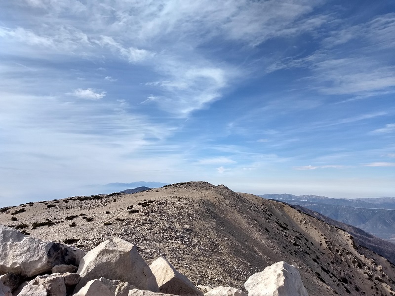
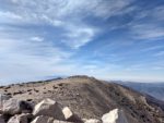
The summit of San Gorgonio is a long and bare summit about three miles past High Creek Camp. Immediately after the camp, you’ll begin a series of switchbacks that lead up out of the canyon and along a ridgeline. When the ridgeline bends to the north you’ll have some amazing views directly across to San Jacinto Peak. As you come out of High Camp you’ll also notice that the forests begin to thin and the terrain begins to get sub-alpine in nature.
After about a mile past High Creek Camp is when I started to feel the effects of high altitude slow me down. The effects were noticeable on other people as well. I felt my body having to work harder and harder to cover the same amount of distance and my hike time slowing. As the ridge continues, you’ll notice a peak littered with scarce trees. You may think that this is the peak but it is not and it’s only there to mess with your mind and psyche. Once you’re out of the tree line completely, you’ll start getting your first glimpses of the barren peak of San Gorgonio. The trail at this point cuts across the eastern side of the mountain. This is where Vivian Creek Trail eventually meets up with other trails. Pay attention to the signs as you don’t want to miss Vivian Creek on the way down. From here it’s about a half mile with a light amount of elevation gain to the peak.
Enjoy The Peak
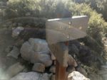
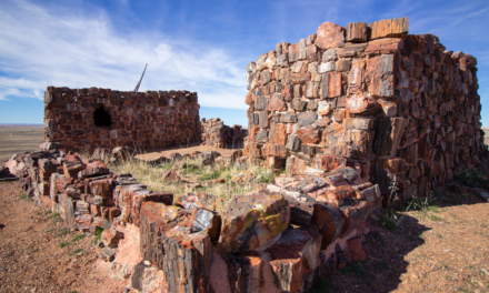
San Gorgonio Peak is quite long with several wind shelters at the top. The true peak is marked by a USGS Benchmark. There’s also a wooden sign to take pictures with and a registry box. Many people including myself like a celebratory beverage at the top of peaks such as this. Use caution, there was a ranger at the top and I’ve read stories about people being cited for drinking alcohol. Drinking alcohol is prohibited and can result in a fine. We waited until the ranger was gone then celebrated hiking the tallest peak in Southern California. Enjoy 360 degree views of Southern California. It’s the only Southern Californian Peak that can be seen from Mount Whitney.
Wildlife On San Gorgonio Peak
The San Gorgonio Wilderness is an very wild place as far as Southern California goes. It’s certainly possible to experience all of Southern California’s big wildlife here including bears and mountain lions. While we did not see either of those, we did see Mule Deer and a Bobcat. As a reminder, rattlesnakes can commonly be seen along portions of this trail during hotter months and in the lower elevations. Poison oak will probably only be seen on the lower portions of the trail in meadows and near water sources.