
Cowles Mountain Trail Guide via Barker Way
If you’re ever done any type of hiking in San Diego County, you’ve undoubtedly heard of Cowles Mountain. Located in Mission Trails Regional Park, this mountain is the tallest point in the City of San Diego. However, at 1,593 feet, this mountain resembles more of a coastal hill than anything else. Despite that, there is no question that this hike is one of, if not the most popular hikes in the city.
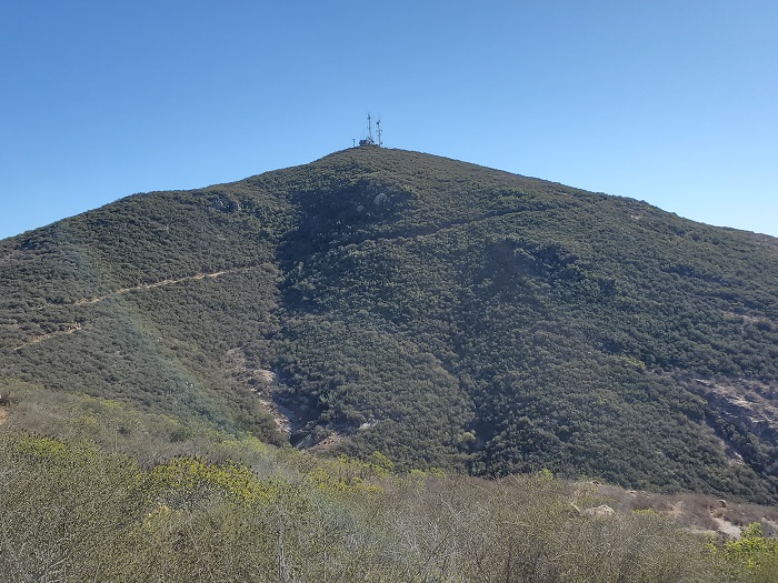
There are a few different ways to get to the peak of Cowles Mountain. For the sake of this article, I’ll be focusing on the Barker Way trailhead. This trailhead is still popular but far less crowded than the Golfcrest Drive trail. Accessing Cowles Mountain from Barker Way is also shorter than the Big Rock Park trailhead. This trailhead begins along Barker Way in the neighborhood of San Carlos in San Diego. The trail begins along the south flank of Cowles Mountain. From there the hike joins with the service road along the east side of the peak and eventually to the radio towers and onward to the top of Cowles Mountain.
Mission Trails Regional Park History
In the heart of the City of San Diego rest about 8,000 acres of open space land. This area is known as Mission Trails regional park and is available to the public for recreational use. Within the park are five distinct peaks: North Fortuna, South Fortuna, Kwaay Paay, Pyle’s Peak, and the tallest, Cowles Mountain. Mission Trails Regional Park was founded in 1974 and is one of the few areas of open land in the city proper of San Diego. It is this park which essentially divides central San Diego to the eastern cities of the county.
Prior to European settlers, the area was inhabited by the peoples of the San Dieguito’s, the La Jolla’s, and the Kumeeyaay’s. Of a special note, Father Junipero Serra, a important figure in San Diego’s early history assisted with the exploration of this area. His expeditions eventually led to the building of a dam along the San Diego River that runs through the center of the park.
On A Personal Note:
The views from the top of Cowles offer great views of the City of San Diego including the coast off downtown. If you find it absolutely necessary to hike Cowles Mountain, I recommend this route or the Big Rock Park trailhead. Either of these options will usually provide quieter and less crowded hikes compared to the Golfcrest Drive access. I personally like to relate Cowles Mountain to Pacific Beach. It’s not the best place in the county but life will probably lead you here at some point.
There’s a significant amount of inconsiderate people filling the air with whatever music they are listening to on their speakers here. As a reminder, listening to speakers scares away wildlife with more sensitive ears and also ruins the nature experience for other people. When visiting the outdoors, please leave no trace.
Hiking Tip: There is a variation in the trail along the Barker Way route that can shave off approximately a 0.7 mile in length. Check out the trail conditions tab for more information of where this is.
Cowles Fun Fact: The peak was named after an early ranching pioneer who settled El Cajon in 1877 by the name of George A. Cowles. Many people mis-pronounce the name of this peak. The correct pronunciation is actually like the word coal.
Looking for more of a challenge? Consider taking this hike past the peak and continuing on to Pyle’s Peak. This lesser known peak is only accessible after passing Cowles Peak. For an even more difficult challenge, consider taking the Mission Trails Regional Park Five Peak Challenge.
Have you recently done this hike? Please post your photos in or leave an update to the trail conditions in the comments section.
- Overall Difficulty: 60%
- Overall Views: 55%
Cowles Mountain via Barker Way Quick Facts:
- Estimated Distance: 3 miles.
- Max Elevation: 1,594 feet.
- Elevation gain: 859 feet.
- Estimated Time: 1-2 hours.
Cowles Mountain via Barker Way Trail Directions:
Open in maps. The trailhead is located off of Barker Way in the San Diego neighborhood of San Carlos. There is no defined parking lot here and all parking is along the street. Please keep in mind that this is a neighborhood where people live their lives. Be respectful and remember to leave no trace that you were there. Mission Trails Regional Park is open from dawn to dusk.
Cowles Mountain via Big Rock Park Pictures:
-
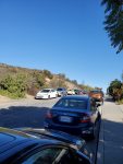
- The parking situation along Barker Way
-
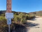
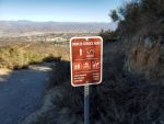
- A few informational signs at the trailhead.
-
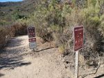
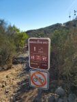
- A few more signs marking the beginning of the trail. Most of the trail resembles this type of condition with the exception of a few rockier parts towards the very top.
-
- Cowles Mountain service road marker. The service road is a gravel/dirt road.
-
- This is the west spur that will cut out approximately 0.6 miles of distance by bypassing most of the service road.
-
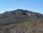
- Looking towards Cowle’s Mountain.
-
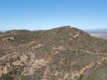
- A view towards Pyle’s Peak. Hikers can access this peak from Cowles Mountain to extend their trip by about three miles.
-
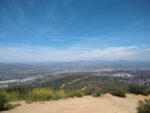
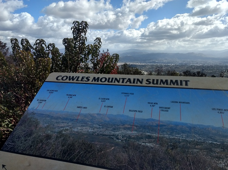
- The view from the top looking east.
-
- Looking to the east with the San Diego County mountains in the backdrop.
-
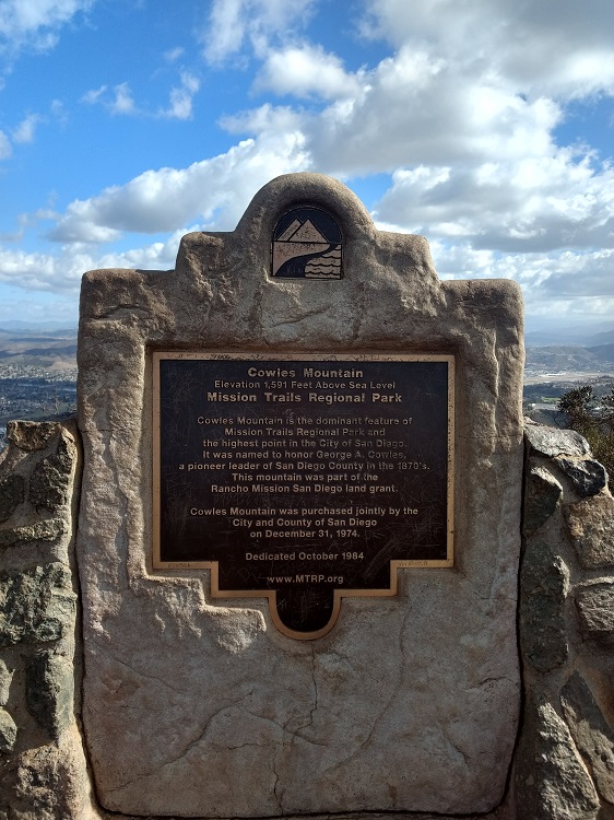
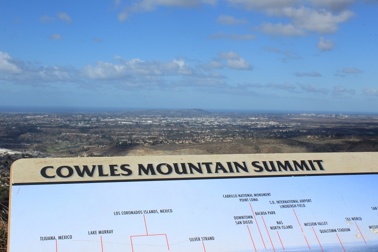
- The monument on the top of Cowles Mountain.
-
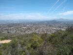
- The views to the East.
-
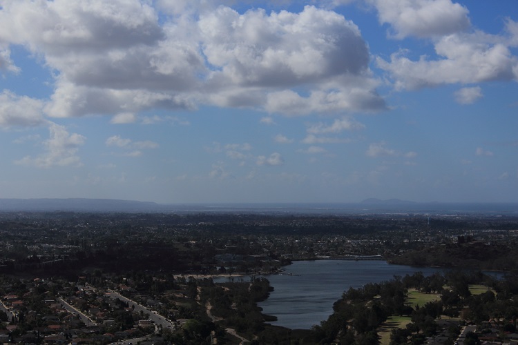
- Lake Murray, Mexico, and the Coronado Islands.
-
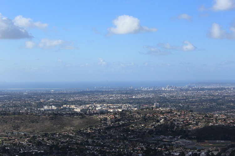
- Downtown San Diego.
-
- The views to the west.
Who Cowles Mountain via Barker Way Is For:
Novice Hikers: Cowles Mountain is usually known as a difficult hike for those that are new to hiking. It’s not uncommon for there to be rescues related to heat exhaustion. Statistically, this trialhead is about the same length and about fifty feet less in elevation gain than the Golfcrest Drive trailhead. However, the trial here lacks the coastal breeze of the west entrances making this hike hotter and more difficult. If you’re new to hiking and don’t don’t have much of a fitness base, this trail will be on the difficult side. Newer hikers looking for a challenge or to up their fitness game will enjoy this trail.
Advanced Hikers: Advanced hikers will likely be somewhat annoyed by how crowded the peak can get at the top. However, this route is more peaceful and a little more challenging than the Golfcrest Drive entrance. If you’re looking for more of a challenge, continue on to Pyle’s Peak for some extra distance and a quieter trail.
Expert Hikers: If you’re in much need for some outdoor time and live locally, this trail will do the trick. If you want to test yourself, attempt the Five Peak Challenge in one day.
It’s always a good idea to be aware of what type of hiking level you’re at.
Best Time Of Year To Hike Cowles Mountain:
This trail faces the southeastern side of the peaks that make up Mission Trails Regional Park. Because of the location that the trail faces, the coastal winds are mostly obstructed until the very top. The result is that this trail is warmer and hotter throughout the year than the Golfcrest Drive trail.
To get the most out of this trail, visit this area from mid-winter to mid-spring. The winter rains light up the hills with green and usher in vibrant wildflowers. During the summer it’s not uncommon for daytime temperatures to be in the mid-90’s to well over 100 degrees. This trail is short enough that it could be done during the cooler dawn or dusk hours before the sun heats up the trail. Exceptionally hot days should be avoided on this trial.
It’s always a good idea to check the weather prior to hiking.
Cowles Mountain via Barker Way Trail Conditions:
There are a couple variations of hiking to Cowles Mountain from Barker Way. The first variation will be along the west spur of the trail. At approximately the 0.6 mile mark the trail forks to the east and to the west. Taking the west fork will knock about 0.7 miles of distance off the trail and cut out a significant portion of the service road. The east fork adds on the distance and later connects with the service road about half way up. Deciding on which fork to take really comes down to personal preference. The east fork of the Barker Way trailhead is about 0.7 miles longer and spends more time on the Cowles Mountain Service Road than the west fork.