
Mastodon Peak Trail Guide – Joshua Tree National Park
For those who have spent time within Joshua Tree National Park, you’ll know there is no shortage of names for rock formations that resemble common objects. Skull Rock, Elephant Rock, and Heart Rock are a few examples. Mastodon Peak is no different. Named by early European settlers to the region, a mound of large rocks was given by those who thought it resembled the head and trunk of a prehistoric elephant known as a Mastodon. Rocks aside, short trail offers hikers a variety of experiences: views of the Salton Sea, remnants to early mines used for gold and quartz, and a nearby spring that provided the area with life giving water.
Mastodon Peak is a loop trail and can be hiked clockwise or counterclockwise. Depending on the route taken, the hike will either begin or end with Cottonwood Spring. This area was an important site of mining that occurred between 1870 and 1910. It was only one of two different areas that provided water between the north Salton Sea area and the Dale Mining District near Twenty-Nine Palms. Given the area’s harsh environment and lack of water, the spring was a popular waypoint for travelers, freight haulers, and business operators in the region. Today there are very little remnants of the original site but Cottonwood Springs is easily recognizable by its fan palm trees and cottonwood trees that were planted at the site. This area is also a great place to view wildlife and birds in the area.
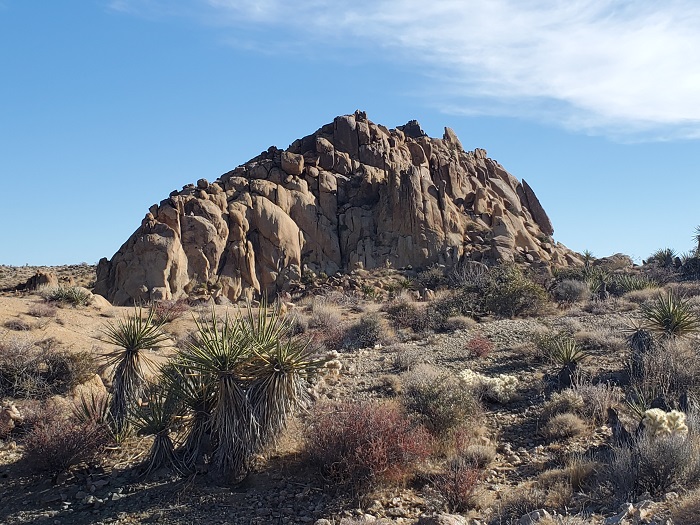
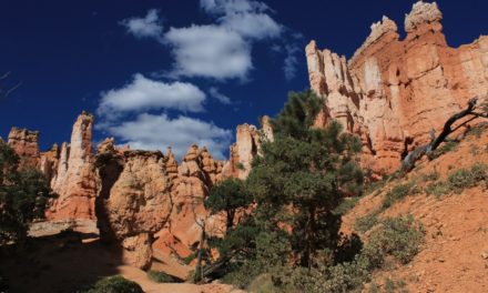
Continuing on from Cottonwood Springs the hike will eventually loop towards Mastodon Peak. Mastodon Peak will be recognizable by a very large round of granite rocks. The area surrounding Mastodon Peak is primarily known for it’s mining operations started by a gentleman with the name of George Hulsey in the 1920’s. At the base of the peak is Mastodon Mine that was built in the 1930’s. The hopes of this mine were to eventually obtain a large ore of gold here. However, faulting at the site severed the main vein and it couldn’t be relocated causing the mine to cease operations. Downhill from Mastodon Peak and located above a wash are what remains of a stamp mill and housing units. Today only the concrete foundations remain.
On A Personal Note:
If you’re looking for a short trail to hike, add this to the list of things to do for your Joshua Tree National Park itinerary. This trail is best hiked as a loop trail but it can also be hiked as an out and back, usually from Cottonwood Springs. The loop trail takes hikers past the sites of the old Winona Mill. We actually passed by Winona Mill without knowing that it was there. There are a few washes that the trail goes through on the north end of Mastodon Peak. Be mindful to keep an eye on the trail and not continue up the wash and lose your course. Some of the notable views from atop Mastodon Peak will be Salton Sea to the south with San Jacinto Mountain rising above it and Eagle Peak directly to the east.
Looking for some other things to do? Visit the day guide to Joshua Tree National Park. For those looking for a longer hike, you can combine this with the Lost Palms Oasis Trail which is 7.2 miles from Cottonwood Springs. If you’re looking for a hike of similar style, check out the Barker Dam Loop Trail. As a reminder, expect on there being no cell phone service within the park. Plan your itenerary ahead of time or rely on the park map.
Sources:
1. N.a. “A Day At Cottonwood Spring.” Joshua Tree National History Association. http://npshistory.com/brochures/jotr/cottonwood-spring-1973.pdf. 1973. Accessed 1 November 2021.
Have you done this trail recently? Please leave a comment about updates to the trail descriptions or trail pictures below.
- Overall Difficulty: 50%
- Overall Views: 85%
Mastodon Peak Trail Quick Facts:
- Max Elevation: 3,428 feet.
- Elevation Gain: 413 feet.
- Estimated Distance: 2.6 miles.
- My Actual Distance: 2.6 miles.
- Estimated Time: 1-2 hours.
- My Time: 1 hour 14 minutes moving; 1 hour 26 minutes total.
Mastodon Peak Trail Directions:
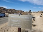
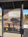
Open in maps. There is a small parking lot at Cottonwood Oasis Road at the Cottonwood Spring site. The lot can fill up quickly. The Cottonwood Spring area can be used to access multiple places including Eagle Peak and the Lost Palms Oasis. There is some street parking that can be found. However, the road is a little narrow and shoulder space is limited. The next nearest available parking would be at the Cottonwood Visitor Center about 1.2 miles away. For those staying at the Cottonwood Campground, the trailhead is a half mile away. Cell phone service is poor within the park so it’s likely you’ll have to use a park map. Cost is the price of admission to the park. An America The Beautiful Pass will also work.
Mastodon Peak Trail Pictures:
-
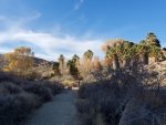
- The beginning of the hike along Cottonwood Oasis Road.
-
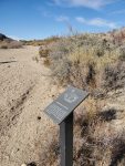
- There are a few placards along the trail highlighting the local vegetation.
-
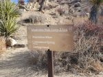
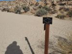
- Another trail marker.
-
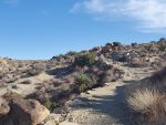
- One of the first washes. Keep an eye out for the trail markers highlighting when to turn onto and off of the wash.
-
- Leading out of the wash.
-
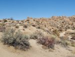
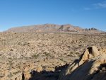
- Continuing up a gentle incline further out of the washes.
-
- Leading into another wash.
-
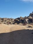
- Up and out of the next wash approaching Mastodon Peak.
-
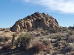
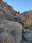
- The large mound of rocks representing Mastodon Peak.
-
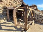
- Mastodon Mine.
-
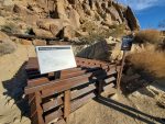
- Information regarding the mine.
-
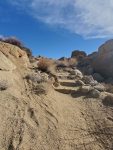
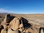
- The small rock scramble leading up to the top of Mastodon Peak.
-
- A view looking east towards Eagle Mountain.
-
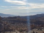
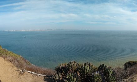
- Looking towards the south with the reflection of the Salton Sea and San Jacinto Mountain to the right.
-
- Looking to the north.
-
- A view towards the west with the San Bernardino mountains along the horizon.
-
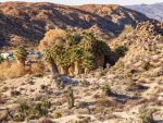
- Cottonwood Springs to the west.
-
- Approaching Cottonwood Springs.
-
- Cottonwood Springs; the trail to Mastodon Peak can also be started here and hiked in an opposite direction.
Who Mastodon Peak Trail Is For:
Novice Hikers: Overall this trail isn’t too hard. One of the most difficult things about this hike will be the heat if you’re hiking during the hotter months. There is a mild rock scramble to get up to the very top of Mastodon Peak. Those with mobility issues or with small children may not be able to get to the very top. The base of Mastodon Peak is very obtainable though.
Advanced Hikers: This is a great hike to pair along with other short trails or things to do within the area. If you’re looking for a longer trial, consider hiking to the Lost Palms Oasis.
Expert Hikers: Consider hiking to the Lost Palms Oasis. For an even more difficult challenge, consider Eagle Peak to the east of here from the same trailhead.
It’s always a good idea to be aware of what type of hiking level you’re at.
Best Time Of Year To Hike Mastodon Peak:
Late winter and early spring is without a doubt the best time to hike this trail. Years with higher than normal rainfall will also bring an abundance of vibrant colors of blooming cactus, Joshua Trees, and wildflowers. May usually ushers in hot temperatures and the hottest months are typically June and July with temperatures exceeding well over 100 degrees. Summer and early fall can still have some very hot temperatures but the evenings and mornings tend to be a little cooler.
Summer can bring about other problems besides just heat. The summer months are the monsoon season for the desert. This season brings about the chance for lightning and thunderstorms. Avoid being out in the open during a thunderstorm to prevent being hit by lightning. The trail does not have any low lying areas so there should be no concern of flash flooding here.
It’s always a good idea to check the weather before heading out on a hike.
Mastodon Peak Trail Conditions:
For the most part, this trail is in very good condition and maintained by the National Park Service. There are effectively three ways to hike this trail: as an out and back, a loop trail, and either clockwise or counterclockwise. My recommendation is to do the hike as a loop. The hike can either be started from Cottonwood Springs or where the Mastodon Peak trail marker is. The Mastodon Peak trail marker is located about 1/10th of a mile away from Cottonwood Springs on the east side of the road. It is visibly marked by a metal trail marker. For the sake of this article, I will be writing about the trail being done in a clockwise way because it was the way that I hiked it.
The hike for Mastodon Peak starts alongside the Cottonwood Oasis Road just before the Cottonwood Springs parking lot. There is a metal trail marker for Mastodon Peak on the east side of the road along the shoulder. After walking four about a tenth of a mile the trail crosses a sandy wash. Follow the wash until the trail intersects with the Cottonwood Springs Nature Trail and take an immediate right. The trail will follow a gentle incline to the southeast before coming to another wash. Follow this wash in the same direction for about 0.2 miles before again turning to the right to continue. The trail will eventually lead to another and final wash that will need to be followed for another 0.2 miles.
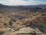
After the final wash the trail will bend to the southwest and the large lump of rocks known as Mastodon Peak will look recognizable. Follow the trail to the base of Mastodon Peak. The trail will wind up the north face of the peak passing Mastodon Mine along the way. From there the trail will wrap to the south side and if you’re up for it, do the minor rock scramble to the top of the peak and enjoy the views. From up here the cottonwood and fan palm trees of Cottonwood Springs should easily be visible. Once you’ve exhausted your time atop Mastodon Peak, follow the trail back down towards the west and continue along the marked trail which will wind its way back to your initial starting point. Cottonwood Springs should be visible for most of the time as you approach it. Stay on the path to prevent native vegetation that grows off the trail from getting disrupted. The trail gets a lot of foot traffic but still keep an eye out for rattlesnakes.