
Hiking South Fortuna Peak
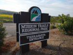
Located in the heart of central San Diego is the nation’s sixth largest municipally owned park, Mission Trails Regional Park. This park is home to 7,220 acres of open space land for recreational use. Within the park itself are five distinct peaks. South Fortuna is the park’s shortest peak at 1,094 feet. The regional park was founded in 1974 and is one of the last open areas of land that divides central San Diego from what locals refer to as East County. Mission Trails Regional park is a good reminder of what the people of the San Dieguito’s, the La Jolla’s, and Kumeeyaay’s used to get to see before European explorers settled and developed this area.
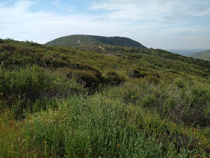
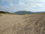
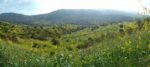
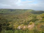
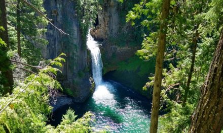
Despite the low elevation, reaching the summit via this trail is a good workout and offers substantial views. From the summit the rest of the park’s peaks will be visible: Kwaay Paay, North Fortuna, Pyle’s Peak, and the tallest, Cowles Mountain. The Fortuna’s are divided by the rest of the other peaks by the San Diego River which has carved out Mission Gorge directly below and in between Kwaay Paay and South Fortuna.
The origin of the name of the Fortuna peaks is unknown. In Spanish it means fortune. I’m only speculating here but perhaps it had to do with what the early missionaries believed would be good fortune from the views on the summit. Looking to the west is the City of San Diego, the Pacific Ocean, the hills of Mexico, and the Coronado Islands. To the north will be the Santa Ana Mountans, Mount Woodson, and Iron Mountain. Looking farther out east will be Palomar Mountain, San Jacinto Mountain, and San Diego’s second tallest, Cuyamaca Peak
South Fortuna Trail Entrances
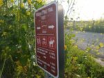
There are multiple trail entrances to hike this peak. Some are more difficult than the others. This peak can be accessed through the Oak Canyon Trail near the Old Mission Dam and likewise off the Jackson Road staging area near the visitor center. For the purpose of this article, the trail guide will focus on the Tierrasanta Road entrance. This route follows the San Diego Gas and Electric (SDGE) utility road through a saddle between North and South Fortuna. Altogether there are about sixty miles of trails in Mission Trails Regional Park. A complete map of all the trails can be found here.
On A Personal Note:
Most people that I’ve talked to have hiked this trail from the Jackson Road staging area. The Jackson Road route takes visitors up the south side of this peak with an infamous staircase and is the more difficult option. This guide through the Tierrasanta Road entrance is a good option for doing both Fortuna Peaks and is the easier one between the two. I highly recommend this route as a good way to do both peaks and experience the western side of the park.
Occasionally, this area will give views to some of San Diego’s larger wildlife. There have been reports of the occasional mountain lions in the area. I’ve personally seen bobcats, coyotes, and mule deer along my travels through here. Spring is a great time to see local wildflowers.
Have you recently done this hike? Please post your photos in or leave an update to the trail conditions in the comments section.
- Overall Difficulty: 65%
- Overall Views: 75%
South Fortuna Peak Trail Quick Facts:
- Estimated Distance: 5 miles.
- My Distance: 5.14 miles.
- Total Elevation: 1094
- Elevation gain: 494 feet.
- Estimated Time: 2-4 hours.
South Fortuna Peak Trail Directions:
South Fortuna Peak Trail Pictures:
-
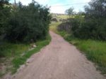
- The start of the trail at the end of Clairemont Mesa Blvd.
-
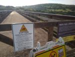
- There is a well known bridge here that was used for the military at one point.
-
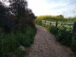
- Heading towards the Fortuna Saddle Trail.
-
- Headed towards the Rim Trail.
-
- North Fortuna in the distance from the Rim Trail.
-

- Connecting with the Fortuna Saddle Trail.
-
- North Fortuna to the left and South Fortuna to the middle right.
-
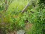
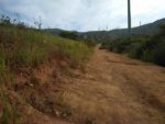
- The saddle trail heads down into a small riparian area – watch for poison oak off the trail.
-
- Looking at the oak riparian area.
-
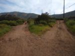
- The Fortuna Saddle Trail ends up becoming a SDGE road for power lines. This split lmeets up later on up the hill.
-
- The SDGE utility road.
-
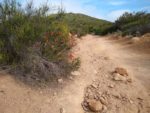
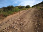
- The utility road becomes the steepest and most difficult part of the trail.
-
- Looking down the Saddle Trail with the Rim Trail along the mesa in the far distance.
-
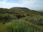
- South Fortuna as seen from North Fortuna.
-
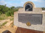
- The summit of South Fortuna Peak and an informational plaque.
Who South Fortuna Peak Is For:
Advanced Hikers: This trail will be easy for those in this category but the views will be rewarding for a trail so close to the city and without the crowds of other peaks in the park. While you’re up there, head across the way and summit North Fortuna as well.
Expert Hikers: This is a fun peak to check off the list for a Sunday afternoon type of hike. If you want to test yourself, attempt the Five Peak Challenge in one day.
It’s always a good idea to be aware of what type of hiking level you’re at.
Best Time Of Year To Hike South Fortuna Peak:
South Fortuna Peak Trail Conditions:
The entrance to trail is at the end of Clairemont Mesa Blvd. There hikers will pass over an old bridge that was used for the military. Just after the bridge there will be a fork in the trail. Continue to the right to connect with the Fortuna Saddle Trail. From this trail, the Fortuna Saddle trail will intersect with a few other crossings including the Rim Trail but maintain the course on the Saddle Trail.
The Saddle Trail is essentially a utility road that is used for the SDGE power lines that span east to west across the park. Continue following this trail and it will eventually come to a crossing that splits North and South Fortuna Peak. Follow the trail south. If your heart desires, follow the trail completely to the north on the way back to check North Fortuna off the list too.