
Hiking Sitton Peak
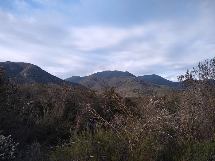
Just a short drive inland for the popular and crowded Orange County coastline runs a small range of peaks that make up the Santa Ana Mountains. These mountains are part of another stretch of the Cleveland National Forest. Within this protected national forest also lies it’s own protected wilderness section known as the San Mateo Canyon Wilderness. Sitton Peak lies within this wilderness area and although it’s not one of the most prominent peaks, it’s vantage point offers a great view of the San Bernardino Mountains like San Gorgonio and San Jacinto, the Orange County coastline, and Northern San Diego County including Palomar Mountain. On a clear day San Clemente and Catalina islands can be seen off the coast.
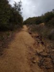
The trail leading up to Sitton Peak winds up and down through approximately nine to ten miles of the San Mateo Canyon Wilderness and national forest land to an elevation of 3,273 feet. The trail persists of mostly coastal chaparral. However there are a few riparian areas along the way including an oak grove and a seasonal creek within the first half of the trail. Throughout the late winter and spring there is an abundance of wildflowers. The wilderness gives a great opportunity to see some of Southern California’s wildlife like birds, snakes, and the occasional larger wildlife like mountain lions and deer.
Exploring The San Mateo Canyon Wilderness
The entire wilderness section encompasses 39,413 acres of protected land manged by the United States Forest Service. This area is unique to Southern California in that it averages somewhere between fifteen to twenty inches of annual rainfall each year. This amount of rainfall is something that’s not so common this close to the coast. Occasionally, cold winter storms have even been known to leave a short lived dusting of snow in the the highest peaks located in this area. The actual San Mateo Canyon runs east-west for about seven and a half miles. The hills catch the winter and spring rains and funnel them into several seasonal creeks that feed the canyon.
The trail to Sitton Peak begins at the Bear Canyon Trailhead off the Ortega Highway which connects Orange County to the Lake Elsinore area. A day use permit is required to be filled out and can be done so at a stand shortly after the trail entrance. Backpackers will need an overnight permit. Applications can be made through the Trabuco Ranger District or by calling (951) 736-1811. Since this area is managed by the Forest Service an Adventure Pass or America The Beautiful Pass is required for parking.
On A Personal Note:
I really enjoyed the rolling hills along the trail to Sitton Peak. I hiked this during the early spring and the hills were lush and green. Much of the Cleveland National Forest lies in San Diego County. I had no idea that this portion of the manged forest contained so many hidden gems. The area is a short drive from northern San Diego and the wilderness is largely protected to the large open space to the south of Camp Pendleton Marine Base. I recommend doing the Bear Ridge portion of the trail at least one way to add some variety to the scenery.
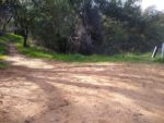
Parking was a little difficult for me to find initially since it was my first time here. There is a large parking lot for the Bear Canyon Trailhead directly across from a popular local candy store/coffee shop. A day use permit is also available from the Candy Store for five dollars. I recommend to check out some of the chocolates and candies sold at this shop – they’re pretty good.
Have you hiked this trail recently? Please updates and/or pictures in the comments section below. When visiting nature, please remember to adhere to the Leave No Trace Principles.
- Overall Difficulty: 85%
- Overall Views 90%
Sitton Peak and Bear Ridge Trail Quick Facts:
- Elevation: 3,273 feet.
- Elevation Gain: 1,923 feet.
- Estimated Distance: 9-10 miles.
- My Actual Distance: 9.67 miles.
- Estimated Time: 4-6 hours.
- My Time: 4 hours 8 minutes moving; 5 hours 4 minutes total.
Sitton Peak and Bear Ridge Trail Directions:
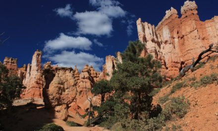
Sitton Peak and Bear Ridge Trail Pictures:
-
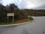
- This is the parking lot directly across from the candy shop. It is on the north side of the road.
-
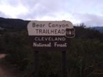
- Look for the trailhead sign directly to the west of the candy shop.
-
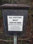
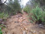
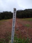
- Sign in with the day use permit form and drop it off in the box.
-
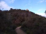
- Heading up the first bit of elevation gain.
-
- Looking to the west with Sitton Peak in the far background.
-
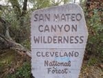
- Entering the San Mateo Canyon Wilderness.
-
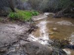
- There is a seasonal creek right near the wilderness sign.
-
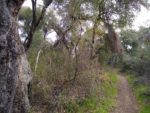
- A deep, oak riparian area that runs adjacent to the creek.
-
- The creek winds up the hill to a small oak meadow.
-
- Turning right at the trail intersection to head to Sitton Peak.
-
- Adacent to this old trail is another creek. I could hear water flowing but couldn’t actually see it do to a small ravine that it runs through.
-
- The flat trail winds through a mild elevation gain to another trail intersection called Four Corners.
-
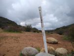
- Here at Four Corners, multiple trails intersect. Chose the north trail with the marker labeled Sitton Peak.
-
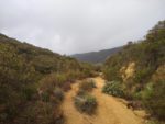
- The Sitton Peak portion of the trail after Four Corners.
-
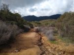
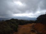
- The trail heads down a mild elevation loss before the actual final ascent to the peak. A first look to the rainy west.
-
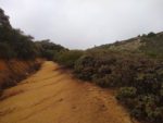
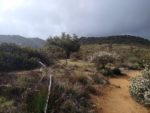
- Some of this trail does become narrow.
-
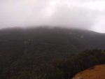
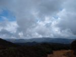
- This is where Sitton Peak would be – although covered in clouds.
-
- A break in the weather and the view of Sitton Peak.
-
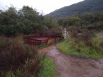
- A horse well prior to the ascent of Sitton Peak.
-
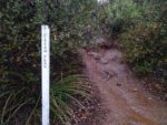
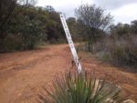
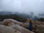
- Shortly after this horse well is the turn off to Sitton Peak. The final ascent is about a quart mile long and the most difficult part of this trail. This marker is easy to miss.
-
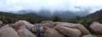
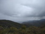
- A cloudy view from the peak.
-
- A less cloudy look to the west from the summit.
-
- There is an additional way back to the Oak Grove via Bear Ridge. This adds a slight amount of mileage on the way back. This can be found at the Four Corners intersection.
-
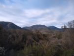
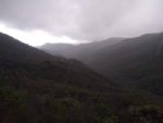
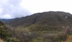
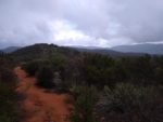
- A cloudy look to the east from Bear Ridge.
-
- More of Bear Ridge.
-
- A look to the southeast from Bear Ridge.
-
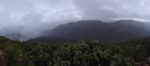
- A less cloudy view to the east from Bear Ridge.
Who Sitton Peak and Bear Ridge Trail Is For:
Advanced Hikers: These hikers will find this trail rather enjoyable. The rolling hills that make up the trail to Sitton Peak is a good way to spend half a day without being too exhausting.
Expert Hikers: Those with a good base level of fitness will likely find this trail on the easier side. However, the moderate distance and wilderness of the area will still provide an enjoyable day with rewarding views.
It’s always a good idea to be aware of what type of hiking level you’re at.
Best Time Of Year To Hike Sitton Peak and Bear Ridge Trail:
Summer can be quite hot throughout the area and even well into fall. As the days heat up the hot temperatures and lake of shade along the trail could really take a toll. Aim for the cooler days and start early in order to be back off the trail before the most intense heat kicks up. On days with heat warnings or incredibly hot temperatures, I’d skip this trail altogether. Wait until the heat of the summer fades and the fall season nears.
Sitton Peak and Bear Ridge Trail Conditions:
Sitton Peak: Getting Started
As mentioned earlier in this guide, the trail starts behind the local candy shop at the Bear Canyon Entrance. There will be a sign in box immediately afterwards. I recommend filling it out, although nobody will probably know if you don’t. However, doing so helps those that mange the National Forest keep track of foot traffic. It’s also in your own best interest to leave behind a paper trail just in case something happens.
From the entrance, the trail winds up the side of a ridge overlooking the Ortega Highway. To the far right will be the views of the hills of where you’re ultimately headed. The trail winds up a gentle incline before eventually coming down a gentle slope to a seasonal creek. During the dry season this area will be noticeable by the abundance of oak trees in the area. From here the trail heads slightly up to a junction called Morgan Trail.
Sitton Peak: Morgan Trail To Four Corners
Eventually the trail comes to a junction in a beautiful oak grove. During the wetter season the area will appear lush with green grass. Nonetheless, the grove is a beautiful area with bountiful shade. Here there are two options, head to the west or keep going straight south. Both options will lead to another trail junction called four corners.
Taking the west option will lead towards another ravine with another seasonal creek known as Pigeon Springs. To be honest, I could hear water running through the ravine below but it looked quite steep to reach the actual creek. From this point on it’s a moderate elevation gain to the Four Corners trail junction.
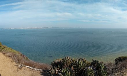
The second option would be to continue straight along the Bear Ridge Portion of the trail. Unlike the first option this ridge winds gently to the south then west up to the Four Corners trail junction. The route offers a good open view towards San Diego and to the eastern Riverside and San Diego mountain ranges.
I highly recommend taking Bear Ridge at least one way to give a different perspective. Neither way is harder than the other but Bear Ridge is slightly longer than heading to the right.
Four Corners To Sitton Peak
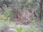
Both trail options meet at a junction called Four Corners which is essentially a crossing of several different trails. Each trail has a marker and to the northwest will be one for Sitton Peak and is also known as the Sitton Peak Truck Trail. From here the trail will wind through a series of inclines and declines before eventually reaching another offshoot for the actual peak itself. The offshoot is a little overgrown with manzanita so it is easy to miss. Keep an eye out for a large metallic horse well right before it. Shortly past the well will be a marker with a short route that heads up to Sitton Peak.
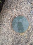
The short quarter of a mile heading up to Sitton Peak is without question the most difficult part of the trail. Much of it is overgrown with manzanita. This is also the portion of the trail with the steepest grade. Take heart in that the incline is short lived. Once at the top there will be a series of several large granite boulders and a marker at the top of the peak. Enjoy the views to the Pacific Ocean, south to San Diego, and the tall peaks that rise out of Riverside County. From there head back down to the Four Corners junction and decide if Bear Ridge is an option that you want to take on the way back. Then pick up some candy or a coffee from the local store before heading back home.
