

Iron Mountain Trail
Like Mount Woodson. and Cowles Mountain, Iron Mountain located in Poway is another one of San Diego’s iconic hikes. While not as popular as it’s neighboring peak, Mount Woodson, Iron Mountain must be included as one of San Diego’s quintessential hikes. Iron Mountain lacks the infamous potato chip like it’s neighbor, but the proximity to the city, views, and moderate difficulty make this a popular trail.
There are a couple of different ways to hike Iron Mountain but for the purpose of this article, I’ll be focusing on the main way to hike this trail which is at the end of Poway Road off the 67 highway. Aside from the ease of access, the top of Iron Mountain offers up panoramic views of San Diego County. On a clear day a person could see to Catalina Island, views of San Diego City, the San Diego mountain ranges to the east, and even as far as San Jacinto Peak when conditions permit. This trail also gives a great opportunity to experience some of San Diego’s wildlife such as coyotes, snakes, and local birds like California quail and hawks. Occasionally a bobcat, mountain lion, or deer will make a rare appearance. The spring months make for a good time to see local chaparral in bloom.
Iron Mountain is maintained and under jurisdiction of the City of Poway. A good rule of thumb is that the trail is open from sun up from sun down. According to the city, the trail is good for people, dogs, horses, and bikers. During extreme hot spells where the weather is forecasted to be over 100 degrees Farenheit, the city has adopted a new policy of shutting down the trail to prevent heat related injuries. During the summer months, if there is any question of hot weather, check with the City of Poway or Sherrif office to see if the trail will be open during heat events. See more on the best time of year to do this hike below.
Do you have any updates to the hiking trail or want to share your hike/pictures? Please leave a comment below.
- Overall Difficulty: 65%
- Overall Views: 70%
Iron Mountain Trail Quick Facts:
- Elevation: 2,744 feet.
- Elevation Gain: 1,1,35 feet.
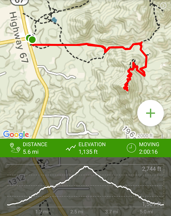
- Estimated Distance: 5.2 miles.
- My Actual Distance: 5.6 miles.
- Estimated Time: 2-4 hours.
- My Time: 2 hours 22 minutes.
Iron Mountain Trail Directions:
Iron Mountain Trail Pictures:
-
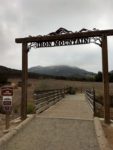
- The beginning of the trail at the parking lot.
-
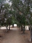
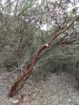
- The infamous oak shaded portion of the trail. This is the only shaded part of Iron Mountain.
-
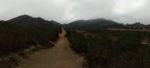
- Heading up the beginning of the trail with a mild elevation gain. Foggy mornings are a nice time to hike this trial.
-
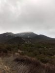
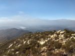
- Most foggy mornings give way to sunny skies. Iron Mountain on the right.
-
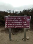
- A variety of trail indicators along the trail.
-
- The fog brings much needed moisture to the well adapted plants and animals here.
-
- Manzanita – common to the upper areas of Iron Mountain.
-
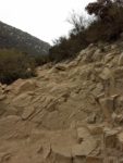
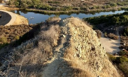
- Rockier portions of the trail.
-
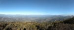
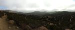
- The view from the top looking towards the northwest.
-
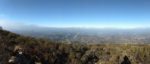
- The view to the southwest.
-
- One of my favorite viewpoints looking to the south on San Vicente Dam.
-
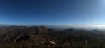
- Looking to the northeast with the San Diego’s mountain ranges to the east.
-

- A neat view locator at the top of Iron Mountain.
Who Iron Mountain Trail Is For:
Advanced Hikers: This trail isn’t so easy that it will leave you looking for more but if you have hiking experience, this trail won’t be that much of a challenge. This trail will likely leave you longing for something more. However, this is still an iconic San Diego trail that should be done to experience the views. Iron Mountain is also a great trail to help keep your endurance up. It’s not uncommon to see people running along this trail to train.
Expert Hikers: This is a fun hike with minimal challenge.
It’s always a good idea to be aware of what type of hiking level you’re at.
Best Time Of Year To Hike Iron Mountain:
This trail can be unbearable to hike during the summer after the seasonal marine layer departs in June. For those people who are still ambitious about hiking this area, bring lots of water, salty snacks, and try to do the trail early in the morning to beat the heat. Fall and Spring temperatures can be nicer but still warm. Given that there is no shade on this trail, my personal recommendation is to hike this earlier in the day or when temperatures cool in the afternoon. As a rule of thumb, the best time to do this trail during the mid-day will be during late fall, winter, and early spring.
Iron Mountain Trail Conditions:
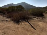
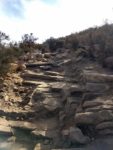
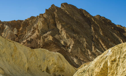
The trail starts out flat but then quickly leads into a moderate elevation gain. The lowest part of the trail is a mix of dry grass and chaparral. Eventually the trail gives way to a mix of manzanita and chaparral typical of Southern California inland valleys. The composition of the trail is mostly loose dirt which eventually gives way to a combination of dirt and batholithic and grandioritic rock. Many of the large granite boulders that line the peak are reddish in tint which are from iron deposits in the rock.Continuing up the mountain there will be a couple of forks in the trail with a sign that reads Iron Mountain Peak Trail. Each fork will eventually meet up and both ways will take you to the top. I’ve actually never taken the right fork and from what I’ve seen, most people take the left fork. A little over half way up on the trail there is a clearing and a flat area for a helicopter to land. The landing spot is for those hikers who need rescuing, particularly on hot days.
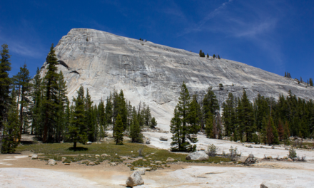
Shortly after the helicopter landing is where the bulk of the hard work on the trail comes in. At about two miles into the trail, a series of mild switchbacks will lead to the top. At the top of the trail there are some picnic tables to sit and enjoy a snack and take in the view. I prefer one of the large boulders that overlooks the San Vicente Dam away from the picnic tables myself.From the top the panoramic views of San Diego are amazing. Cuyamaca Peak, Palomar Mountain, and the rest of the peaks that make up the Cleveland National Forest can be seen. Looking down will reveal San Vicente Dam and the rest of San Diego to the Pacific Ocean. On clear days San Jacinto in Riverside and Catalina Island will be visible
Rattlesnakes are common in this area. Poison oak which tends to prefer shadier and soil that is more moist will not likely be seen but keep an eye out for it in the shadier parts and especially during wet years to be safe.