
Santa Margarita River Trail Hiking Guide
In the arid Mediterranean climate of Southern California, lush arroyos are hard to come by. The Santa Margarita River gorge is an exception and an area that checks off all the boxes when looking for river trails in Southern California. Located in the town of Fallbrook in northern San Diego County, the Santa Margarita River trail is home to almost one thousand different species of plants and animals.
There are a couple of preserves dedicated to the protection of this river gorge. One is owned and managed by the County of San Diego Parks and Recreation. This trail however focuses on the portion of the river run by the Wildland Conervancy and manged by the Fallbrook Trails Council. The length of the trail runs about five miles along the length of the river and is about 1,384 acres.
The headwaters of the Santa Margarita river form at the Temecula and Murrieta creeks in Temecula. This river drains the watershed of northern San Diego County between the Santa Ana Mountains and the northwest portion of Palomar Mountain in southern Riverside County. The river flows untouched approximately thirty miles forming the Temecula Canyon along its way emptying out to the Pacific Ocean at the south end of the military base, Camp Pendleton in.
Santa Margarita River Trail History
For centuries, the corridor along the Santa Margarita River trail was used by both the Pechanga and Luiseno Native Americans. In more recent times, the area which the Wildland Conservancy manages was owned by the California Southern Railroad. In the late 1800’s local San Diegan businessmen were attempting to connect the region by rail to the east coast.
The route ran from the City of San Diego up the coast and along the Santa Margarita River Valley. From there the train route eventually ran through the Cajon Pass in the San Bernardino Mountains and out east. This route would’ve opened San Diego to the east for rail access. However, after a large rain, the river basin flooded and knocked out many of the 200 plus bridges that ran across the gorge.
Today the Santa Margarita remains one of the last undamed river basins in Southern California. This portion of the preserve is managed by the Wildland Conservancy. Another portion just south of this trailhead is managed by the County of San Diego. The last portion of the Santa Margarita River lies on MCAS Camp Pendleton land. This federally owned land allows for much needed protection to the river delta.
On A Personal Note:
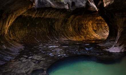
This hike is a great area to view one of the few and great riparian zones that San Diego County has to offer. The amount of shade here is a nice option for those seeking some shelter from the sun during the hot San Diego months. The trail is also one of the few areas to catch native plants with a display of fall colors.
I have to admit when I hiked this trail I was a bit bummed out about the number of people that were blasting music along the trail. Playing loud music through speakers ruins the hiking experience for other hikers. If that isn’t something you care about, it also drives animals from the area. Their ears are more sensitive than ours and many animals rely on this river for a source of water. Please keep your music to yourself and remember Leave No Trace Principles.
Looking for an even more impressive riparian river in San Diego? Try the Los Penasquitos Canyon Preserve which forms the lagoon to Torrey Pines State Reserve.
Sources:
1. N.a. “Santa Margarita River Trail Preserve.” The Wildlands Conservancy. 2020. https://www.wildlandsconservancy.org/preserve_santamargarita.html. Accessed 28 June 2020.
2. N.a. “Santa Margarita River Trails Map.” Fallbrook Trails Council. 2020. https://fallbrooktrailscouncil.com/trail-map. Accessed 27 June 2020.
3. N.a. “The Historic California Southern Railroad.” Santa Margarita Ecological Reserve, San Diego State University. San Diego State University Field Stations Program College of Sciences. 2020. https://fsp.sdsu.edu/resources/history/california-southern-railroad/. Accessed 27 June 2020.
Do you have any updates to the hiking trail or want to share your hike/pictures? Please leave a comment below.
- Overall Difficulty: 35%
- Overall Views: 80%
Santa Margarita River Trail Preserve Quick Facts:
- Max Elevation: 486 feet.
- Elevation Gain: 151 feet.
- Estimated Distance: 1-5 miles.
- My Actual Distance: 3.6 miles.
- Estimated Time: 1-3 hours.
- My Time: 1 hour 40 minutes moving; 1 hour 49 minutes total.
Santa Margarita River Trail Preserve Directions:
Santa Margarita Trail Preserve Pictures:
-
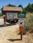
- The small dirt parking lot for the trail.
-
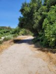
- The trail leading out along the banks of the river.
-
- A portion of the trail rides up along the
-
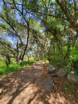
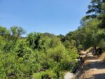
- For most of the trail, there is ample shade.
-
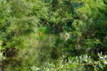
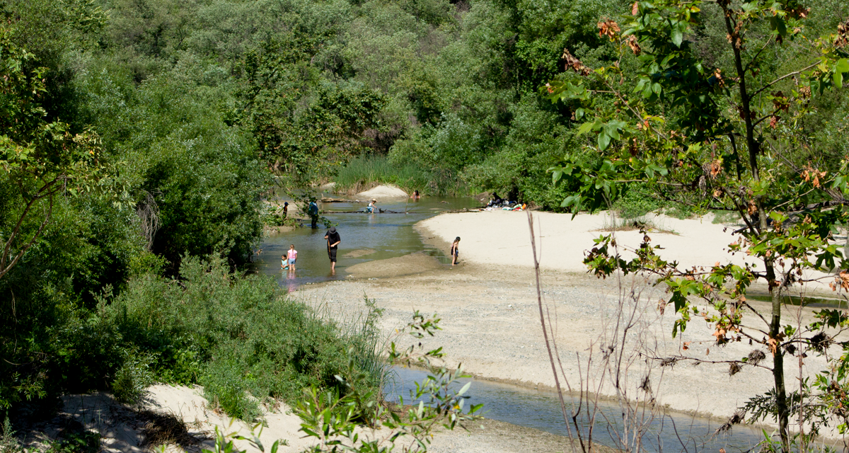
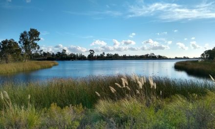
- Some of the views looking out across the river.
-
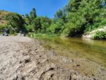
- Annual floods along the river deposit some nice sand banks.
-
- A look a little closer to the water.
-

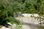
- The trail becomes a little less clear the further down the river banks. One upton is to head up and around the river.
-

- Creatures lurk along the trail.
Who Santa Margarita River Trail Preserve Is For:
Advanced Hikers: Despite being a short trail, this is a great option for those advanced hikers looking for a lush riparian environment.
Expert Hikers: This trail is not long nor difficult. It can also be quite crowded. There are some more difficult river hikes in San Diego if that’s your jam.
Same. It’s always a good idea to be aware of what type of hiking level you’re at.
Best Time Of Year To Hike Santa Margarita River Trail Preserve:
Heading into spring is when this area really starts to come to life. Trees, chaparral, and native flowers look fresh from winter and spring rains. The river is also past its flood stage and the sand banks allow for some nice views. Summer can be quite hot in the area but there is ample shade along the trail. Early mornings work best to beat the heat during summer.
Always remember to check the weather before heading out on a hike.
Santa Margarita River Trail Preserve Conditions:
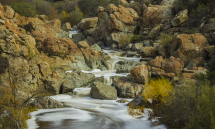
In some areas there will be two parallel trails. One will hug the bank of the river and another one will be on slightly higher ground. At around 1.6 mile mark the trail becomes a little less established. One option is to scramble around rocks along the river to push further ahead. Another option is to take a use road up and around the rocky part to connect back with the established trail.
This preserve allows for a source of water and movement of wildlife between the Santa Ana and Palomar Mountain ranges. Be alert for larger wildlife here such as bobcats or mountain lions. In general, there is no shortage of wildlife here from birds to rodents. Rattlesnakes are common. This is also the perfect growing environment for poison oak. This plant is all along the trail. Know it, keep an eye out for it, and avoid it to make your hike all the more enjoyable.
