
Los Penasquitos Canyon Preserve Trail
The hiking trails within Los Penasquitos Canyon Preserve are located in the heart of the City of San Diego. The Preserve sits in between the town of Rancho Penasquitos to the north Sorrento Valley to the west, Poway to the east, and Mira Mesa to the South. While most people only venture between Interstate 5 and Interstate 15, hikers can hike past of I15 to explore some of the creek into Poway. Altogether, the park contains over four thousand acres of land and over twelve miles of trails to explore.
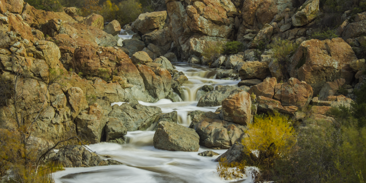
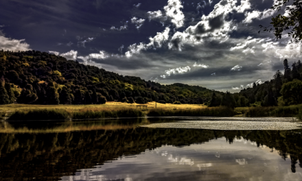
What makes the Preserve so great is the Los Penasqutos Creek which runs east to west from Poway to the coast. The creek actually is a major source of fresh water to the lagoon that makes up Torrey Pines Reserve. Within the preserve are several major attractions, one of them being a waterfall. The waterfall is located about half way between both the preserve’s eastern and western trailheads. Near the east entrances are a couple other attractions: creek crossings, a grave site for one of San Diego’s earliest pioneers, and the historic, Rancho Penasquitos Ranch House.
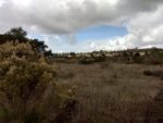
One of my favorite things about the Penasquitos Creek is that it generally flows year round. The fresh supply of water allows hikers and other visitors to enjoy a canyon rich with Cottonwood, Oak, and Sycamore trees. It’s also one of the few places close to the city where San Diegans can witness trees displaying fall foliage. The year round water supply also attracts some of San Diego’s larger wildlife like bobcats, mule deer, coyotes, and mountain lions to name a few. In the spring when the creek is at it’s highest levels the surrounding area has beautiful wildflowers and dense meadows.
For the sake of this trail guide, I’ll mostly be talking about the trail from the park’s eastern entrance off of Black Mountain Road. However, the park does have a couple different trail entrances with trail conditions being just about the same from either the west or east entrance (see more details on the trail directions below).
The park is operated by the City and County Of San Diego. Generally, area is open most days of the year and closed during rain events and for at least forty-eight hours afterwards. Although trails are open throughout the daylight hours, the actual parking lots are only open from 8am to to sunset. For more information about park and trail status, you can always call 858-538-8066 or check with the county’s website.
On A Personal Note:
Update: On May 27, 2019 a four year old child was out near the middle of the preserve. During the mid-afternoon he was attacked by a mountain lion. The attack did not result in a fatality. This event serves as a reminder for people to be aware of their surroundings and to be prepared for a worst case scenario.
I’ve hiked portions of this trail a few times from both parks east and west trailheads . There are very few trails in San Diego that have a constant water source throughout the year and because of that the trails are nice throughout all four seasons. What’s great about these trails is that it’s great for all levels of hikers. Much like the trails in Balboa Park, people can choose their own adventure here and make their hike as long or as short as they would like it to be.
The creek through the eastern side of the trail seems to have a larger flood plain. Because of that the forest is more dense and hikers have the opportunity to explore winding trails along the creeks edge. My favorite time to catch this trail is after it rains. After a rain the creek floods the area and the waterfall can turn into a nice rapid – by San Diego standards of course. I’ve also seen an abundant amount of wildlife in the area particularly coyotes that come down to the creek in search of food and water.
Do you have any updates to the hiking trail or want to share your hike/pictures? Please leave a comment below.
- Overall Difficulty: 50%
- Overall Views: 85%
Los Penasquitos Canyon Preserve Trail Quick Facts:
- Elevation: 266 feet.
- Elevation Gain: 150 feet.
- Estimated Distance: 6-8 miles.
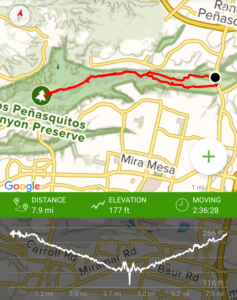
- My Actual Distance: 7.9 miles.
- Estimated Time: 2-4 hours.
- My Time: 2 hours 36 minutes moving. 4 hours 22 minutes total.
Los Penasquitos Canyon Preserve Trail Directions:
The western trailhead rises up in Sorrento Valley off of Sorrento Valley Blvd. Open in maps. The west trailhead to Los Penasquitos Canyon rises up with a mild elevation gain and heads to the eastern preserve of the park. Most people turn around at the halfway point of the waterfalls but some continue all the way to the other end of the Preserve before turning around.
One the eastern end of the Preserve lies the park’s main entrance. Open in maps. This parking lot lies at the end of Mercy Road right off Black Mountain Road. The parking lot is open from 8am to sunset daily. As of this time, I’m not aware of any daily parking fee. At this entrance there is an equestrian staging area and a small parking lot that leads down the Preserve’s South Trail.
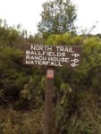
I’ve never actually parked at the park’s east entrance. Instead, I park just north of there at the Canyonside Community Park. The Canyonside Community Park is located on the North end of Penasquitos Creek and is the entrance to one of the park’s features: The Los Penasquitos Ranch House. Parking is available at either the Ranch House down a long driveway or at the parking lot of the Canyonside Community Park. From this parking lot people can either use the North Trail to walk to the waterfall or walk to the South Trail entrance off Mercy and Black Mountain Road.
Between the east and west entrances there are numerous use trails established throughout the neighborhood of Mirsa Mesa on the south end and all along the north end along Carmel Valley Road and Highway 56 that lead to Penasquitos Creek. If you do decide to access the Creek from one of those lesser known areas, please have respect for the residents in the neighborhoods by limiting noise and packing out your trash.
Los Penasquitos Canyon Preserve Trail Pictures:
-

- There are many places to park along this Preserve- I chose in the parking lot of Canyonside Community Park.
-
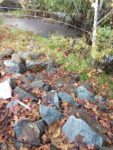
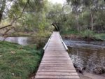
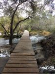
- From the parking lot I walk across the bridge over Penasquitos Creek and carefully down the rocks.
-
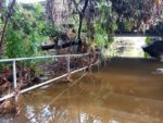
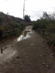
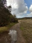
- After a good rain, quite a bit of the area will be flooded underneath Black Mountain Road.
-
- Coming up from the bridge walking towards the Equestrian Staging Area/Penasquitos Canyon Parking Lot.
-
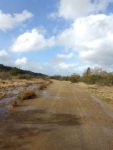
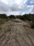
- The majority if the first part of the trail on this side is a paved dirt road which is for bike, hiker, and equestrian use.
-
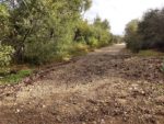
- The South Trail seems to lie in most of the flood zone and sometimes after rains the trail will be washed out.
-

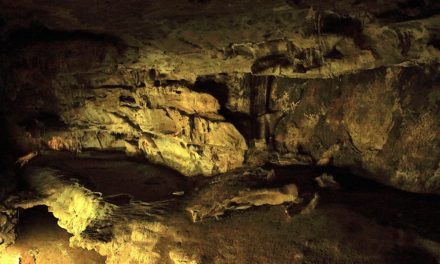
- There are several crossings along the Penasquits Creek, this is one of them. The Ranch House is also another staging area and parking lot along the North Trail.
-

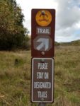
- A little information board.
-
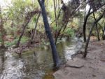
- I didn’t attempt to cross the Ranch House Crossing as it was completely flooded. I don’t even have any pictures of it but it looked something like this.
-
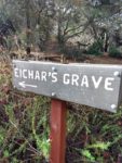
- Shortly past the Ranch House Crossing is a popular graves site that dates back to the 19th century.


-
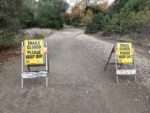
- During heavy rains, the county usually closes some of the trails due to flooding. The South Trail tends to flood easily while the North Trail is higher and drains better.
-
- This is somewhere past the trail closure signs. The area continued to get more and more washed out along the main trail but there are a number of use trails that travel along the creek.
-
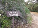
- I crossed at Carson’s Crossing to get to a drier trail. This bridge wasn’t washed out and the trail along the northern side was in very good condition.
-
- The North Trail is bordered by the town of Rancho Pensasquitos.
-
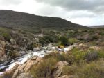
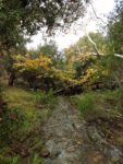
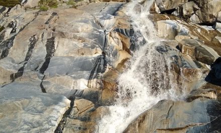
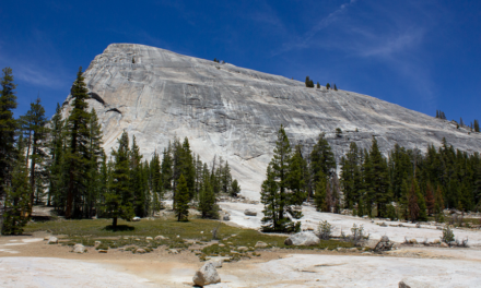
- Finally at the waterfall. From here in the background the hills of Torrey Pines can be seen. If you continue for about two miles you’ll be at Interstate 5.
-
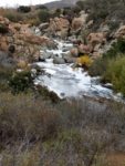
- Winter is my favorite time to catch this waterfall – it’s more like a rapid.
-

- When the creek isn’t in its flood stage it is possible to cross here between the North and South Trails if you use caution.
-
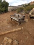
- Most people stop in the area above the waterfall to enjoy a picnic.
-
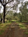
- The North Trail has several established trails and old roads.
-
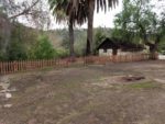
- The Rnacho Penasquitos Ranch House.
-
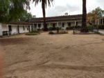
- More of the Rancho Pensaquitos Ranch House.
-
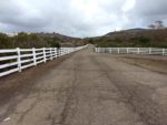
- The driveway leading up to the Ranch House. People can also park at the Ranch House. This long driveway leads to where I parked my car at the Canyonside Community Park.
Who Los Penasquitos Canyon Preserve Trail Is For:
Advanced Hikers: Advanced hikers will likely find this trail easy – and it is. But not all hikes have to be a challenge to have enjoyable views.
Expert Hikers: For an extra challenge, do a full loop between the east and west end of the park. The Oak forests are a nice change of pace for a trail that’s close to the city.
It’s always a good idea to be aware of what type of hiking level you’re at.
Best Time Of Year To Hike Los Penasquitos Canyon Preserve:
To catch the waterfall at its peak it’s best to head out on this trail after a decent rain. However, the South Trail is prone to flooding and being washed out so use caution. I’d recommend sticking to the North Trail after rain events to avoid muddy trails and to prevent eroding the trails.
Los Penasquitos Canyon Preserve Trail Conditions:
The elevation with this hike is minimal but will vary depending on which direction a person starts this trail. For those that start on the eastern side, the elevation gain will be made on the way back to your car. For those that start on the western side, leading up to the waterfall will cause the elevation gain.
My favorite way to hike this area is to park in the Canyonside Community Park. From there I like to walk down to the South Trail right under the Penasquitos Creek Bridge that runs across Black Mountain Road. This portion of the trail has nice creek and meadow views. From there I like to cross the creek at Carson’s Crossing and take the North Trail to the waterfall.
Los Penasquitos Canyon Waterfall
One of the major highlights of these trails is the waterfall. I’ll be honest with you, the waterfall isn’t very large and is more of a series of short cascades. Thus, the waterfall is best observed after a good rain. The waterfall is about halfway between each of the park’s west and east ends and serves as a turnaround point and picnic spot for many who frequent the area. When the waters are at lower levels it is actually possible to cross at this area and I’ve seen people do it many times. However, use caution – the exposed rocks can be quiet slippery and a fall could easily lead to a bad day and possibly a traumatic injury.
Los Penasquitos Canyon Preserve Notable Mentions
Native American use of the canyon dates back over six thousand years. Historically, both the La Jolla and Kumeyaay Indians used this area frequently. On the park’s western entrance lies the remains of an Adobe that dates back to 1857. On the east end lies a historic Ranch House that dates back to 1823. The Los Penasquitos Ranch House dates back to 1823. The Ranch House is a recipient of a Mexican land grant and the second oldest documented residence in San Diego County. Along the south end of the trail shortly past the equestrian staging area lies the grave site of John Joseph Eichar. It’s believed he was a cook at the Ranch House and the only known American to have been buried in the Los Penasquitos Canyon.
Things To Look Out For
Keep an eye out for poison oak – the shade near the meadows and water source give this area the perfect growing environment for it. Poison oak can commonly be seen in the undergrowth and wrapping around the trunks of trees. Occasionaly it will grow out over the trails. I highly recommend not to touch anything green if you’re not familiar with what poison oak looks like.
The year round water source makes this a great habitat for just about all of San Diego’s wildlife. Be watchful for rattlesnakes along the trails as they can commonly be seen here. I’ve seen coyotes here on multiple instances. The area also attracts mule deer and smaller game animals so with that, brings along bobcats and mountain lions. Do know that those sightings are more rare and usually only seen during dawn and dusk hours.