
Hiking Mount Wilson Observatory Trail Via Chantry Flat
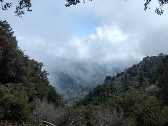
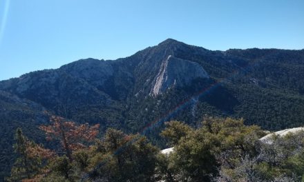
The hike up into Mount Wilson is a beautiful trail approximately 13.1 miles in length. The Mount Wilson Observatory trail can take anywhere from 5-8 hours depending on your skill level. The hike starts out at Chantry Flat Recreation area in Sierra Madre, California. The hike then takes you through the Angeles National Forest up an elevation gain of about 4,373 feet to a total elevation of 5,784 feet. The view from the top of Mount Wilson looks down on the greater Los Angeles area as well as other peaks in the Angeles National Forest. There are several great spots to sit down and enjoy a picnic at the top.
Do you have any updates to the hiking trail or want to share your hike/pictures? Please leave a comment below.
- Overall Difficulty: 90%
- Overall Views: 75%
Mount Wilson Peak Quick Facts:
- Elevation: 5,784 feet
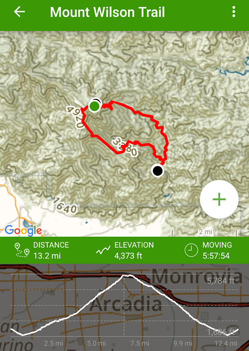
- Elevation Gain: 4,373 Feet
- Estimated Distance: 12.8 miles
- My Actual Distance: 13.2 miles
- Estimated Time: Seven Hours
- My Time: 5:57
Mount Wilson via Chantry Flat Trail Directions:
Open in maps. Because you can drive to the top of Mount Wilson, be careful to not let the driving directions take you to the top. The trail head to Mount Wilson via Chantry Flat is located in Big Santa Anita Canyon with the same trail head for Sturtevent Falls. There is a small parking lot that fills up very early. If the parking lot is full, you’ll have to find street parking on the windy road somewhere. Don’t forget, an adventure pass is required. An America The Beautiful pass will also work.
Mount Wilson Peak via Chantry Flat Pictures:
Who Mount Wilson Trail Is For:
Advanced Hikers: This hike will be a fun challenge and the persistent switchbacks and elevation gain will be a nice leg burner.
Expert Hikers: This will also be a fun challenge and a great workout.
It’s always a good idea to be aware of what type of hiking level you’re at.
Best Time Of Year To Hike Mount Wilson Peak:
Mount Wilson Trail Conditions:
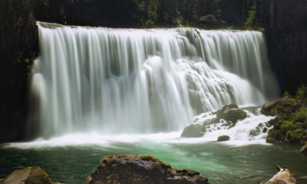
I’ve read from other sites that the trail via Chantry Flat can have some overgrowth, but that wasn’t my experience. The trail was made up of mostly dirt and very well maintained. The bottom of the trail runs through a Canyon with a stream that takes you up through several short man made waterfalls as well as Sturtevant Falls. Once at Sturtevant waterfall the trail goes through a very long elevation gain made up of mostly switchbacks until the observatory.
As the trail gets into the higher elevations the dirt trail gives way to some rocks on the trail but it’s not too bad. At the top where the observatory is located the walking path is paved until the trail heads back down. Most of the trial keeps you shaded from the sun by the pine trees in the higher elevations and by large oak trees in the lower elevation. Keep an eye out for poison oak. Rattlesnakes can be common in this area. Don’t bring any less than two liters of water and bring enough food to fuel you through thirteen miles. I had a sandwich, cliff bar, beef jerky, and an apple.