
The Complete Devil’s Bridge Hiking Guide
Devil’s Bridge is a popular out and back hiking trail in Sedona, Arizona. The trail winds through Sedona’s beautiful red dirt and juniper covered landscape to a natural sandstone bridge. The bridge connects to a nearby towering butte and can be hiked out on to. This trail is a popular destination for tourists, photographers, and hikers from all walks of life.
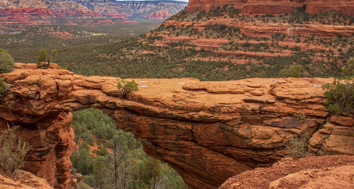
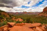
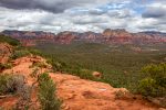
The bridge is located in the Coconino National Forest and is the largest natural sandstone arch in the Sedona Area (1). Despite the name of this hike, the bridge is actually a wind eroded arch formed over time. As your eyes scan the horizon, enjoy the buttes, hills, and mountains that surround the area including the towering Capitol Butte which devil’s bridge is adjoined to at over 6,000 feet in elevation.
Throughout this hike will be views of deep red, orange, and white hues that fill the hills and valleys throughout the area. Sedona sits in the southwestern edge of The Four Corners region of the United States. Geologically this region is known as the Colorado Plateau. This particular area features some of the most unique landscape in the country. The colors and terrain throughout Sedona formed from uplifting of the Colorado Plateau several million years ago (2).
On A Personal Note
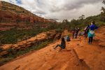
Devil’s Bridge is a very iconic trail in the southwest and is probably the most popular trail in Sedona. There is no shortage of people here as many come for that photograph of them standing on top of this arch. For those who are acrophobic, the width of walking out onto the bridge is wider than it looks. See the pictures in the tab to get an idea of how wide the bridge actually is.
The bridge itself is probably around four stories tall. Therefore, if you venture out onto it, use caution and don’t lose your footing. With that said, I still think you would have to be reckless or completely careless to fall off of this bridge. There are some steeper parts while hiking up the butte to reach the bridge that seemed sketchier. I also thought that the overlook from the butte to Devil’s Bridge was more dangerous than the bridge itself.
There is an ample parking lot with bathrooms for the trailhead starting at Dry Creek Road. However, If you have a high clearance vehicle you can actually drive one mile in to the “official trailhead” for Devil’s Bridge. This will cut your hiking distance in half. All other people will need to park at the main parking lot.
As a reminder, please try to stay on the trail at all times to prevent erosion. Please remember to always leave no trace when visiting the outdoors.
Sources:
1. N.a. “History of Sedona.” Sedona History. City of Sedona. https://www.sedonaaz.gov/home/showdocument?id=34040. 15 March 2018. Accessed 21 September 2021.
2. N.a. “Devil’s Bridge Trail No. 120.” United States Forest Service. United States Department of Agriculture. https://www.fs.usda.gov/recarea/coconino/recarea/?recid=55292. Accessed 21 September 2021.
- Overall Difficulty: 50%
- Overall Views: 95%
Devil's Bridge Trail Quick Facts:
- Max Elevation: 7,030 feet.
- Elevation Gain: 521 feet.
- Estimated Distance: 3.9 miles.
- My Actual Distance: 4.2 miles.
- Estimated Time: 1-2.5 hours.
- My Time: 1 hour 9 minutes total; 51 minutes moving.
Devil's Bridge Trail Directions:
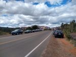
Open in maps. There are two options for parking. The one for most people will be at the main parking lot along Dry Creek Road. The parking lot is of ample size but given the popularity of this trail, it can fill up very quickly especially on holidays, weekends, mornings, and evenings. As of the time of this writing, there is no use pass associated with parking here. The good news is that outside of the parking lot there is street parking that can be found along the main road.
For those with high clearance vehicles, you will be able to continue down Dry Creek Road until the start of the official trailhead for Devil’s Bridge. After the main parking lot Dry Creek Road turns from pavement to dirt and a high clearance vehicle is needed. About one mile down Dry Creek Road there will be a small dirt pullout and a sign for the Devil’s Bridge trail on the east side of the road. Dry Creek Road can become washed out during and after storms and occasionally icy during the winter.
Although this hike is located in a National Forest, a use pass or America The Beautiful Pass is not needed here.
Devil's Bridge Trail Pictures:
-
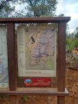
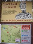
- An informational placard at the beginning of the trail.
-
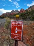
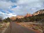
- The hike is two miles from this point starting on Dry Creek Road.
-
- Dry Creek Road prior to turning into dirt.
-
- Dry Creek Road. This part is only passable with a high clearance vehicle.
-
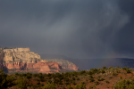
- Rain storms looking to the mountains towards the north.
-
- About one mile in the official trailhead for Devil’s Bridge starts.
-
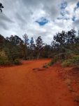
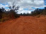
- Once the trail forks off from Dry Creek Road it’s mostly soft red dirt up until the base of Capitol Butte.
-
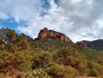
- Capitol Butte in the close distance leading up to Devil’s Bridge.
-
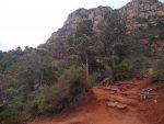
- Once at the base of Capitol Butte there is a steep and significant climb.
-
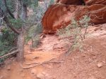
- It’s hard to see in this picture but there are narrow stairs that may be difficult for some people leading up to Devil’s Bridge.
-
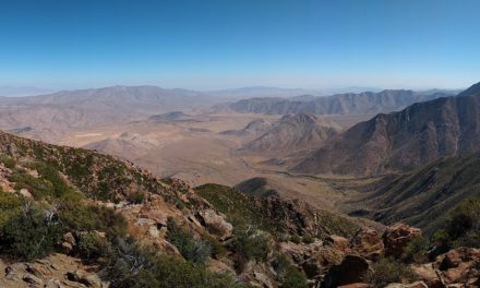
- Finally at the top. Looking out toward the northwest from Devil’s Bridge.
-
- Overlooking devil’s bridge from above.
-
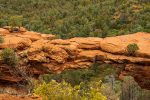
- Looking down onto Devil’s Bridge.
-
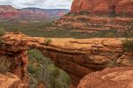
- A beautiful perspective of Devil’s Bridge looking towards the colorful mountains of Sedona.
-
- Walking out onto Devil’s Bridge. As you can see the width is more than it looks from a distance.
Who Devil's Bridge Is For:
Novice Hikers: This is not necessarily a hard trail. However, the mild rock scrambling along the wall of the butte to reach Devil’s Bridge may be a little difficult for some people including children.
Advanced Hikers: This is a fun hike. It’s not too difficult and not too tough.
Expert Hikers: Although this trail lacks significant elevation gain and distance, the views are worth it for the short hike.
It’s always a good idea to be aware of what type of hiking level you’re at.
Best Time Of Year To Hike Devil's Bridge Trail:
Located somewhat between the harsh deserts of Phoenix and the cooler elevations of Flagstaff, Sedona is in a unique spot meteorologically. This trail does experience four seasons as far as temperatures are concerned. Temperatures are moderate during the fall and get colder as winter kicks into gear. Sedona is far enough north with a high enough elevation that the area can see several inches of snow throughout the year. However, these snowy events are often very short lived.
The driest months for Sedona are during the late spring and early summer. Summer is the hottest time of year with temperatures in the middle of the summer reaching 100 degrees on a regular basis. Sedona is also located in the North American monsoon region. Each summer thunder and lightning storms can be a regular occurrence. As a general rule of thumb, it’s never a good idea to be out on an exposed trail during a lightning storm. If you hear thunder and see lightning, seek shelter. After significant rains, the trail and Dry Creek Road can become washed out.
There’s not necessarily a bad time of year to hike this trail. If you can withstand the heat, early mornings are the optimal time. Regardless, it’s always a great idea to check the weather before a hike.
Devil's Bridge Trail Conditions:
Generally speaking, the trail is in excellent condition. The actual trail for Devil’s Bridge doesn’t really start until about one mile in. However, as I mentioned, only people with high clearance vehicles will be able to make it that far down Dry Creek Road. Otherwise, park at the main parking lot. From here Dry Creek Road will immediately turn from pavement to dirt. Follow along the dirt road to the north until the sign for Devil’s Bridge Trail along the east side of the road.
Once at the junction for the Devil’s Bridge trail, continue east for about one mile. Half a mile in this trail segment the trail approaches the base of a butte. The trail will steadily climb up the face of the butte for half a mile more until you reach the overlook for Devil’s Bridge. There will be some maintained steps along the way up the butte. Use caution here as it is steep, narrow, and can be slippery when wet.
The steps will wind up the butte for approximately 150 feet until you come to an overlook of Devil’s Bridge to the northwest. The bridge is connected to the viewpoint that can be walked out on to. It’s usually crowded here with a line to get on to the bridge for photos. The bridge is flat and a lot wider than I expected to be. Be careful not to fall but I personally thought the butte was more unsafe than the bridge. There is very little shade along the trail so dress accordingly. Rattlesnakes could be seen during the warmer months. The temperatures are too hot for no poison ivy along the trail.