
Olivenhain Dam loop trail is a moderately hiked reservoir in the Elfin Forest Recreational Reserve. The reserve is located in Escondido, California and offers wildflower viewing, picnics, and great views of the Pacific Ocean, Lake Hodges, local San Diego Mountains, and the Escondido Creek. The loop trail hits many of the main sights in Elfin Forest.
Olivenhain Dam Loop via Way Up Trail In Elfin Forest
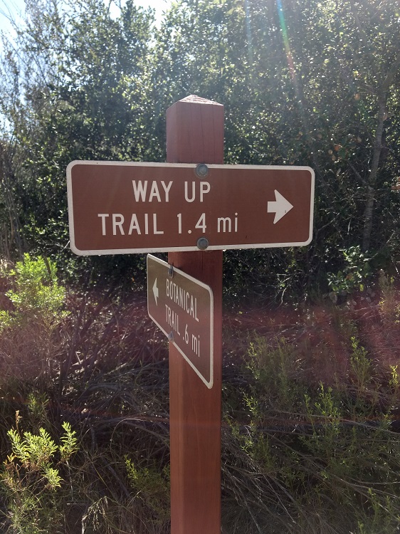
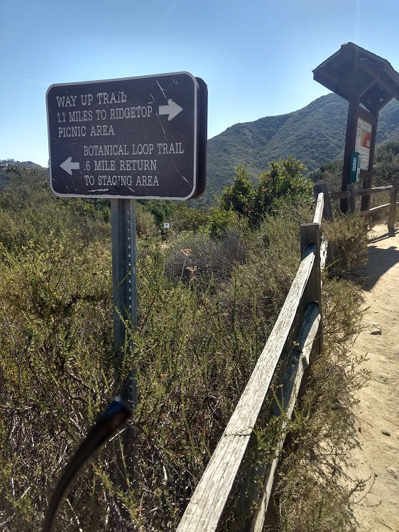
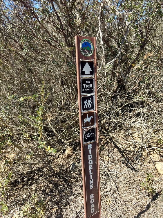
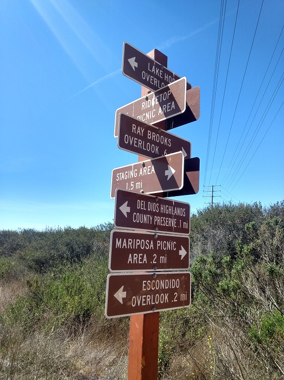
Olivenhain Dam is located in the Elfin Forest Recreational Reserve in Escondido California in San Diego County. The dam forms a reservoir which holds over seven billion gallons of usable water for the San Diego area. Elfin Forest Reserve lies inside the Escondido Watershed. The Escondido Creek flows year round from Lake Wohlford through the reserve all the way to the San Elijo lagoon in Encinitas. The Elfin Forest Reserve has about eleven miles of hiking trails available for public use. The smaller of the trails are about half a mile but there are many off shoots of the main trails. With these smaller offshoots you can extend the trails to several miles by connecting them together. This hiking guide references the Olivenhain Dam Loop Trail. The trail begins on the Way Up Trail at the parking lot. The Way Up Trail terminates at the top and to the right you can take the Ridgeline Maintenance Road to the Ray Brooks Olivenhain Dam overlook. You can then loop back and take the Ridgeline Maintenance Road back to the Way Up Trail around the dam to the Lake Hodges Overlook. The Olivenhain Dam loop trail is great for bird watching, wildflower viewing, picnics, and offers views of the coast and local San Diego Mountains. There are multiple shaded benches that can be used for picnics near the top of the Way Up Trail or at the Olivenhain Dam Overlook.On A Personal Note
This little gem of a reservoir his hidden above the hills of Escondido. I actually had no idea this reservoir existed until I hiked to the top. The trail is a moderate challenge and I used to use this area for trail running. On a calm morning or evening the reservoir does have some beautiful lake reflections. The source of water makes this place a good opportunity for bird viewing. Looking for another trail similar to this? Try the Lake Hodges High Trail. This trail is part of the San Dieguito River Park trail system and skirts along the high edges of Lake Hodges. Througout the trail will be expansive views of Lake Hodges. This is a great option for bird viewing during the dawn and late afternoon hours.Do you have any updates to the hiking trail or want to share your hike/pictures? Please leave a comment below.
- Overall Difficulty: 45%
- Overall Views: 65%
Olivenhain Loop via Way Up Trail:
- Elevation: 1,384 feet.
- Elevation Gain: 927 Feet.
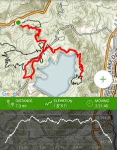
- Estimated Distance: 6-8 miles.
- My Actual Distance: 7.3 miles.
- Estimated Time: 3-4 hours.
- My Time: 2:31.
Olivenhain Dam via Way Up Trail Directions:
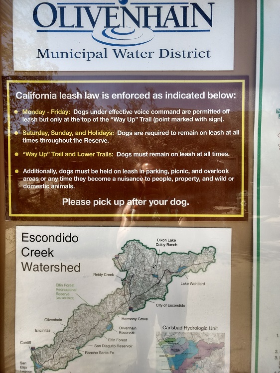
Open in maps. The trailhead to Olivenhain Dam begins at the Way Up Trail within The Elfin Forest Reserve. Directions are very simple. The parking lot is off a windy Harmony Grove Road. This road goes through a residential neighborhood so please use common courtesy when going through this area. The parking lot is a dirt parking lot that is gated. Hours of operation are 8 a.m. to about thirty minutes prior to sunset. On the gait, posted hours are until 7:30 p.m. The Elfin Forest Reserve is open every day except Christmas and during Red Flag Warnings. For other questions about the parks hours of operations, please check their website.
Olivenhain Dam via Way Up Trail Pictures:
-
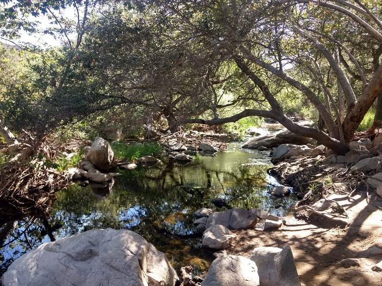
- Trailhead near the Escondido Creek.
-
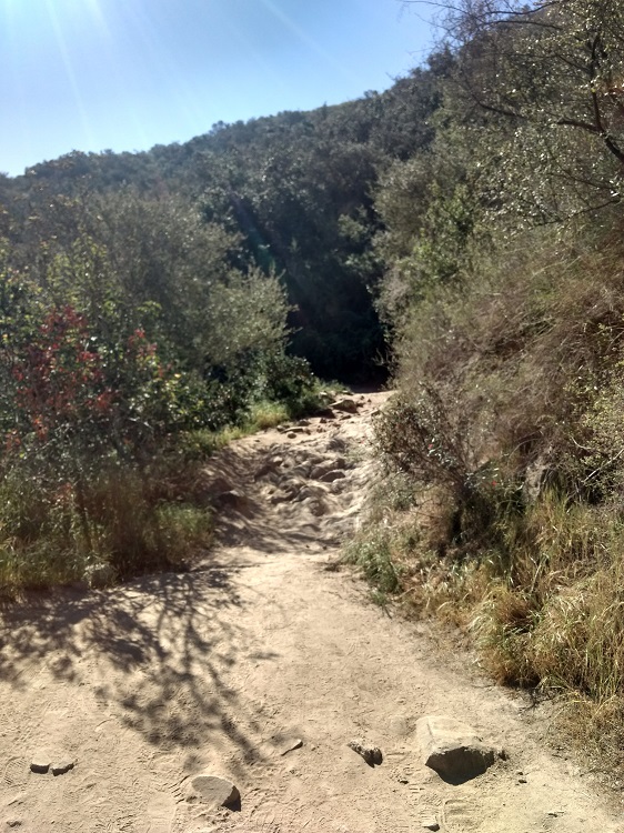
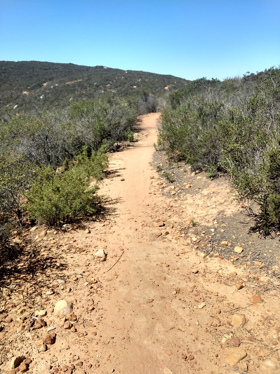
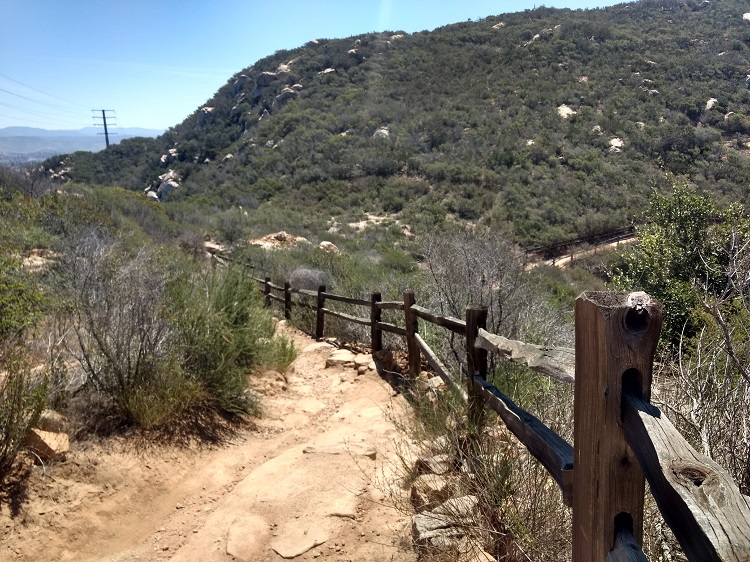
- Way Up Trail up through the canyon. This hike is mostly exposed to the sun.
-

- Local wildflower blooms during the spring are common in this area.
-
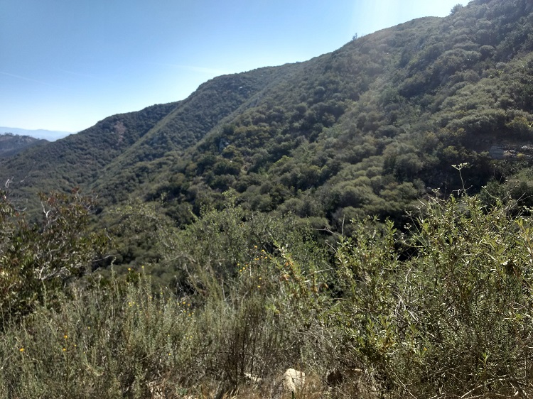
- The view of the canyon coming up out of Escondido Creek.
-
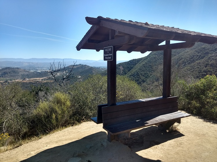
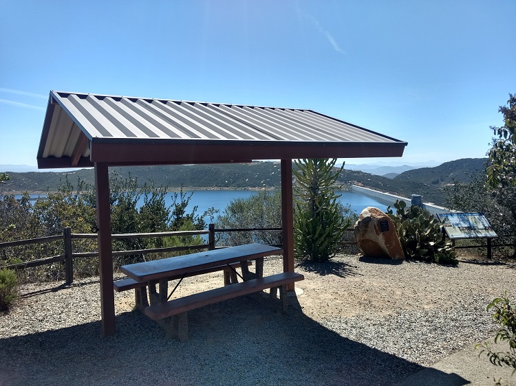
- There are many shaded benches throughout the reserve and scattered along the dam. These spots make for great rest areas and picnic spots.
-
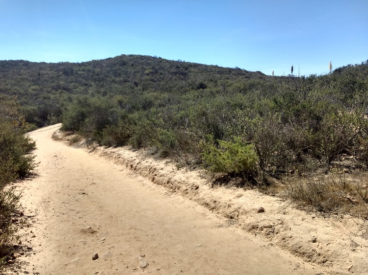
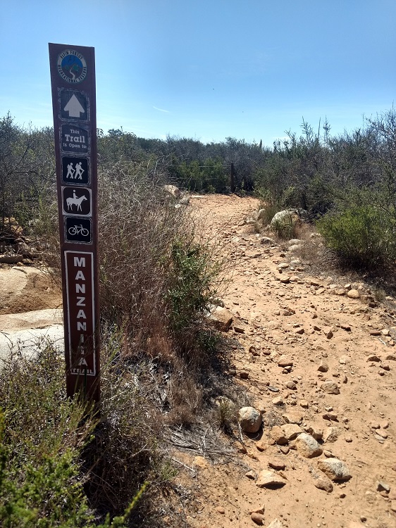
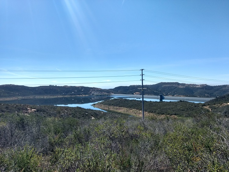
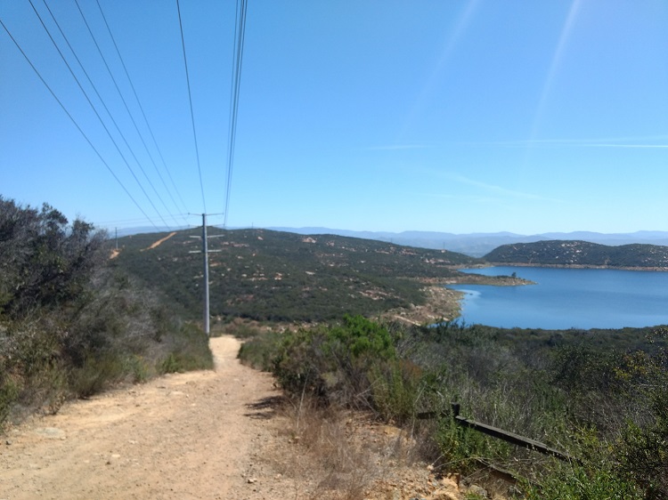
- The Way Up Trail turns into a utility road with many trail offshoots.
-
- The view of the fog line hovering over the Pacific Ocean.
-
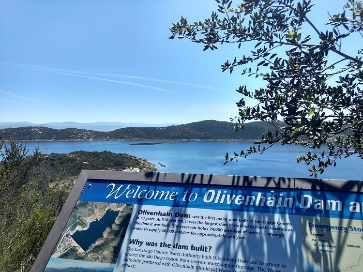
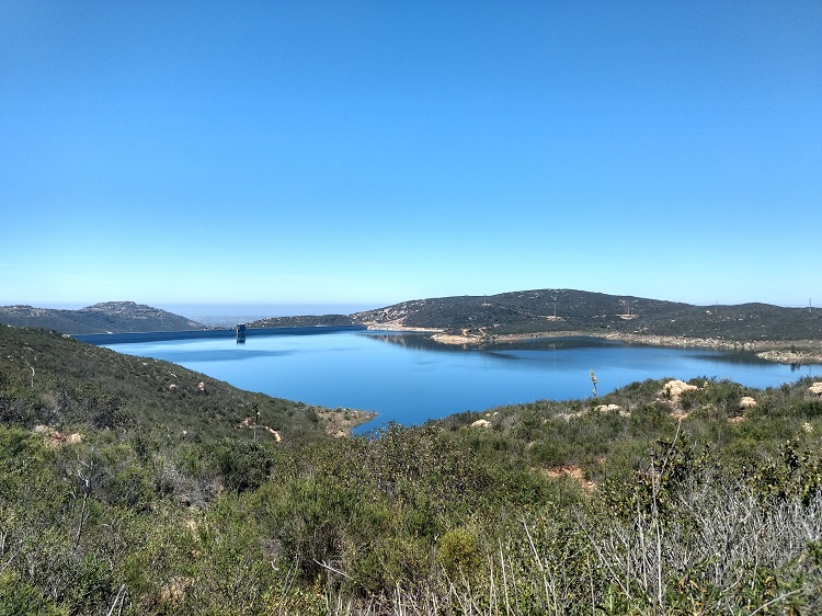
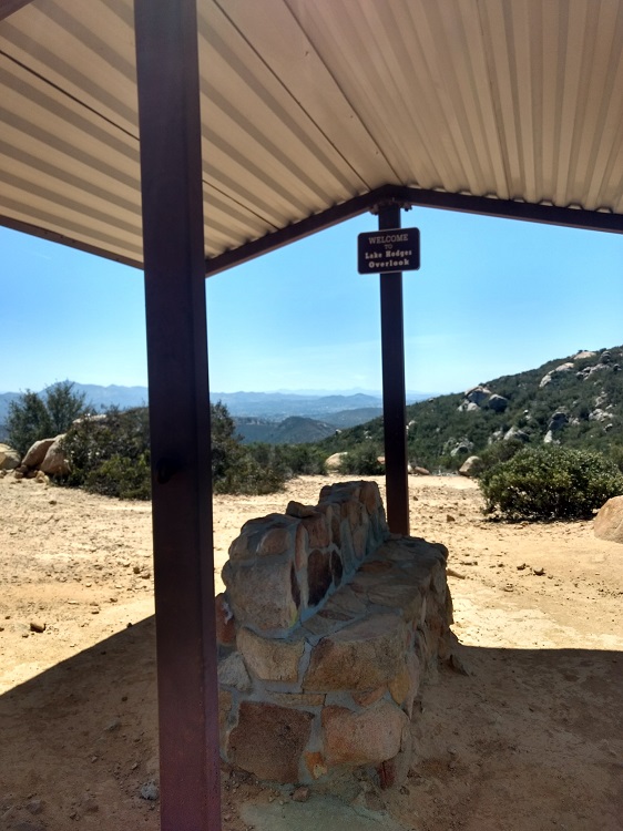
- At the Ray Brooks Picnic Area overlooking the dam.
-
- The trail loops back around the utility road to the opposite side of the dam to the Lake Hodges Overlook.
-
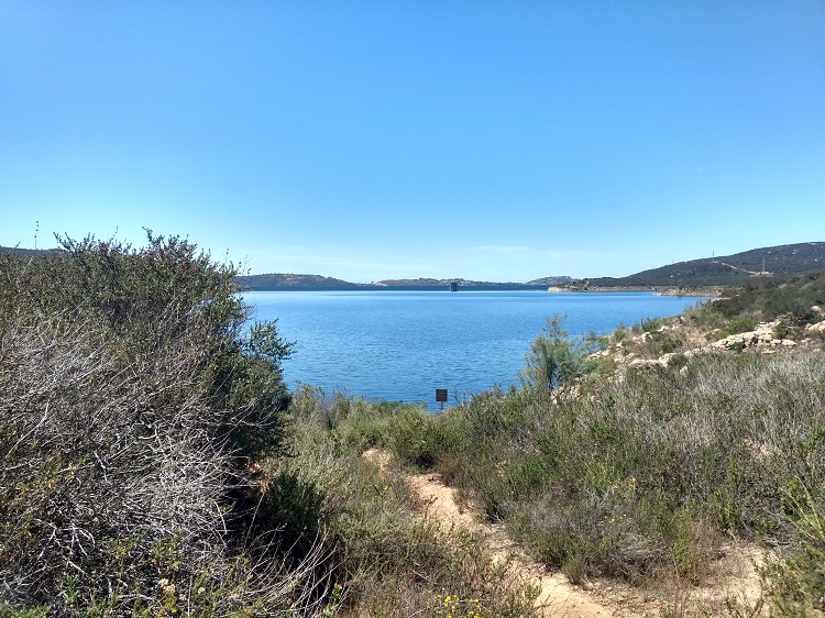
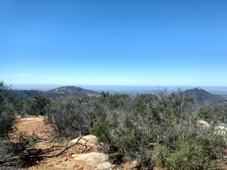
- The view from the Lake Hodges Overlook trail.
-
- Lake Hodges Overlook.
-
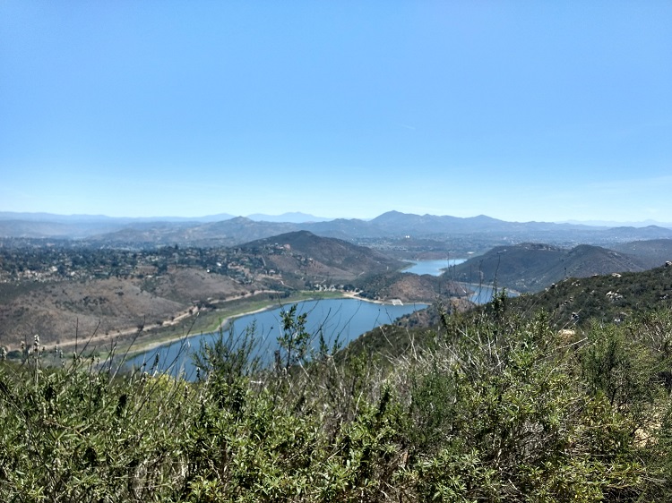
- Lake Hodges Overlook.
-
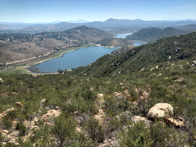
- Lake Hodges Overlook.
-
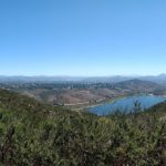
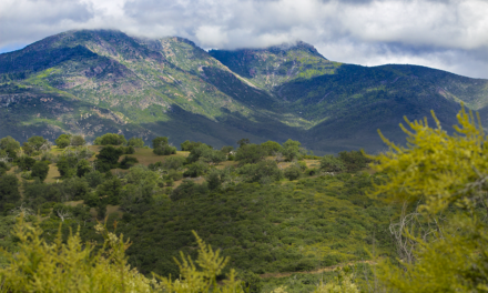
- Lake Hodges Overlook with the backdrop of San Diego’s local mountains and other hiking spots.
Who Olivenhain Dam via Way Up Trail Is For:
Novice Hikers: The Elfin Forest Reserve is a great place to hike if you’re new to hiking. There are just over eleven miles of trails within the area. To do the entire loop from the Ray Brooks Picnic Area to the Lake Hodges Overlook is just over seven miles. The toughest part of the trail is on the Way Up Trail. The rest of the trail is mostly flat with a few inclines/declines. The full loop will be a good challenge.
Advanced Hikers: The full loop trail will be pretty easy. Most of the elevation gain is in the beginning of the trail. If you want to explore more of the area, you can piece together the trail offshoots. However, I think that the trail isn’t that challenging and some of the views are kind of monotonous.
Expert Hikers: Those that fall into this category of hiker may be bored with the trails. If you’re looking for another city peak to conquer, add this to your list. The views aren’t all that bad.
It’s always a good idea to be aware of what type of hiking level you’re at.
Best Time Of Year To Hike Olivenhain Dam via Way Up Trail:
As most Southern California coastal hikes go, this one is best for mild fall, spring, and winter days. Hot summer days are probably some of the worst times of year to be out on this trail. The most beautiful time of year to enjoy this trail is during the spring after the winter rains bring green to the brown hills. On a good rain year, wildflowers can be plentiful.
This trail is short enough to be done during the cooler hours of the morning or evening. The caveat would be to get the trail overwith before the hot sun rears its head. There is no shade along the trail except near the creek at the trailhead. The coastal sea breeze can give some relief at the top of the trail. Avoid this park during hot weather and Red Flag Warnings.
Olivenhain Dam via Way Up Trail Conditions:
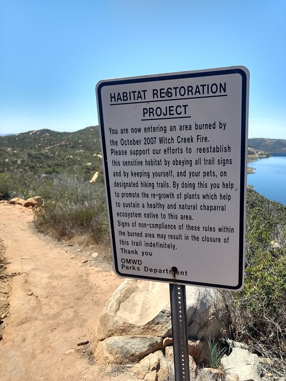
The trail is moderately trafficked and maintained as a part of the Elfin Forest Reserve. As the trail gets up to the top, crowds tend to thin out. The trail starts in the canyon where the Escondido Creek runs through. This is the only portion of the trail that’s shaded. As son as the trail gets away from the creek it turns into dirt switchbacks until the top of the ridgeline utility road. The Escondido creek flows year round so keep an eye out for poison oak in the shaded areas near the water.
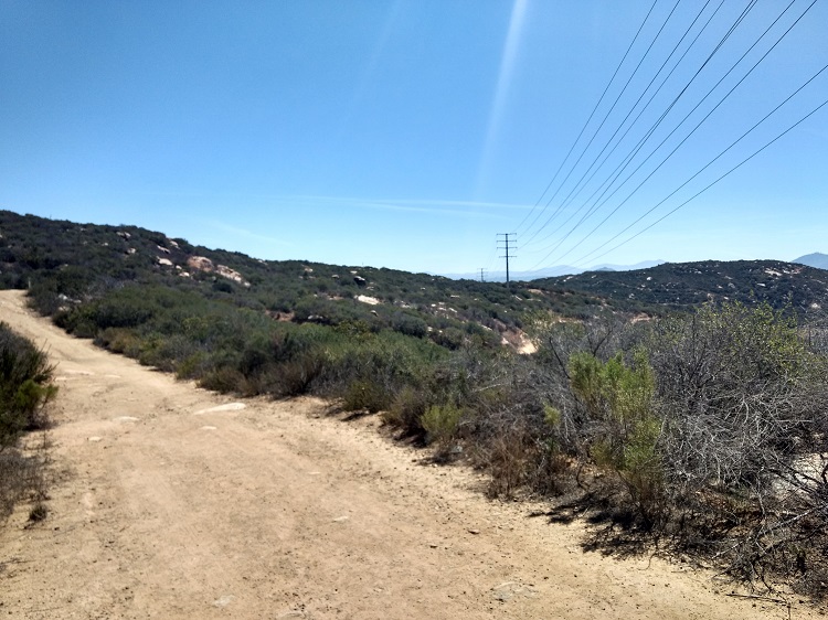
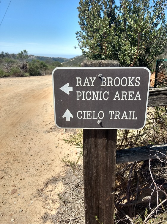
The ridgeline utility road is used to dam and utility maintenance and is mostly dirt and small rocks. Off the utility road are several offshoots of the trail that lead in different directions but all ultimately end up back to the maintenance road. Once at the top of the Way Up Trail take the road to the right until the Ray Brooks Picnic area for the western view of the dam and San Diego Coast.
From there loop back around and go past the Way Up Trail. From there the maintenance road will turn into the Lake Hodges Overlook trail. The Lake Hodges Overlook trail is a traditional trail that transitions from the dirt road. Keep an eye out for rattlesnakes throughout the trail. Depending on how long you’re on the trails for, keep in mind that you’ll be completely exposed to the sun.


