
Morro Rock Hiking Trail Guide
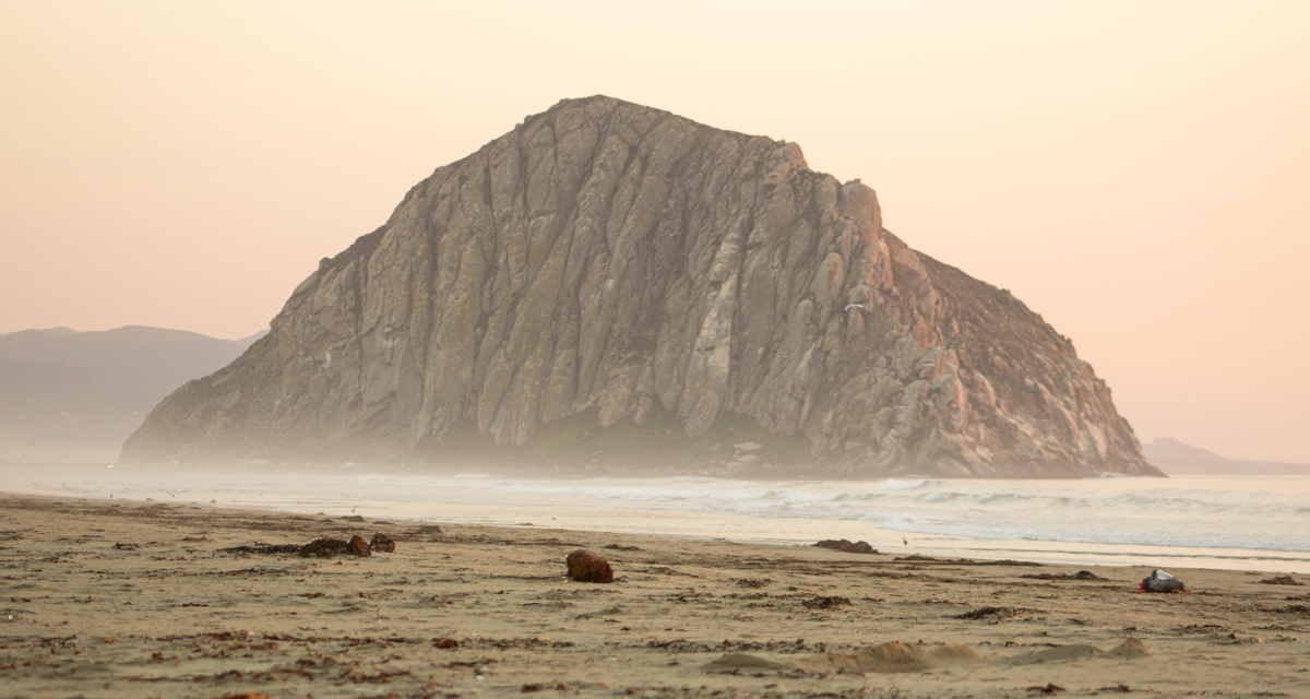
Sitting 581 feet tall on the north end of Morro Bay is an impressve mound of rock known as Morro Rock. There is a short trail that starts at the south end of Morro Rock Beach and skirts along the base of Morro Bay Harbor and its famous rock. The trail serves up an amazing opportunity to look into the moderate sized fishing harbor as well as peer across large sand dunes on the south side of the bay. Another neat view is an old decomissioned power plant with three towering smoke stacks that rises above the embarcadero. For the bird watchers Morro Rock is a registered landmark by the State of California and ecological reserve. Several species of birds make their home here to nest.
Morro Rock doesn’t serve just an aesthetic purpose. Native Americans made it their home for thousands of years and is of spiritual significance. The name of the rock was given to it by Juan Cabrillo when he sailed into the nearby Estero Bay. Cabrillo was part of the first European led Spanish exploration of the West Coast. In Spanish Morro refers to a domed rock.
The rock formation is known as a volcanic plug. Plugs are formed when lava hardens inside the vent of an active volcano. Through millions of years the original volcano becomes dormant and eventually erodes away. Whats left is the hard rocky plug. Morro Rock is one of nine plugs in the region. Ranging from 23 to 27 million years old they extrend from Morro Bay to Islay Hill near the San Luis Obispo County Airport.
Sources:
1. N.a. (2008). Morro Rock. California State Parks Placard. Exhibited at Morro Rock October 2020.
On A Personal Note:
This is a short trail but a very fascinating landmark. The views take you around the base of the rock and to the edge of the Morro Bay harbor. This trail is a great one if you have a little bit of time to spend in the area and want to walk near the beach. Morro Rock also makes for a great photography subject. I look forward to going back here to photograph it more. When you’re done with your time here make it a point to stop at the embarcadero for some fresh fish and chips or fish tacos.
Another great place to get a different perspective of the rock is from Morro Strand State Beach on the north end of the bay. During the low tide the rock gives a great reflection in the sand. If you have the time I recommend checking out this beach. It’s a beautiful white sand beach with some sand dunes. One thing I was surprised about seeing the rock up close was the amount of bird feces. From a distance the white blotches aren’t really noticiable on the rock.
Have you been on this trail recently? Leave an update on the trail conditions in the comments below.
- Overall Difficulty: 5%
- Overall Views: 85%
Morro Rock Trail Quick Facts:
- Max Elevation: 19 feet.
- Elevation Gain: 19 feet.
- Estimated Distance: 0.9 miles.
- Estimated Time: 10-20 minutes.
Morro Rock Trail Directions:
Open in maps. The parking lot is at the end of Coleman Drive. The road leads to Morro Rock Beach. Morro Beach is usually full of surfers in the water. Morro Beach leads all the way up to Morro Strand State Beach which is a beautiful white sand beach. The trail for Morro Rock will lead around the south side of the rock. Parking is free and not limited by any hours.
Morro Rock Trail Pictures:
-
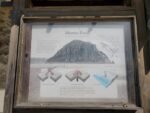
- An informational placard near the rock.
-
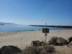
- Looking out to the south side of Morro Bay.
-
- The part of the trail from the parking lot to the beach.
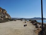
-

- A small white sand beach protected by the jetty at the end of the harbor.
-

- Looking at the reflection of Morro Rock from the beach.
-

- A view of the embarcadero and old power plant.
-

- Another view of Morro Rock from the Strand State Beach just after sunset.
Who Morro Rock Trail Is For:
Novice Hikers: This is a great trail for families, those unable to do longer hikes, or those with just a short amount of time and needing a quick way to stretch their legs. The trail is also great for strollers up until where you have to get down to the beach.
Advanced Hikers: This isn’t a difficult hike by any means but it’s a great way to see the south side of the bay. The short trail also offers up some great photography opportunities.
Expert Hikers: This isn’t difficult or any sort of a challenge.
It’s always a good idea to be aware of what type of hiking level you’re at.
Best Time Of Year To Hike Morro Rock:
Please be advised to stay off the jetty. During the fall through spring storms can send powerful waves to the coast. The large waves can make for some hazardous conditions as well as strong currents. Use caution when it comes to getting too close to the water and jetty.
It’s always a great idea tocheck the weather before a hike.
Morro Rock Trail Conditions:
This is a very short trail and well maintained. The trail to Morro Rock begins at the end of Coleman Drive where the parking lot is. From there the trail winds around the south end of Morro Rock along a sandy trail. The trail ends near the tip of Morro Rock where a protective jetty begins. There is a small sandy beach protected by the jetty along the harbors edge. When the waves aren’t large and crashing over the jetty it’s a great place to walk down to the water. There are no rattlesnakes along the trail. There is also no poison oak along the trail.


