
Lake Hodges High Trail Hiking Guide
For those that make the drive along the I-15 corridor through Escondido and into San Diego, they’re likely very familiar with Lake Hodges. Lake Hodges is a large artificial lake that separates the city of San Diego from Escondido. There are numerous hiking trails along the shore’s of this lake. For the focus of this article, the guide will be focusing on the Lake Hodges High trail.
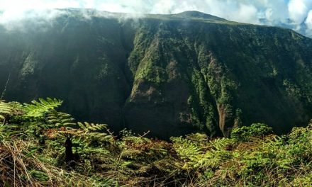
The Lake Hodges high trail runs just over six miles along lake’s northern shore. The trail originates along a portion of the San Diguito River Park before leading to the southeast. The trail winds around the summit of Bernardo Mountain before coming to a terminating viewpoint. Notable views along this hike include Mount Woodson, Palomar Mountain, and the famous Lake Hodges pedestrian footbridge. Looking to the west will look across the lake to the Del Dios Highlands Preserve where the Olivenhain Dam is situated in its hills.
Lake Hodghes Dam History
The history of Lake Hodges dates back as far as 1918 when it was initially constructed. It officially became a part of the City of San Diego in 1925. The dam’s construction took place along a downstream portion of the San Dieguito River along the Del Dios Gorge. The dam’s construction is highly visible along the Del Dios Highway rising up above afluent community of Rancho Santa Fe.
This trail is a portion of the San Dieguito River Park and trail system. The river which empties at the San Dieguito Lagoon in Del Mar gathers steam from it’s origination along Volcan Mountain in Julian. Altogether this river is responsible for draining a large portion of the central San Diego watershed. Eventually, the entire San Dieguito River will feature nearly seventy miles of hiking trails that span from the Pacific Ocean to the Pacific Crest along the Coast to Crest Trial.
Today the dam is operated and maintained by the City of San Diego Public Utility Department. It’s responsible for servicing thousands of citizens with potable water. When full the capacity of Lake Hodges has a depth of 115 feet, 27 miles of shoreline, and covers 1,234 acres. There is also a pipeline thar runs form Olivenhain Dam to the lake that can generate enough electricity to power 26,000 homes.
On A Personal Note:
Lake Hodges is such a large source of water that it’s a great place for viewing wildlife. Birds are in no shortage and it’s common to see large raptors catching the coastal breeze while they soar above the lake. Keep an eye out for coyotes and mountain lions during the dawn or dusk hours. The relatively flat trails make this a great option for families.
On an occasional rare year, there will be enough rainfall in Southern California to bring Lake Hodges to capacity. In order to to prevent dam failure, the city will release thousands of gallons of water to make room for runoff. The water pours from the dam gates making a large man-made waterfall into Del Dios Gorge. If you ever have the opportunity to see this happen, check it out. The city will announce when they do this.
Kayaking, canoeing, boating, and fishing are available on the lake. A valid California Fishing License is required. There is no swimming in the lake. The lake is open for water activities from February to October. For more information, please visit the city’s official website.
Looking for another nearby lake with views of Lake Hodges? Try the Olivenhain Dam trail from the Elfin Forest Preserve. This trail leads up into the Del Dios Highlands and looks down on lake hodges from several hundred feet.
Do you have any updates to the hiking trail or want to share your hike/pictures? Please leave a comment below.
Sources:
1. N.a. “Hodges Reservoir.” The City of San Diego. https://www.sandiego.gov/reservoirs-lakes/hodges-reservoir. 2020. Web. Accessed 18 July 2020.
2. N.a. “Hodges Reservoir Water Level.” Questions and Answeres. The City of San Diego. https://www.sandiego.gov/sites/default/files/hodges_qa_051319.pdf. 10 May 2019. Web. Accessed 18 July 2020.
3. N.a. “Lake Hodges Projects.” San Diego County Water Authority. https://www.sdcwa.org/lake-hodges-projects 2020. Web. Accessed 18 July 2020.
Do you have any updates to the hiking trail or want to share your hike/pictures? Please leave a comment below.
- Overall Difficulty: 40%
- Overall Views: 65%
Lake Hodges High Trail Quick Facts:
- Max Elevation: 430 feet.
- Elevation Gain: 295 feet.
- Estimated Distance: 6 miles.
- My Distance: 5.5 miles.
- Estimated Time: 2-4 hours.
- My Time: 1 hour 52 minutes moving; 2 hours 20 minutes total.
Lake Hodges High Trail Directions:
The second option is to park along Lake Drive. There is street parking here with a small parking lot. If the lot is full streetside parking is available. Be respectful towards any residents that life in the area. Parking here will be right where a portion of the San Dieguito River trail runs along the lake.
Lake Hodghes High Trial Pictures:
-
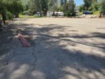
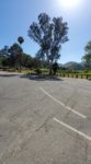
- The small parking lot off Lake Drive that would have otherwise been open if it weren’t for Covid.
-
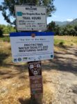
- The trail starts on a portion of the San Dieguito River Trail.
-
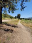
- The hike leads around the north side of the lake along Mission
-
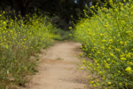
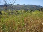
- Some parts of the trail are overgrown with mustard. Be alert for snakes.
-
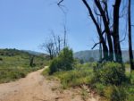
- There are two trails on opposite dies of Mission Road. This one is on the other side of the road. Burn scars from the Witch-Creek fire still visible.
-
- Mission Road eventuall ends where the Lake Hodges Recreation parking lot is.
-
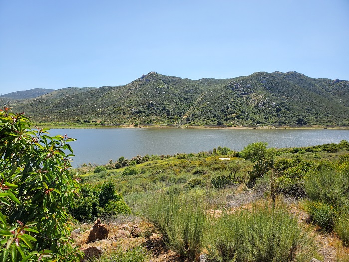
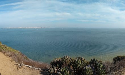
- Looking across the lake towards the Del Dios Highlands Preserve and the Lake Hodges dam in the far left.
-
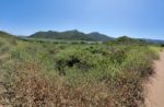
- The trail then hugs the base of Bernardo Mountain for the remainder of the hike.
-
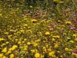
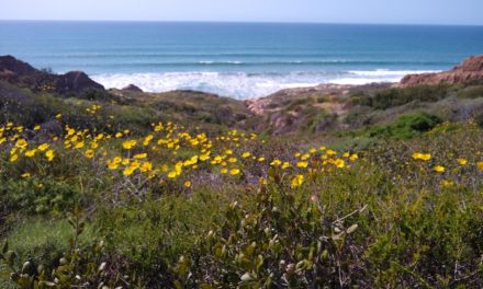
- Wildflowers are common during the spring.
-
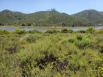
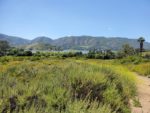
- A view of the soutend of lake hodges.
-
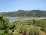
- A view of the lake from the trail’s turn aroudn point.
-
- Looking to the west towards the Del Dios Highlands Preserve on the way back.
Who Lake Hodges High Trail Is For:
Advanced Hikers: Although the lack of elevation is less of a challenge on this trail, it’s a great option for those to do with less experienced hikers. During the spring and especially after a rainy year, there are a varity of wildflowers along this trail.
Expert Hikers: For a more difficult Lake Hodges hike, this trail can be combined to form a sixteen mile out and back hike. Trail entrance points are at either the Bernardo Summit trailhead or at the Lake Hodges Dam trailhead.
It’s always a good idea to be aware of what type of hiking level you’re at.
Best Time Of Year To Hike Lake Hodges High Trail:
Summer at Lake Hodges can be extremely hot. It’s not uncommon for the majority of the summer to post high temepratures in the 90’s to 100’s. For a trail with no shade along the path the heat and sun can be brutal. For the hotter days, hiking during the dawn or dusk when temperatures are at their coolest is the best option. It’s also the best time to see wildlife before they seek shelter from the heat. Dress accordingly.
It’s always a good idea to check the weather before heading out on a hike.
Lake Hodges High Trail Conditions:
To be honest, the first bit of the trail is a little disappointing. A narrow bike path/use trail follows along Lake Hodges way until the recreational area. There was no vehicular traffic when I hiked but I’d imagine the cars to be a bit disappointing while on the hike. Once past the Lake Hodges Recreation area the trail continues along the San Dieguito River Trail on a utilty road past the base of Bernardo Mountain.
On the south flank of Bernardo Mountain there will be a turn off to the right along the wooden fence that follows the trail. About ten yards out will be a viewing point that overlooks the south side of Lake Hodges and looks into Poway and Rancho Bernardo. There is no poison oak along the trail. Keep an eye out for rattlesnakes during the warmer months. They are quite common here.