
Clouds Rest via Tenaya Lake
Clouds Rest is a large granite peak within Yosemite National Park. The peak gets light to moderate traffic due to it’s distance away from the Yosemite Valley floor but the views from atop are some of the best in the park. The peak doesn’t get quite the same reputation as Half Dome, but the perks are less crowds, no permits, and equally incredible views. There are a few different ways to get to Clouds Rest but for the sake of this trail, I will be focusing on how to get to Clouds Rest via Tenaya Lake. The trailhead begins near Tenaya Lake, which is an impressive view itself. During a calm morning or evening, the glass-like water paints a mirror image of the surrounding mountains and forest. The shores of the lake are also lined with crystal clear blue water and white sand.
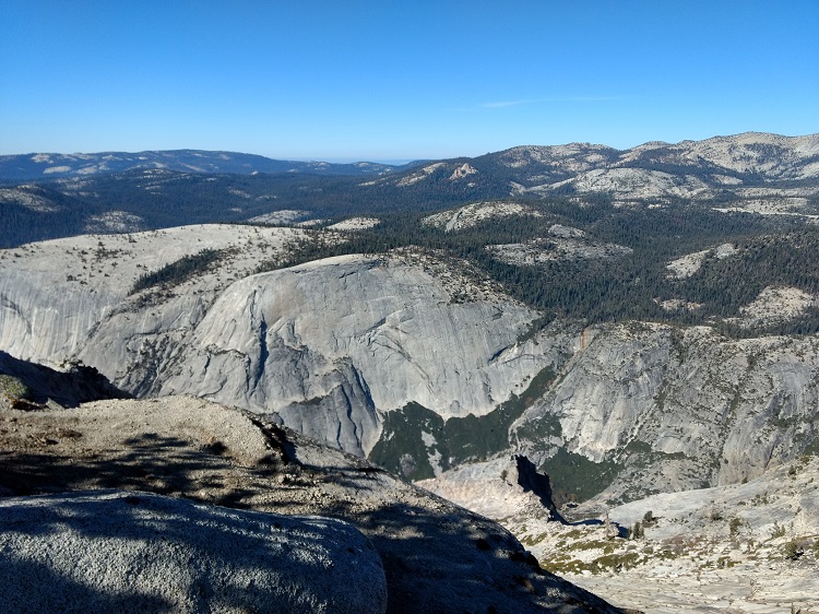
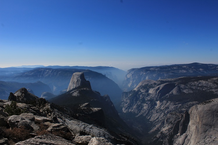
One of the most notable things about the peak of Clouds Rest is how it sits directly above Half Dome. The peak of Clouds Rest is actually at higher elevation and looks down on Half Dome. From Clouds rest, hikers climbing up Half Dome can be seen. One of my favorite things about Clouds Rest is as the trail nears the peak, there is a slim ridge line up to the top. This ridge can bring jitters to those afraid of heights. One wrong move could mean a fall to a few thousand feet to the canyons below.
The top of Clouds Rest is a perfect place to have a picnic while admiring the beauty of Yosemite National Park. After the the climb down, if time permits, enjoy a small victory break on the shores of Tenaya Lake to take in the beauty one last time before leaving.
Do you have any updates to the hiking trail or want to share your hike/pictures? Please leave a comment below.
- Overall Difficulty: 75%
- Overall Views: 100%
Clouds Rest via Tenaya Lake Quick Facts:
- Elevation: 10,007 feet.
- Elevation Gain: 3,113. feet.
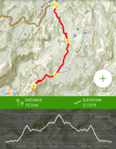
- Estimated Distance: 12.3 miles.
- Estimated Time: 6-8 hours.
- My Time: 8 hours – I took a lot of photos, spent some time on the lake, and had a lunch at the top.
Clouds Rest Trail Directions:
The trailhead is about an hours drive on Tioga Road from the west entrance to the pass. There is a small parking lot on the right side of the road that is marked. Please know your route before you go, there is no cell phone reception. Cost is admission to Yosemite National Park. An America The Beautiful pass will also work.
Clouds Rest via Tenaya Lake Pictures:
-
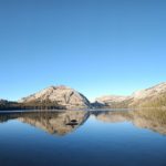
- The stunning view of Tenaya Lake.
-
- The many meadows that make up the lower elevation of the Clouds Rest trail.
-
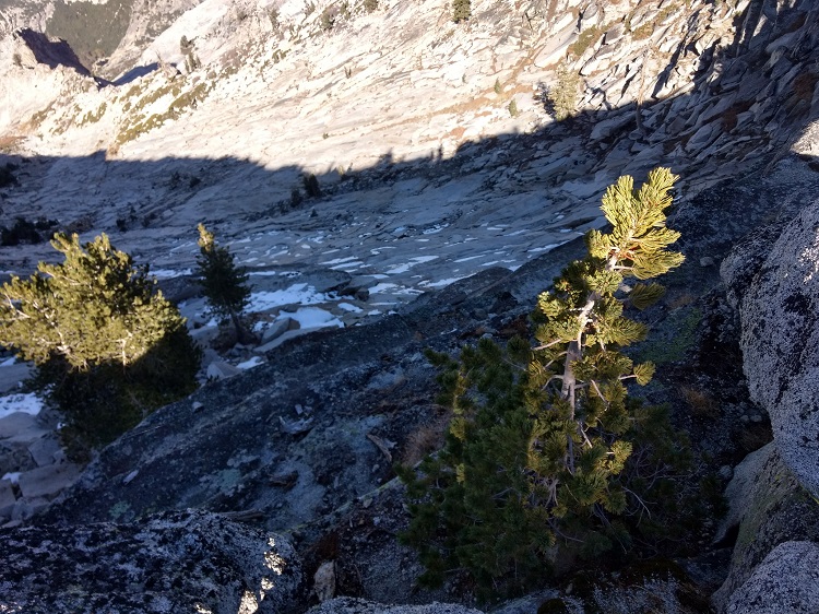
- A couple miles into the trail there is a thousand foot elevation gain through a series of switchbacks.
-
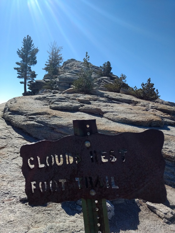
- Looking up to the beginning of Clouds Rest’s granite peak.
-
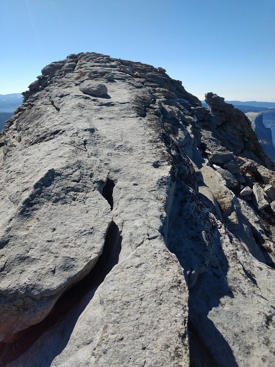
- Nearing the slim ridgeline up to Cloud’s Rest.
-
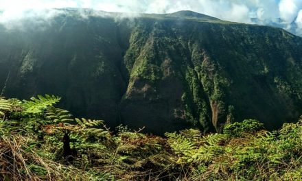
- Looking into Tenaya canyon.
-
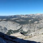
- A panoramic view of Tenaya canyon.
-
- Looking straight down into Tenaya canyon.
-
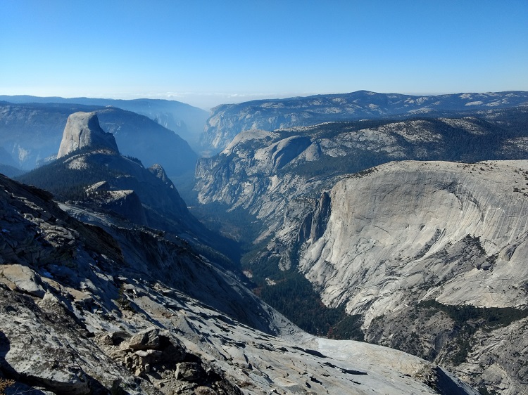
- Looking down from Clouds Rest into Yosemite Valley.
-
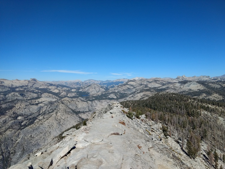
- Looking north from the top of Clouds Rest at the slim ridgeline to the top of Clouds Rest.
-
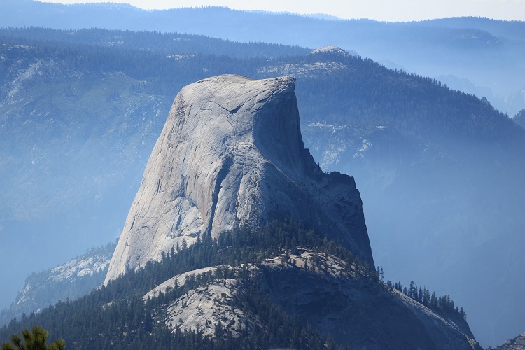
- The amazing view of Half Dome from Clouds Rest.
-
- Yosemite Valley from the top.
Who Clouds Rest via Tenaya Lake Is For:
Advanced Hikers: This is a challenging hike that is perfect for those looking to become more experienced with navigating trails where there is no cell phone reception. The elevation gain and length of the trail give this hike a good opportunity for more advanced trail planning.
Expert Hikers: This is a perfect day hike. Once you do this trail you’ll want to explore some of the other connecting trails within the area.
It’s always a good idea to be aware of what type of hiking level you’re at.
Best Time Of Year To Hike Clouds Rest via Tenaya Lake:
Late spring through early fall is the best time of year to hike to the peak of Clouds Rest. Depending on the Seirra snowpack, snow and Ice will still remain along some parts of the trail. The earlier the time of year, the more snowpack there will be along the trail. Use caution when along the upper portion of the trail if there is snow or ice. The ridgeline at the very top of Clouds Rest is very narrow and a fall off the side will likely result in death.
I hiked this in late October. At that time there hadn’t been any snowfall accumulation but there were still pockets of ice along the higher elevations.
Clouds Rest via Tenaya Lake Trail Conditions:
In the higher elevations, melting snow or ice could make portions of the trail slippery. During the summer, there is always the threat for thunderstorms with hail and lightening. Be aware of weather conditions and the weather can rapidly deteriorate in this area.
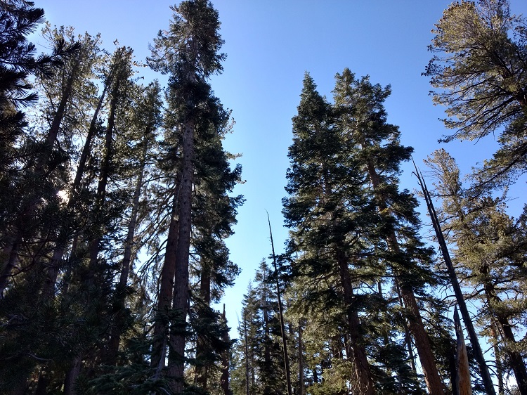
As for the trail conditions themselves, the trail is in great condition and is lightly to moderately trafficked by both people and animals (mostly people). The trailhead begins near the parking lot for Tenaya Lake. The trail then goes through some lengthy meadows and then to about a one thousand foot elevation gain in three-quarters of a mile of distance. In my opinion, this elevation gain is the toughest part of the trail. The elevation gain goes up a granite peak and features many switchbacks.
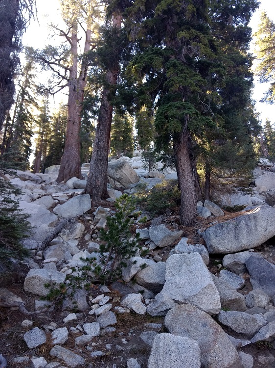
Once at the top, the trail then goes back down into a valley with a small lake, drainage stream, and meadows. Once through the valley the trail starts ascending up to the top of Clouds Rest. The trail becomes more exposed to the sun as the elevation increases. As the trail nears the granite peak of Clouds Rest, the trees thin out and make way for the ridge line that leads to the top of Clouds Rest.
The ridge line is the next most difficult part of the trail; not because of elevation but because of the thin trail line and steep canyons that are a few thousand feet deep on both sides. One wrong slip on ice or tripping here could be incredibly dangerous.
Once at the peak of Clouds Rest, there are many large flat granite rocks to sit on and enjoy the view. If you have binoculars, check out the climbers making their way up Half Dome. From there, you can turn around and visit Tenaya Lake one last time.
The trail to Clousd Rest via Tenaya lake does intersect with a few other trails. Fortunately, signs are posted along the trail to steer you along the right trail. If you don’t want to deal with worrying about different trails, use a GPS finder; there is no cell phone reception.
Keep an eye out for poison oak, rattlesnakes, and other larger wild animals like bears and mountain lions.