
Hiking Lake Calavera
The Calavera trail system is part of a thirteen city-owned and managed nature reserves in the City of Carlsbad. The Calavera Nature Preserve makes up a nice series of trails that feature coastal sage scrub, mixed chaparral, southern willow scrub, mulefat scrub, and freshwater marsh. Calavera Nature Preserve has four main features: Mount Calavera which is an extinct volcano (and the only one in San Diego), Lake Calavera, the Solar System Walk, and an old abandoned mining cave, if you can find it.
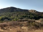
The first of the preserve’s features is Mount Calavera. Mount Calavera is an extinct volcano and San Diego’s only one and one of three in Southern California. The main trail system skirts around Mount Calavera but there are a series of use trails that take you right up to the top of the extinct volcano and right back down. Mount Calavera itself is dated to be around 22 million years old – so it won’t be erupting any time soon. The volcano is considered plugged by old magma which has formed a plug within the tube system to the center of the volcano. The volcano was originally formed along a hot spot between the sliding of two tectonic plates.
Lake Calavera
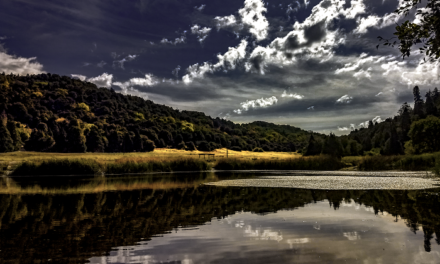
Lake Calavera itself holds about 520 acres of water and is about 400 acres across. The lake is a man made reservoir with a dam along the south side of the lake. Lake Calavera is unique in that the marshlands surrounding the lake attract coastal bird species that aren’t normally found away from the coastline. Altogether the area is home to four sensitive plant species and twelve sensitive animal species. Through a series of funds, the City of Carlsbad has been doing a natural habitat restoration project to the area. I have to give the city kudos at recognizing the importance of natural vegetation. Through the restoration project the city is working on eliminating and keeping invasive plant species out and reestablishing native plants. Native plants help to attract the natural wildlife.
Trail Entrances
There are a few primary trail entrances, College Blvd. to the west, a north entrance off Tamarack Avenue, and an eastern entrance at Oak Riparian Park. These trail entrances are the most encouraged entrances. The Solar System Walk begins shortly after entering the Tamarack Avenue tralihead. The College Blvd. and Tamarack Avenue access points form a lollipop type of trail. However, there are several of other already use established trail entrances throughout the neighborhood that I’d like to discourage the use of. For the purpose of this trail guide, I’ll be focusing on the Oak Riparian Park trail entrance to Calavera Nature Preserve. Although, the trail description for the other entrance would be more or less the same.
For more information, please visit the City of Carlsbad Calavera Nature Preserve website.
On A Personal Note
This is a unique trail that I really liked. What I found annoying was that there was an abundance of water/sports drink bottles that people left behind along the trail. What was equally as annoying was the amount of people that left their dog poop in the dog poop bags along the trail. This is a trail maintained by the City of Carlsbad and they provide trash cans and free dog poop bags for people, so use them! Pack it out! Please be respectful and mindful to the park rules and nature.Have you done this trail recently?
Looking for another trail nearby? Check out the Batiquitos Lagoon Trail. This short hike is between the City of Carlsbad and Encinitas. The trail skirts the edges of one of the lagoons that are popular in coastal North County.
Please leave a comment about updates to the trail descriptions or trail pictures below.
- Overall Difficulty: 25-65%
- Overall Views: 65%
Lake Calavera Trail Quick Facts:
- Elevation: 531 feet.
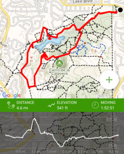
- Elevation Gain: 460 feet.
- Estimated Distance: About 0.5-6 miles.
- My Actual Distance: 4.6 miles.
- Estimated Time: 1-2.5 hours.
- My Time: 1:52 minutes.
Lake Calavera Trail Directions:
There are a couple of other trail entrances established primarily through use and through the local neighborhood. However, I’d like to discourage use of these access points as the main entrances are the preferred entrance system by the city and establishing other routes can lead to erosion. Oak Riparian Park is a small park with a decently sized parking lot. Please be respectful to the area as there is a residential neighborhood that lines Calavera Preserve.
Lake Calavera Trail Pictures:
-
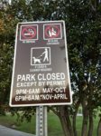
- A few trail rules posted at the trailhead.
-
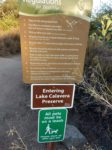
- A few more regulations posted at the trailhead.
-
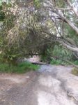
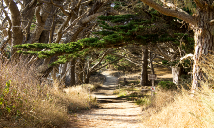
- Leaving Oak Riparian Park onto the trailhead.
-
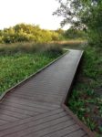
- The City of Carlsbad redid some of the trail network through some of the marsh portions.
-
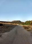
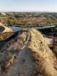
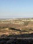
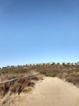
- Headed out onto the open trail with Mount Calavera in the background.
-
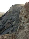
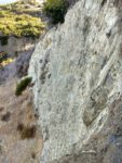
- Looking into Mount Calavera with its distinct volcanic plug.
-
- Headed up to the top of Mount Calavera.
-

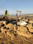
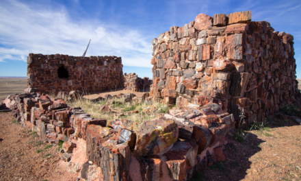
- There is a memorial at the top of Mount Calavera.
-
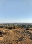
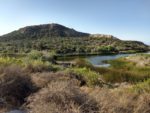
- Mount Calavera has a mini Mount Baldy look to it. Looking down on Lake Calavera.
-
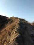
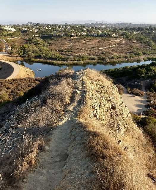
- Looking up along the Mount Calavera ridge from the trail.
-
- Headed down Mount Calavera.
-
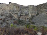
- Looking into Mount Calavera from the bottom of the trail.
-
- Looking down on Lake Calavera.
-
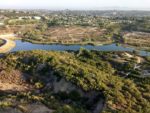
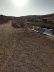
- Lake Calavera dam.
-
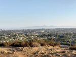
- A better view of looking to the north.
-
- Looking to the west.
-
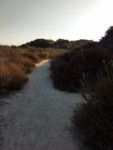
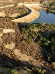
- The trail around the perimeter of Lake Calavera.
-
- More of the perimeter trail.
-
- Near the lake.
-
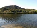
- Near the shore of Lake Calavera.
-
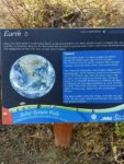
- The featured Solar System walk along the Calavera trail system.
Who Lake Calavera Trail Is For:
For those hikers who are incredibly novice, this trail system is a great place to try some longer distance and mild elevation gains. Those people who have difficulty ascending and descending steeper terrain might have some difficulty with coming up or down Mount Calavera but it’s pretty manageable. I’ve read a few things mentioning that trekking poles are needed to help get up or down the volcano but I don’t think they’re needed. If you want them that bad, bring them along.
Advanced Hikers: For advanced hikers, this iconic extinct volcano is a fun hike to spend a few hours in the morning. The shorter trails won’t be much of a challenge nor will the elevation of Mount Calavera, but the views are nice.
Expert Hikers: Same.
It’s always a good idea to be aware of what type of hiking level you’re at.
Best Time Of Year To Hike Lake Calavera:
I hiked this during one of the typical San Diego heatwaves in the middle of summer. I was on the trail by around 6:45am before it got two hot and was out in a couple of hours. At that time of day the temperature wasn’t that bad. The coast also helps to keep this area from warming up as quick as inland areas.
Lake Calavera Trail Conditions:
At the Oak Riparian Park there is a parking lot big enough for a dozen cars or so. Once there the trail starts at the end of the parking lot and winds through the shadiest portion of the trail. This portion of the trail is made up of trees (some of them Oak) and winds through a man-made false-wood path through a light marsh system that gets its water source from runoff. I’d imagine that levels of the water here will be highest during the winter after rains.
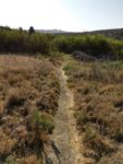
After this semi-marsh type of terrain, the trail opens up into a typical Southern California chaparral/grassland type of terrain. Eventually the trail will split off to the right and to the left. Going to the right will take you around the perimeter of Lake Calavera and eventually the dam and Solar System walk. I suggest going left and hiking this lollipop trail in a clockwise direction.
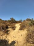
Taking the trail to the left will split you also take you around the perimeter but it will bring you near the base of Mount Calavera. From what I could tell there’s actually no defined trail up the side of the extinct volcano. What I did notice were several narrow zig zag trails through chaparral to the top that were offshoots from the perimeter trail. I picked the most obvious trail and headed up to the top of Mount Calavera. The elevation gain is pretty minimal and within a matter of ten to fifteen minutes I was at the top of the volcano.
Lake Calavera Volcano
At the top of Mount Calavera is a small memorial. I’m not sure what the story behind this memorial is but if someone would like to share it in the comments, I’d love to hear about it. From the top of Mount Calavera are 360 degree panoramic views of North Count San Diego. On a clear day you can see from the coast to the mountain ranges within the Cleveland National Forest to the north and to the east. It’s also a great vantage point to look down on the rest of Calavera Nature Preserve.
The trail down the west side of Mount Calavera was rather intriguing. There is a small ridge that reminds me of Devil’s Backbone on Mount Baldy in Los Angeles. The ridge line takes you down and across the caved in caldera of what used to be the volcano. A fall off the ledge here would be a few hundred feet down but the trail is by no means sketchy. Don’t get too close to the ledge and you’ll be fine. The rest of the walk down is much like the initial way up – a little steep but not unbearable. Those people with difficulty descending might have to go slower.
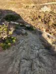
Once at the bottom of the west side of Mount Calavera, the trail curves to the left and right. Head to the left and the trail eventually meets up with the perimeter trail of the preserve. Take the trail to the right and the trail will lead to the center of Mount Calavera and up against the wall of the ledge of the volcano. At the bottom of Mount Calavera are some random rock formations that people have put up. I also ran into a rather large group of California Qual here which was a nice surprise. From the center of Mount Calavera you can either head back out and the trail will take you across Lake Calavera dam and by the lake and to the perimeter and back to Oak Riparian Park.
I opted to head back to the fork at the bottom of Mount Calavera and join the perimeter trail. This portion will take you by where the College Blvd. trail entrance begins. This part of the trail turns from dirt to a paved portion of the trail. This portion of the trail is also where the Solar System walk is.
Lake Calavera Solar System Walk
The Solar System Walk at Calavera Nature Preserve begins where the Tamarack entrance is and at the dam. There are large printed cut outs that begin with the sun and end with pluto with small facts about each planet. It’s an interesting part of the trail. If a person just wants to do the Solar System walk, it’s perfect for novice hikers, only about a half mile in length, and perfect for families. From the dam, the trails loop back to Oak Riparian Park.
Dogs are allowed on the trail as long as they are on a leash no longer than six feet. Please be aware that rattlesnakes are common in this area. Most of the trail is free of poison oak, however I did notice some small patches in the most shady parts of the trail near the beginning at Oak Riparian Park.
Please pick up after your pet and hike out what you take in! There was an abundance of dog poop in poop bags scattered along the trail. There are trashcans within the park but regardless, taking your trash out with you is a must! Please leave no trace.