
Tenaja Falls Hiking Trail Guide
The Santa Ana Mountain section of the Cleveland National Forest is largely overshadowed by some of the more popular peaks in the Angeles and San Bernardino National Forest. The Cleveland National Forest holds about 460,000 acres of mountainous and coastal valley recreational opportunities. The majority of the managed land lies south in San Diego but the Santa Ana mountain range between Orange and Riverside County include several gems including Sitton Peak which is part of the Southern California Six Pack of Peaks Challenge. The Tenaja Falls trail is a short out and back hike in the San Mateo Canyon Wilderness. This wilderness is a portion of the Cleveland National Forest that encompasses 39,413 acres. The land essentially covers the large gorge known as San Mateo Canyon and is managed by the United States Forest Service. This particular area draws in enough rainfall and even an occasional dusting of snow to allow for several seasonal waterfalls in the area. Rainfall collects into Tenaja Creek and flows into San Mateo Canyon forming an estimated 150 foot multi-tiered waterfall. The trail is of short duration and a noteworthy hike to check off the list of Southern California Waterfalls. At the top of the falls are a couple of natural pools that are a popular destination. In Spanish, Tenaja refers to a water basin or retention area. I’m guessing this name of the falls is given because of the natural tenajas or small pools at the top of the falls.On A Personal Note:
This is a fun short hike that’s suitable for families as well. The most difficult and time consuming thing about this trial is actually getting to the trialhead. There is a day use permit system where people are required to sign in at. The best view of the falls is actually from the canyon overlook about two thirds of the way up. Alcohol is prohibited at the trailhead and the falls. Overnight hikes require additional permits, check the trail directions for more information. One of the most troublesome parts about this trail is the amount of grafity near the top of the falls along the granite cliffs. For whatever reason people find it necesary to tag the rocks with spray paint and ruin the natural beautify of the area. When visiting the outdoors please respect wherever you visit and adhere to leaving no trace. Have you hiked this trail recently? Please share any trail updates/pictures in the comments below.Tenaja Falls Trail Quick Facts:
- Elevation: 1,462 feet.
- Elevation Gain: 287 feet.
- Estimated Distance: 1.5 miles.
- My Actual Distance: 1.8 miles.
- Estimated Time: 1-2 hours.
- My Time: 49 minutes moving; 1 hour 25 minutes total
Tenaja Falls Trail Directions:
Tenaja Falls Trail Pictures:
-

- Fill out the register at the trailhead.
-
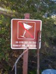
- Some basic rules and regulations.
-

- Additional trail information.
-
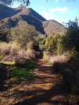
- Heading to Tenaja Creek from the trailhead.
-
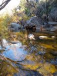
- The first Tenaja Creek crossing.
-
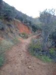
- Heading away from Tenaja Creek and up the canyon.
-
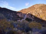
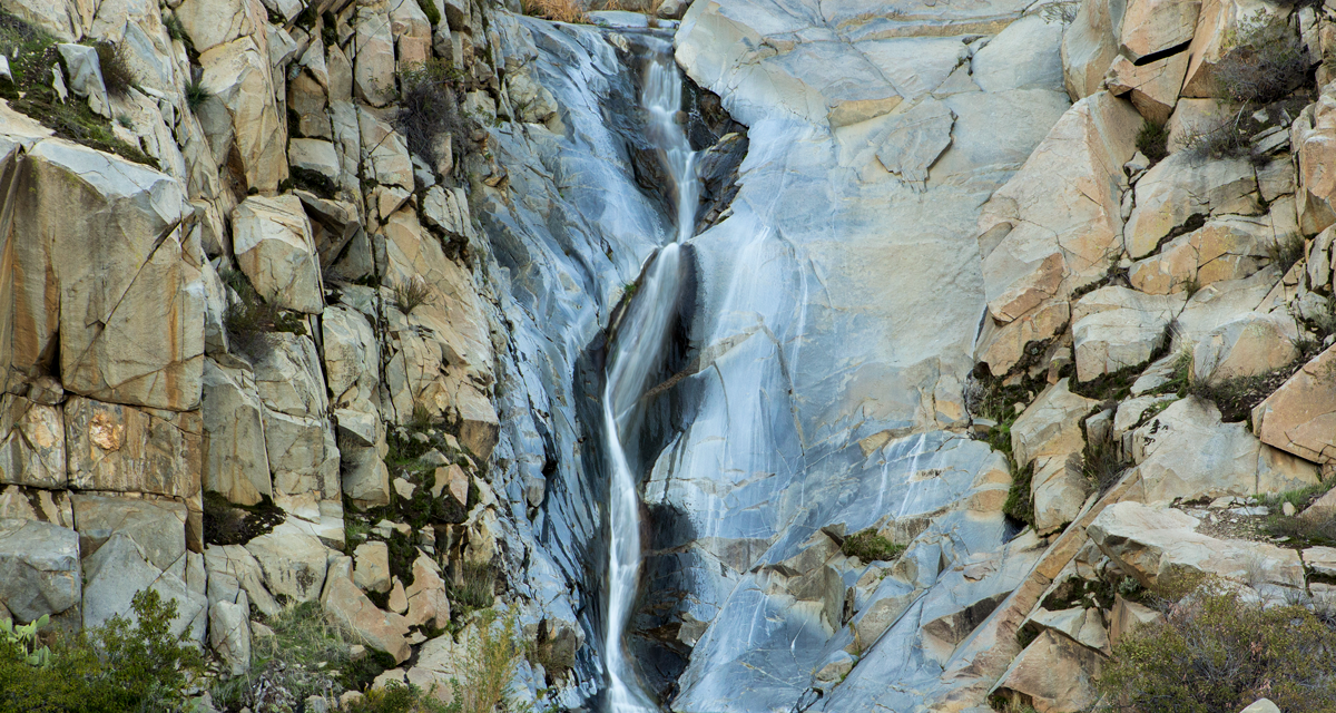
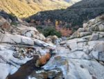
- The first look at Tenaja Falls. A good series of storms would make this a great site.
-
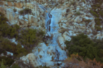
- A closer look at the tired cascading waterfall.
-
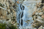
- A closer look at a portion of the falls.
-
- The second creek crossing.
-
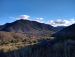
- From the top of the falls looking south into San Mateo Canyon.
-
- From the top of the falls looking down Tenaja Creek.
-
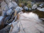
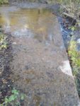
- The top of the falls and one of the pools at the top.
-
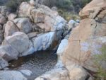
- Another one of the pools at the top.
Who Tenaja Falls Trail Is For:
Best Time Of Year To Hike Tenaja Falls:
If it’s my opinion, the falls are the crown jewel of this trail and hiking this trail for any other reason than the falls seems a little pointless. There are trails with better views of the San Mateo Canyon Wilderness and Santa Ana Mountains than this one. Therefore, the best time of year to hike this trail would to be when the creek is going and the falls are flowing.
The creek is all but a trickle for most of the year until the short-lived rainy season has kicked into gear. Your best bet to catch these falls flowing is between the months of November to April. The creek needs a few solid storms to really get flowing good. Persistent rains will help fill the watershed even more.
As winter heads into spring, the hills will turn from brown to a beautiful green and the hills will be filled with blooming native wildflowers and chaparral. By late spring the creek usually turns to a slow trickle. The summer months can be very hot and it’s not uncommon to see temperatures of 100 degrees in the canyon.
It’s always a great idea to check the weather before a hike.
Tenaja Falls Trail Conditions:
Leading Up To Tenaja Falls
In the creek there will be a trail that leads downstream to Fisherman’s Camp. Ignore this trail branch and continue along the trail that leads out of the canyon. The trail is mostly loose dirt with small granite rocks along the way. The evidence of heavy rains have left their mark by way of obvious trail erosion. About half a mile up is in what my opinion is the best viewing point of the falls. An opening in the trail looks across the canyon directly at tiered waterfall flowing into San Mateo Canyon. Continue climbing slowly along the canyon and eventually the trail again meets up with Tenaja Creek. There is another creek crossing here along a concrete basin that was placed just prior to the point of the falls. There are a couple of small pools at the top of the first couple of tiers which people have used for swimming in. The top of the falls offer a good viewing point overlooking the top of Tenaja Falls. It is possible to scramble down the granite face of the canyon to the bottom of the falls. Use caution and do so at your own risk. I personally think the best view of the falls is from the half mile mark overlooking the canyon. I’d imagine it is possible to head up along Tenaja Creek to the base of the falls but it would probably be greeted with some bushwacking and poison oak. Please be aware that rattlesnakes are common in this area, especially during the warmer months. The best chance of finding poison oak will be near the creek in shaded areas that get a lot of moisture.- Overall Difficulty: 20%
- Overall Views: 85%