
Hiking North and South Fortuna Peak
Located in the heart of central San Diego is the nation’s sixth largest municipally owned park, Mission Trails Regional Park (MTRP). This park is home to 7,220 acres of open space land for recreational use. The regional park was founded in 1974 and is one of the last open areas of land that divides central San Diego from what locals refer to as East County. Mission Trails Regional park is a good reminder of what the people of the San Dieguito’s, the La Jolla’s, and Kumeeyaay’s used to get to see before European explorers settled and developed this area.
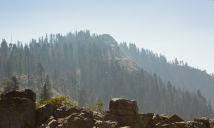
Within the park itself are five distinct peaks. North Fortuna is the park’s third tallest peak at 1,291 feet and South Fortuna is the park’s shortest peak at 1,094 feet. Both peaks divde the northwest section of the park from Mission Gorge and the San Diego River. Overall this trail offers a decent workout and substantial views for a hike so close to the city. From the summit the rest of the park’s peaks will be visible: Kwaay Paay, Pyle’s Peak, and the tallest, Cowles Mountain.
The origin of the name of the Fortuna peaks is unknown. In Spanish it means fortune. I’m only speculating here but perhaps it had to do with what the early missionaries believed would be good fortune from the views on the summit. Looking to the west is the City of San Diego, the Pacific Ocean, the hills of Mexico, and the Coronado Islands. To the north will be the Santa Ana Mountains, Mount Woodson, and Iron Mountain. Looking farther out east will be Palomar Mountain, San Jacinto Mountain, and San Diego’s second tallest, Cuyamaca Peak
North and South Fortuna Trail Entrances
There are multiple trail entrances to hike these peaks. As highlighted in other trail guides, peak access is also available from the Clairemont Mesa Blvd. entrance as well as the Oak Canyon/Old Mission Dam area. For the purpose of this article, the trail guide will focus on the Jackson Road entrance. Altogether there are about sixty miles of trails in Mission Trails Regional Park. A complete map of all the trails can be found here.
While both peaks can certainly be hiked individually, because of the proximity of North Fortuna to South Fortuna Peak, I have decided to include both in this trail guide. Hiking North Fortuna will add just under two miles to the distance but it is just a straightshot down and up a quick saddle between the peaks.
On A Personal Note:
From what I’ve gathered when talking to people at work about MTRP, the Jackson Road staging area appears to be the most popular entrance up to North and South Fortuna. To be honest, I do like the west entrance better based strictly off of my own preference for lighter crowds. This entrance however features two items that the other entrance doesn’t.
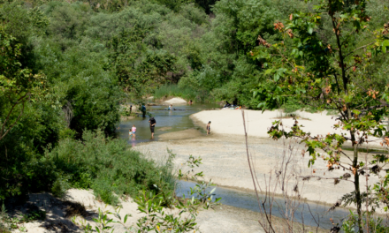
Within the first quarter of a mile the hike intersects the San Diego River before continuing on. The river gorge can be a good place to see native fall colors. Sometimes the river becomes unpassable when a winter storm puts the area into flood stage. Another feature of hiking this side is a well known wooden/dirt staircase cut into the side of South Fortuna.
Occasionally, this area will give views to some of San Diego’s larger wildlife. There have been reports of the occasional mountain lions in the area. I’ve personally seen bobcats, coyotes, and mule deer along my travels through here. Spring is a great time to see local wildflowers.Have you recently done this hike? Please post your photos in or leave an update to the trail conditions in the comments section.
- Overall Difficulty: 70%
- Overall Views: 75%
North and South Fortuna Trail Quick Facts:
- Estimated Distance: 5-7 miles.***
- My Distance: 7.2 miles.
- Total Elevation: 1,291
- Elevation gain: 995 feet.
- Estimated Time: 2-5 hours.
**Total distance depends on route taken. One peak will shorten this trail by about two miles.**
North and South Fortuna Peak Trail Directions:
North and South Fortuna Peak Trail Pictures:
-
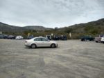
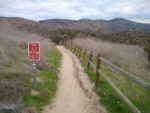
- The ample dirt parking lot for the trail.
-
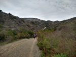
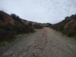
- Headed down the utility road into Mission Gorge.
-
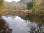
- Looking up the San Diego River.
-
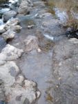
- The shallow river crossing.
-
- Leading up out of Mission Gorge.
-
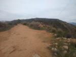
- Headed right along a short ridge looking across to South Fortuna, Kwaay Paay Peak, Pyle’s Peak, and Cowle’s Mountain.
-
- Looking down into Suycott Wash.
-
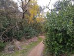
- The small riparian oak wash.
-
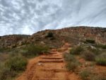
- The infamous staircase looking straight at South Fortuna.
-
- From the peak of South Fortuna looking across to North Fortuna.
-
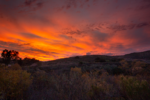
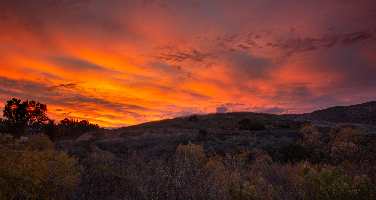
- One of the beautiful San Diego sunsets seen from Mission Trails Regional Park.
Who North and South Fortuna Peak Is For:
Advanced Hikers: I consider myself a somewhat advanced to experienced hiker and I enjoy the hike to the Fortuna Mountains quite a bit. The trails are challenging for it being so close to the city. The trail is also less crowded than other trails of the same caliber like Potato Chip Rock.
Expert Hikers: This is a fun peak to check off the list for a Sunday afternoon type of hike. If you want to test yourself, attempt the Five Peak Challenge in one day.
It’s always a good idea to be aware of what type of hiking level you’re at.
Best Time Of Year To Hike North and South Fortuna Peak:
North and South Fortuna Peak Trail Conditions:
The first portion of the trail is off of Jackson Road. This is actually a utility road that runs through some utility services that are located nearby. The dirt road leads down to Mission Gorge. Here there will be a crossing for the San Diego River. After storms this area can actually become impassable for a brief period of time. However, the rest of the time it’s nothing more than something that could potentially get your shoes wet.
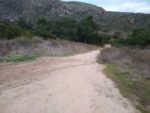
The utility road continues up out of Mission Gorge until it intersects to the right to lead towards South Furtuna and into Suycott Wash. The wash is a small ravine and watershed at the base of the Fortuna mountains. It will be obvious from the transition to chaparrall to dense oak before the trail leaves the shade and continues on to the infamous South Fortuna staircase.
The staircase leading up the side of South Fortuna is the most difficult part of the trail with the most elevation gain. Once at the top of the staircase the peak is nearby over one more rounded hump. Time permitting and if your body feels up for it, head a mile to the north to check North Fortuna peak off the list before heading back down to the parking lot.