
Eagle Rock Hiking Trail Guide
Warner Springs is a small town in the north part of San Diego County that was once famed for a major land travel route of emigration from the East Coast of the United States into Southern California. The trail known as the Southern Emigrant Trail was popular during the early 1800’s but has since given way to airplanes and interstates. These days a shorter hiking trail known as Eagle Rock is a draw of the the small unincorporated town.
For those that aren’t familiar, Eagle Rock is a natural wind swept granite rock formation that looks like none other but an eagle. The trail is just a short offshoot along famous Pacific Crest Trail. This hike is a great way to experience some of the grasslands and oak forests along the San Diego portion of the PCT.
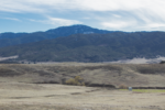
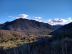
The trail leading up to Eagle Rock features some of the beautiful edges of the coastal mountains of San Diego. The mountains form a large valley of rolling grasslands used for cattle farming. Starting in the town of Warner Springs, this trail will take you through groves of coast live oaks along the Canada Verde creek to the Valle de San Jose between Palomar Mountain, Volcan Mountain, and Lake Henshaw. To the east will be San Diego’s tallest peak, Hot Springs Mountain and to the south, San Ysidro Mountain.
On A Personal Note:
This is a great trail to do during the winter or early spring and the wildlife opportunities could be countless here with a little luck and the right time of day. A good rain year will bring the rolling grasslands to life with wildflowers. A few good storms can make the Canada Verede Creek a peaceful treak through the oak groves along its bank.
In recent years, this trail has gained a lot of popularity. Eagle Rock provides for a great backdrop for photos. It’s very easy to argue that social media has compounded the popularity of this trail. Please remember to pack out your trash when you visit the outdoors – including taking your dog poo bags with you.
Have you hiked this trail recently? Please share any trail updates/pictures in the comments below.
- Overall Difficulty: 50%
- Overall Views: 85%
Eagle Rock Trail Quick Facts:
- Elevation: 3418 feet.
- Elevation Gain: 729 feet.
- Estimated Distance: 6.4 miles.
- My Actual Distance: 6.6 miles.
- Estimated Time: 2-4 hours.
- My Time: 2 hours 40 minutes moving; 3 hours 5 minutes total.
Eagle Rock Trail Directions:
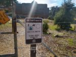
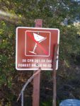
The more simplified giveaway is that the streetside parking is directly across the streeth from the Cal Fire Warner Springs Station which is clearly marked. There is no permit required for parking or to do this hike.
Eagle Rock Trail Pictures:
-

- Look out for this Cal Fire sign when approaching where to park on the highway.
-

- Park along the side of the road.
-
- There is a small gate right off the highway with a trail entrance clearly marked.
-
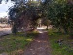
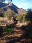
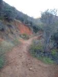
- Walking away from the town.
-
- Heading further away from the town toward Canada Verde creek and San Jose Del Valle.
-
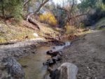
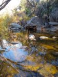
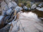
- Canada Verde Creek.
-

- Golden hour in the oak groves along Canada Verde Creek.
-
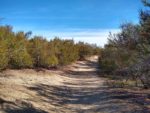
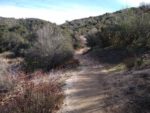
- Heading away from Canada Verde creek and into the grasslands of Warner Springs.
-
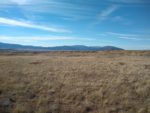
- The open plains of Warner Springs.
-
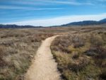
- Looking south along the Pacific Crest Trail.
-
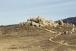
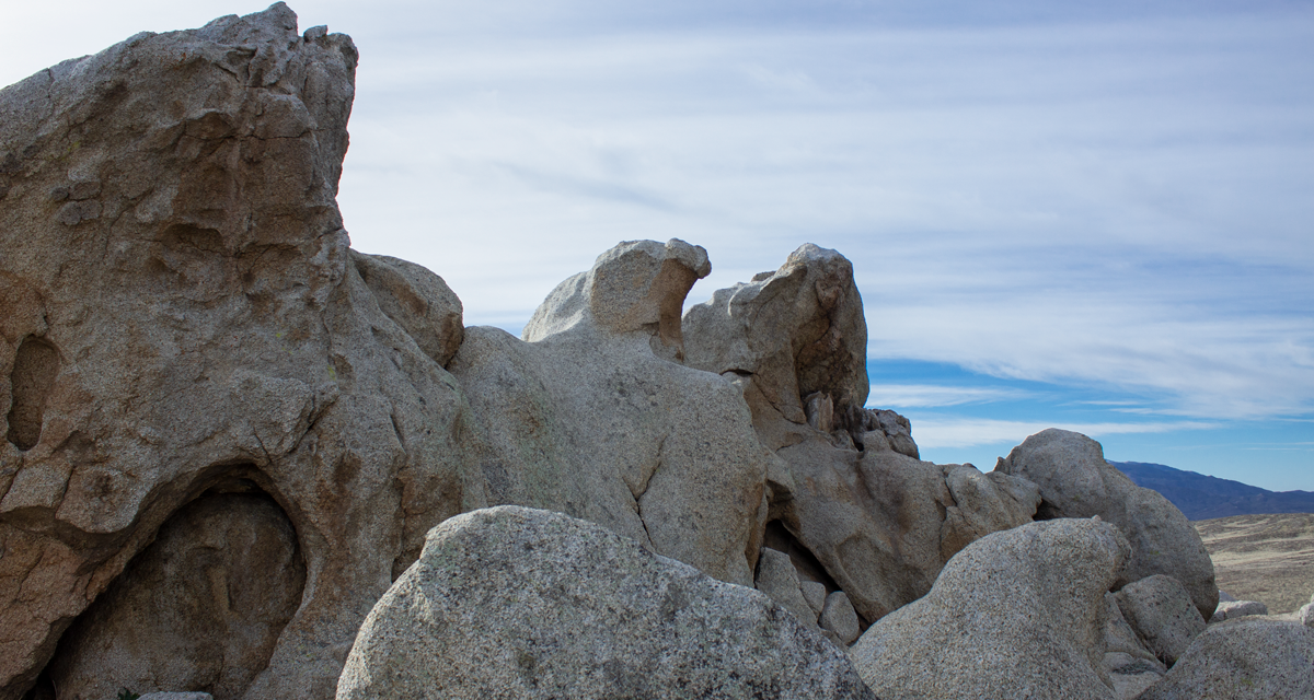
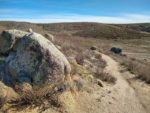
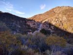
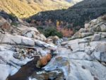
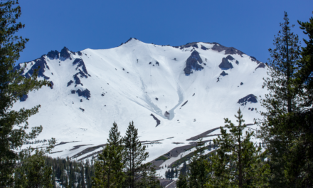
- The pile of eagle rocks as seen from the PCT from the trail in the distance.
-
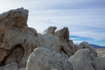
- Eagle Rock in all her glory.
-
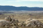
- Looking west to Lake Henshaw from atop Eagle Rock.
-
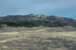
- Looking to the northeast towards the Los Coyotes Indian Reservation and Hot Springs Mountain.
-
- Looking southwest towards Volcan Mountain which overshadows Julian.
-
- The Palomar Mountains in the distance.
-

- Fill out the register at the trailhead.
-
- Some basic rules and regulations.
-

- Additional trail information.
-
- Heading to Tenaja Creek from the trailhead.
-
- The first Tenaja Creek crossing.
-
- Heading away from Tenaja Creek and up the canyon.
-
- The first look at Tenaja Falls. A good series of storms would make this a great site.
-
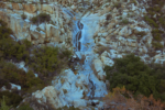
- A closer look at the tired cascading waterfall.
-
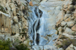
- A closer look at a portion of the falls.
-
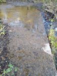
- The second creek crossing.
-
- From the top of the falls looking south into San Mateo Canyon.
-
- From the top of the falls looking down Tenaja Creek.
-
- The top of the falls and one of the pools at the top.
-
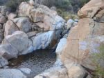
- Another one of the pools at the top.
Who Eagle Rock Trail Is For:
Advanced Hikers: There isn’t much elevation gain along this trail but it’s a great way to spend part of the day. The views won’t disappoint and this is one of those essential San Diego hikes to do.
Expert Hikers: There won’t be any sense of “peak bagging” feeling to this hike. Enjoy the views and in the meantime, think about hiking Hot Springs Mountain which rises to the east of the trail.
Best Time Of Year To Hike Eagle Rock Trail:
The best time of year to hike this trail is during the winter and spring months when the temperatures are cooler. Winter rains can bring the Canada Verde Creek to life for a short bit of time. As spring nears and the weather warms, the rolling grasslands will green and wildflowers will pop up along the trail.
If you’re a quick hiker, the summer months along this trail aren’t necessarily off limits as long as there is an early morning start before the day heats up. About two-thirds of the trail offer no shade and the summer becomes unbearingly hot. I’ve heard stories of people getting heat stroke along this trail.
Fall can be nice as long as it’s closer to winter and the days are cooler.
It’s always a great idea to check the weather before a hike.
Eagle Rock Trail Conditions:
From here on out the Pacific Crest Trail essentially hugs the Canada Verde creek and the Valle De San Jose for about a mile and a half. Along this portion of the trail there is ample shade provided by the oak groves that grow along the creek’s banks. After a few good storms, the flowing water will make for a peaceful backdrop behind the sound of your footsteps.
Eventually the trail migrates away from the creek and into the open grasslands of the valley. At first there will be a mix transition of chapparal and cactus before the scenery gives way to rolling grasslands. The trail will continue south along the PCT on what I assume (if anyone knows the answer, please inform me) is managed ranch land judging by the old remnants of cow dung.
The rock itself is just a short offshot no more than a hundred yards off the PCT. The eagle like formation is only visible from the east side. Approaching the rocks from the west will look nothing more like granite rubble. Enjoy the rocks, take your pictures, and remember take your trash and take your dog poo with you.
Please be aware that rattlesnakes are common in this area, especially during the warmer months. The best chance of finding poison oak will be near the creek in shaded areas that get a lot of moisture.
