
Red Ridge Trail Guide – Torrey Pines State Natural Reserve
The Red Ridge trail is a short out and back hike in the extension of Torrey Pines State Natural Reserve. Altogether the reserve holds around two thousand acres of open space land along the San Diego coastline and extending into the bluffs.
Most people familiar with Torrey Pines are likely unfamilliar with the smaller reserve extension hidden in the bluffs of Del Mar. This small acquisition added about 197 off additional acres of land. These additional acres add additional coastal area to state protection. While that may seem small, the addition contains about 1,500 Torrey Pine trees. This turns out to be about half of the total trees in the entire reserve.
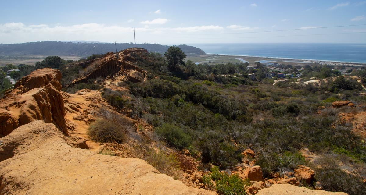
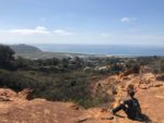
The Red Ridge trail leads from a residential community a short distance to a reddish colored ridge up along the bluffs. From the trail’s termination point is a panoramic view of Torrey Pines State Beach, Los Penasquitos Lagoon, and the bluffs up along the main reserve. The lagoon is formed by the creek which flows to the coast and makes up Los Penasquitos Canyon.
Torrey Pines State Natural Reserve History
Long before any European settlers explored this area, the region was predominantly inhabited by the tribe of Kumeyaay Native Americans. Early Spanish settlers during the 1500-1700’s referred to this area as Punto de Los Arboles, which means Point of Trees. The first modern account of the area was through a British medical doctor and botanist, Dr. Charles Christopher Parry.
Parry was doing work for the United States-Mexico Boundary Survey. Parry named the tree the now famous Torrey Pine after one of his mentors and leading botanists of the time, Dr. John Torrey from New York. Surprisingly, Torrey never actually visited the area to see the trees and only had seen samples of seeds, branches, and cones.
Over the years the City of San Diego slowly acquired parcels of land which now make up what the reserve is today. The most notable of these acquisitions was from Ellen Browning Scripps, who has helped to make San Diego what it is today. In 1956 a special election was held that resulted in the land being given over to the State of California. Doing so allowed all the land, plants, and animals to have the complete protection that was needed. In 1959 Torrey Pines State Park became official. In 2007 the name became a reserve as opposed to a state park.
Torrey Pines Fun Facts
- A famous Spanish missionary, Junipero Serra and his expedition named the tree Soledad Pines (Solitary Pines) during their expeditions through the area in the 1700’s.
- The tree’s only natural habitat is found within this reserve and on the Santa Rosa island in Channel Island’s National Park.
- Torrey Pines have very large systems of roots to be able to tolerate growing in the dry and poor soil conditions.
- The nuts of the pine are edible.
- The height of the tree can grow upwards of fifty feet in the best growing conditions.
- One of the distinguishing characteristics of the needles is that they grow in groups of five.
For more information, call (858)-755-2063 or visit the reserve’s website.
On A Personal Note:
The Red Ridge hike is a very short trail with arguably one of the best views in the extenstion to Torrey Pines State Reserve. The bluffs along the ridge is a great place to catch a sunset, sunrise, or even view the moon rise. Looking out to the east some of San Diego’s most popular peaks can be seen such as Mount Woodson and Black Mountain.
Parking for this trail is in a residential area. Please be respectful to the people who make their place their home and always practice leave no trace principles. If you’re looking for a longer hike, the Margaret Fleming Nature trail has the same access point and will add some additional distance. For a complete map to the small handful of trails in the area, see the official handout.
Do you have any updates to the hiking trail or want to share your hike/pictures? Please leave a comment below.
- Overall Difficulty: 5%
- Overall Views: 70%
Red Ridge Trail Quick Facts:
- Elevation: 394 feet.
- Elevation Gain: 25 feet.
- Estimated Distance: 0.7 miles.
- My Actual Distance: 2.2 miles*.
- Estimated Time: 15-30 minutes.
- My Time: 32 minutes moving; 36 minutes total.
***Total distance also included the Margaret Fleming Nature Trail
Red Ridge Trail Directions:
Red Ridge Trail Pictures:
-
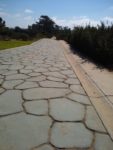
- The cobblestone drive way leading out to the dirt trail.
-
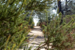
- The dirt trail leading from the paved road.
-
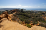
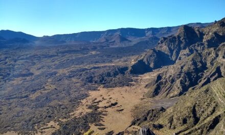
- The red ridge/bluffs looking out over the Pacific Ocean.
-
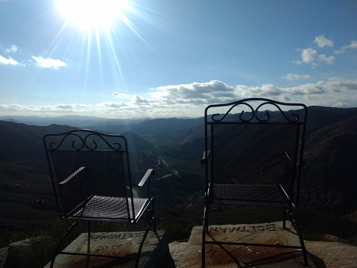
- A great spot to watch the sunset.
-
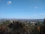
- Looking out to the east, Mount Woodson.
Who Hiking Red Ridge Trail Is For:
Advanced Hikers: Those who fall under this category will likely be bored with these trails. The main preserve has a lot more to offer.
Expert Hikers: Unless you really want to check some trails off your list then this likely isn’t a trail for you. However, it is a great spot to watch the sunset.
It’s always a good idea to be aware of what type of hiking level you’re at.
Best Time Of Year To Hike Red Ridge Trail:
One of the best times to hike this trail is is from late winter to mid spring after winter rains have brought flowers to the plants throughout the bluffs. May and June may be some of the worst times to hike if it’s sun you’re looking for. “May Gray” and “June Gloom” is what locals refer to the overcast days during that frequently keeps the coast from seeing any sun during this time of year.
As with any trail, it’s always a good idea to check the weather before heading out.
Red Ridge Trail Conditions:
The trailhead to this hike starts in the small parking lot at the end of this road. There is a cobblestone driveway that leads down to a few houses. The dirt trail continues after the cobblestone road and ends once you get to the bluffs.