
Hiking Monserate Mountain
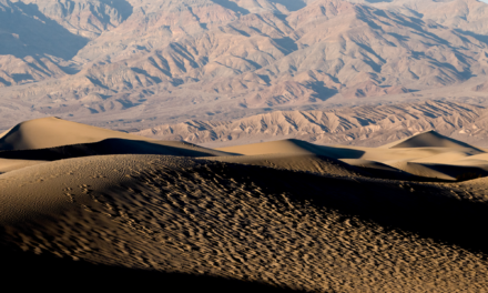
In the far reaches of North County in San Diego lies a modest hill called Monserate Mountain which sits at 1,567. To be fair, this is more of a prominent hill in the inland valleys than a Mountain. What’s not so moderate is the steep approximate one and a half mile to the top with 1,291 feet of elevation gain. The peak itself lies directly off the I-15 North corridor in the City of Fallbrook. From the top of Monserate Mountain, one can see sprawling urban views extending to the Coast, Palomar Mountain, San Jacinto Peak, San Gorgonio Peak, the northern Cleveland Forest, and even the far reaches of the San Gabriel Mountain Ranches on a clear day.
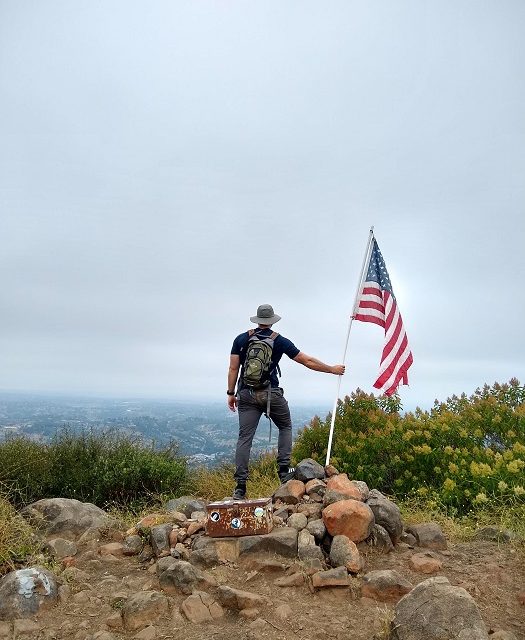
Monserate Mountain is managed by the Fallbrook Land Conservancy (FLC). The FLC is a non-profit organization that aims to preserve the natural habitat through land conservation in the area. This particular preserve features 340 acres of protected land. At the peak of Monserate Mountain rests a United States flag. This flag is a popular opportunity that many people use to take photos.
Each year the North County Fire Protection District holds an annual Fallbrook Firefighters 9/11 Memorial Hill Climb. This annual hill climb has been going on since 2013 near the weekend of September 11th. The hill climb is in honor of the 343 firefighters that died in the terrorist attacks on the Twin Towers in 2001. Money raised during the event is split between the National Fallen Firefighters Foundation and the Wounded Warrior Project. For more information, please check out their website.
On A Personal Note
Monserate Mountain can be a short and sweet hike for those needing to get some outdoor time and who live in the nearby area. The trail is a bit close to civilization for my tastes. There is still a pretty big burn scar from the 2007 Rice Fire from which the vegetation has not fully recovered. In my opinion, this trail is very reminiscent to the popular, Cowles Mountain.
Have you recently done this hike? Please post your photos in or leave an update to the trail conditions in the comments section.
- Overall Difficulty: 70%
- Overall Views: 55%
Monserate Mountain Quick Facts:
- Estimated Distance: 4.1 miles.
- My Distance: 3.99 miles.
- Total Elevation: 1,567
- Elevation Gain: 1,381 feet.
- Estimated Time: 2-4 hours.
- My Time: 2 hours 14 minutes (2 hours moving).
Monserate Mountain Trail Directions:
Monserate Mountain Trail Pictures:
-
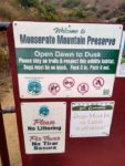
- Monserate Mountain trail hours.
-
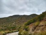
- The beginning of the trial.
-
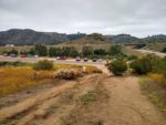
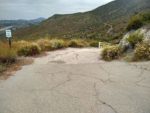
- A look down to the parking lot across the road.
-
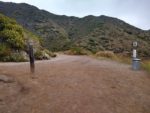
- This is where hikers can go either left or right to complete the trail.
-
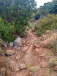
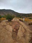
- A significant amount of the trail going up is eroded from past rain events.
-
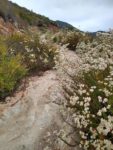
- There’s also portions of the trail with chaparral growing out over the path.
-

- The famous flag at the top of Monserate Mountain that’s a popular place for photo ops.
-
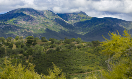
- Clearing skies with Palomar Mountain to the east.
-
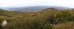
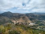
- A look to the west with Fallbrook in the foregrand and and an overcast morning.
-
- One side of the trail is completely paved.
-
- A view of the peak coming down the other side of the trail.
Who Monserate Mountain Is For:
Advanced Hikers: It might be worth a try if you need to really get outside for a bit and want a photo op with the American flag at the top.
Expert Hikers: I’d honestly take the extra time to drive the short distance into the Cleveland National Forest or Palomar Mountain if I lived nearby. But hey, a couple miles outside beats a couple miles on the Stair Master at the gym.
It’s always a good idea to be aware of what type of hiking level you’re at.
Best Time Of Year To Hike Monserate Mountain:
It’s always a good idea to check the weather prior to hiking.
Monserate Mountain Trail Conditions:
There are portions along the trail that have been washed out and eroded from rainfall runoff. Some portions of the trail are also overgrown with low lying chaparral. Use caution going through these parts of the trail. Rattlesnakes are very common here and could be seeking shade from the heat along the trail edges. There is no poison oak in the canyon.