

Hiking Bighorn Peak
Bighorn Peak is just one of many peaks that line the horizons along the San Gabriel Mountains. At 8,441 feet, this peak provides a wonderful hiking opportunity high above the densely populated counties of Los Angeles, Riverside, and San Bernardino. Individually this peak is about thirteen miles in distance and makes for a wonderful day hike. Many hikers opt to also include this peak’s neighbor, Ontario Peak which brings the total distance to an ambitious 14.3 mile hike with an extra 256 feet of elevation.
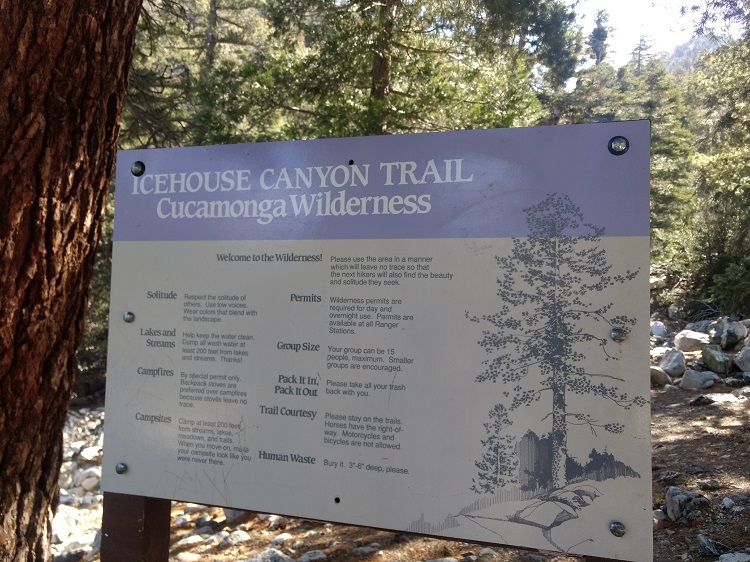
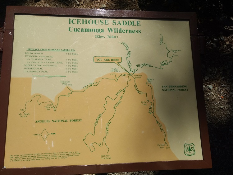
The hike to Bighorn Peak begins in the Icehouse Canyon area in the Cucamonga Wilderness. This wilderness area is just one of several within the Angeles National Forest. Altogether this national forest spreads out above Southern California for over 700,000 acres. The Cucamonga Wilderness covers 12,781 acres with about one third of its land in the Angeles National Forest and the remaining portions in the San Bernardino National Forest.
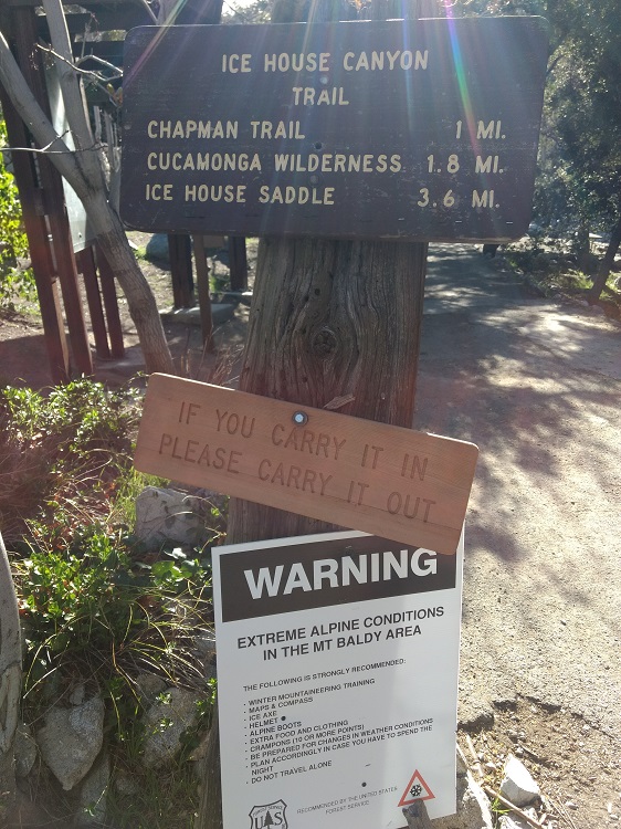
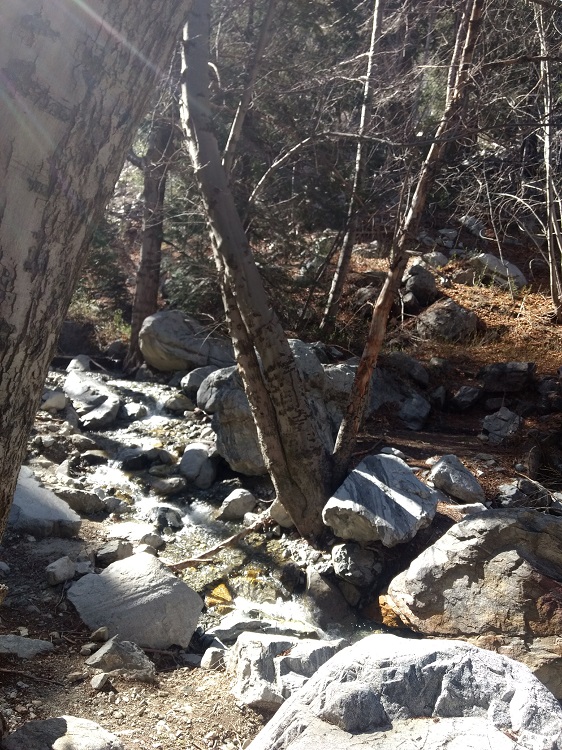
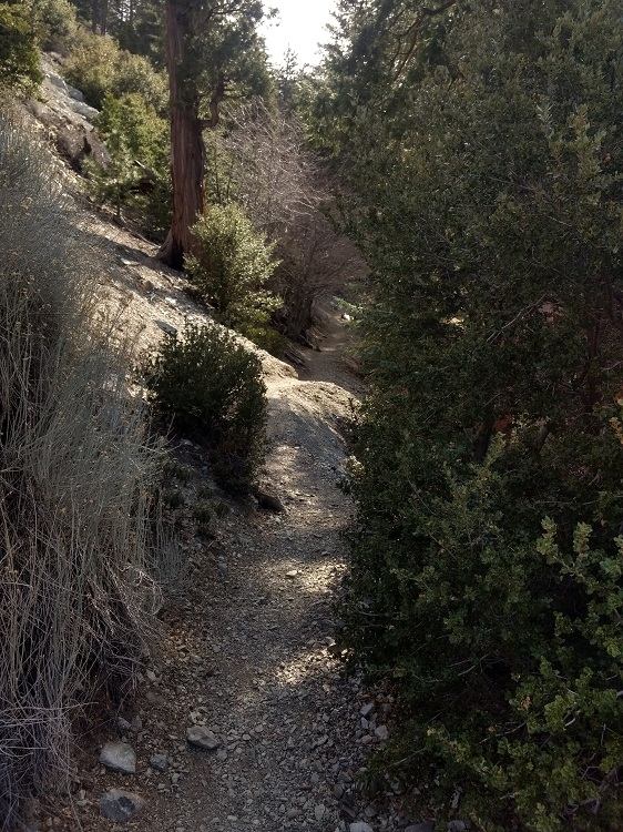
The Icehouse Canyon trailhead is a major trail that leads to a junction of for other peaks in the area including Cucamonga Peak. The bulk of Icehouse Canyon parallels Icehouse Creek and up past Telegraph Wash to the Icehouse Saddle Junction. Along the way will be a series of old recreational cabins. The creek usually flows year round and is fed through a series of springs. There is a spring that crosses the trail just after the two mile mark. This will be the last area for water. Late in the year and in dismal water years, the spring can be unreliable.
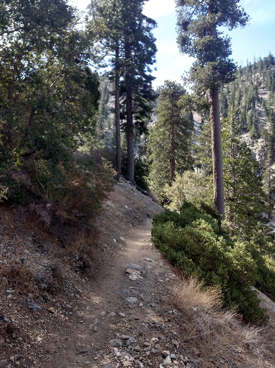
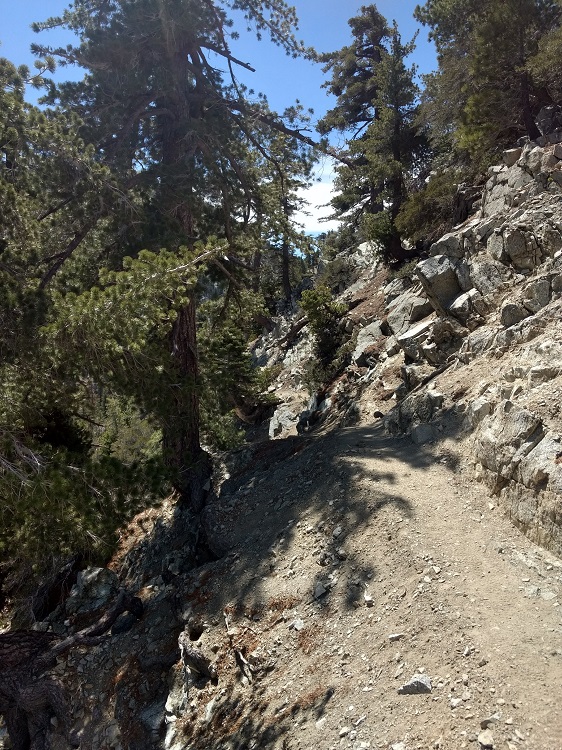
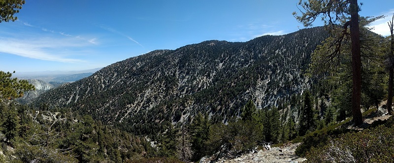
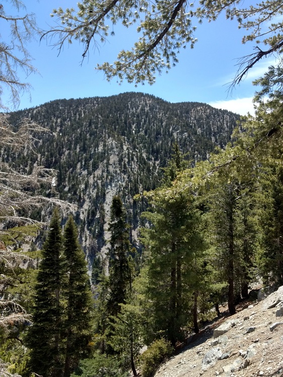
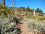
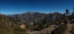
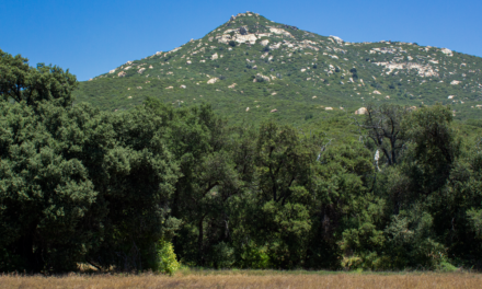
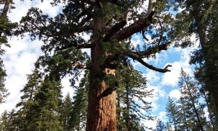
The lower portions of the trail include an oak covered canyon. Higher elevations are a mixed conifer forest of Ponderosa, Jeffrey, and Douglas-Fir pines and Manzanita thickets. There are ample amounts of wildflowers with the later blooms lasting until late summer in the higher elevations. Wildlife viewing opportunities can include bird watching, bears, deer, mountain lions, and bighorn sheep. From the top of this peak, there is a wonderful view overlooking Cucamonga Canyon and across to Cucamonga Peak.
On A Personal Note
Bighorn Peak is less visited than Ontario Peak. For this reason, the side trail to Bighorn Peak can be difficult to see approaching the ridge where the trail junction heads east. Near the peak there is a large patch of manzanita and the trail begins to fade. It was easy for me to keep on the trail leading up but on the way down to the junction, I ended up off trail. Do the best to pick the course of least resistance through the manzanita and rejoin the trail just north of the ridge line.
The switchbacks through the Icehouse Canyon can be quite cumbersome. The good news is that the switchbacks significantly cease after the Icehouse Saddle Junction. The rest of the trail to Bighorn Peak follows a ridge that divides San Antonio Canyon and Cucamonga Canyon. It’s also the dividing point between the Angeles and San Bernardino National Forest. This trail will require a wilderness permit or either an Adventure Pass or America The Beautiful Pass. Permit information can be found in the trail directions tab.
This peak is included on the list of the Southern California Six Pack of Peaks and in my opinion, makes a great alternate peak. I enjoyed this trail and the peaks much more than the popular Cucamonga Peak. Keep an eye out for bighorn sheep along the way, I did see one while approaching Kelly Camp. Prominent points of interest that can be seen from the peak are Mount Baldy, Ontario Peak, Cucamonga Peak, Telegraph Peak, San Gorgonio, San Jacinto, and the sprawling suburban cities of Southern California.
Have you recently hiked this trail? Leave a comment with recent conditions or feel free to share your pictures in the comments
- Overall Difficulty: 85%
- Overall Views 90%
Bighorn Peak Trail Quick Facts:
- Elevation: 8,441 feet.
- Elevation Gain: 3,951 feet
- Estimated Distance: 12 miles
- My Actual Distance: 14.3 miles (with Ontario Peak included).
- Estimated Time: 6-9 hours.
- My Time: Total time 7 hours 34 minutes; 6 hours 4 minutes moving.
Bighorn Peak Trail Directions:
Bighorn Peak Trail Pictures:
-
- The Icehouse Canyon trailhead is a major beginning point to many peaks in this area.
-

- Wilderness Permits are required and are located at this small box in the beginning of the trail.
-
- The trail head begins through this canyon carved out by a seasonal small creek. On good rain years this creek flows year round.
-
- Some o the several switch backs leading up to the Icehouse Saddle.

-
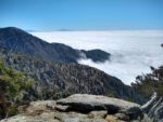
- Looking to the west from near the Icehouse Saddle.
-
- Looking at the back side of Cucamonga Peak from Icehouse Saddle.
-
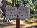
- Ontario Peak will be an immediate right following this sign to Ontario Peak.
-
- After the Icehouse Saddle, there is some relief from the switchbacks.
-
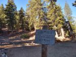
- Kelly Camp.
-
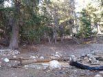
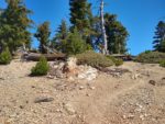
- The old rock foundations from Kelly Camp.
-
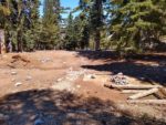
- More of the old rock foundations from Kelly Camp.
-
- After passing through Kelly Camp, the trail really opens op through a series of Manzanita and Lupine thickets and the remnants of mostly old dead conifers.
-
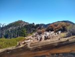
- The somewhat hard to see trail junction to the east with Bighorn Peak in the backdrop.
-
- Leading up the last push up to Bighorn Peak.
-
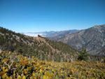
- One of the views looking to the south from near Ontario Peak. Cucamonga Peak, San Jacinto, and San Gorgonio seen in the distance.
-
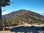
- Looking to the west along the ridge directly at Ontario Peak.
-
- Looking to the west towards Mount Wilson.
-
- Looking to the north towards Mount Baldy.
-
- Overlooking Cucamonga Canyon to Cugamonga Peak in the distance.
Who Bighorn Peak Is For:
Advanced Hikers: This hike will be a challenge for advanced hikers. If setting out when there is ice or snow on the trail, make sure to have adequate equipment. To break this trail up into a shorter section, camping is an option.
Expert Hikers: Those who have a lot of experience hiking in steep unstable terrain should have no difficulty. While it is a tough hike, weather conditions can make it harder. If you have proper equipment, you’ll have no problem. For those wanting more of an overnight experience, there are camping options which connect to longer trails in the San Gabriel’s.
It’s always a good idea to be aware of what type of hiking level you’re at.
Best Time Of Year To Hike Bighorn Peak:
In my opinion, summer is probably the worst time of year to hike this trail. Temperatures can be hot and just downright dangerous. That being said, in the beginning and end of summer there can be some cooler days to be found. Some species of plants bloom late into the summer at the peak.
It’s always a good idea to check the weather before heading out on a hike.
Bighorn Peak Trail Conditions:
Icehouse Canyon to Icehouse Canyon Saddle
The trail begins leading up through Icehouse Canyon and parallels the adjacent creek. Almost immediately the trail begins winding up a series of switchbacks that lead up through the area. As the trail leads up the creek it passes by a series of old use cabins. Enjoy the views and the sound of the creek while you can. As the elevation gains the creek fades and will soon be forgotten and replaced by the fact that you’re still going up switchbacks.
The switchbacks lead up out of the canyon to a Icehouse Saddle Junction. The junction services other peaks that are in the range. Many people use this area as a pit stop before heading to their destined peaks. Some even use it to set up camp. However,the junction is usually the windiest part of the trail drawing in coastal air through Icehouse Canyon that splits between two different peaks. Follow the Ontario Peak trail junction directly to the right of Kelly Camp to get to Bighorn Peak.
Bighorn Peak, Kelly Camp, and Ontario Peak
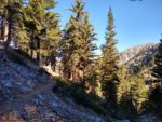
After leaving the Icehouse Saddle, the switchbacks are few and the trail becomes quite pleasant. The trail winds along the ridge above Icehouse Canyon and leads to an old wilderness hotel known as Kelly Camp. All that’s left are the aged and weathered stone foundations. This area is well sheltered and is a great spot for camping if an overnight trip is on the agenda.
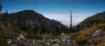
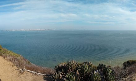
After Kelly Camp the mixed conifer forest gives way into an old burn area littered with dead trees. From here on out the trail gains in slight elevation until it leads to a ridge that divides both the San Benardino National Forest and the Angeles National Forest. One the south side of the ridge will be the cities of Riverside, San Bernardno, and Los Angeles County. In the far distance San Gorgonio and San Jacinto Peak Can be seen. To the other side of the ridge will be Mount Baldy, Mount Baden-Powell, and the rest of the San Gabriel Mountain Range that sprawls to the coast.
When the trail reaches this ridge line, continuing to the west will lead to Ontario Peak. The trail to Bighorn Peak is off to the east and is more difficult to see but it is there if your eyes are keen. This trail is about 1.4 miles round trip and follows the ridge in a saddle like fashion. At the bottom of the saddle there is a large patch of manzanita before pushing back up to Bighorn Peak. The trail does become unorganized and hard to follow through the manzanita. Follow the path of least resistance with the most distinct trail. I wandered off trail on the way down and finally saw the trail again after the swath of manzanita.
After visiting Bighorn Peak, head back down to Icehouse Canyon or continue along the ridge line to Ontario Peak to bag both peaks. As a reminder, rattlesnakes can commonly be seen along portions of this trail. Poison oak is unlikely but may be possible if one would wander along the creek where there’s persistent water and shade.