
Hiking Moro Rock Trail
If you’re entering Sequoia National Park via Highway 198 through the Ash Mountain entrance, you might notice a prominent granite peak looming high above the canyons below. This towering dome structure is Moro Rock. Moro Rock is one of the flagship and most easily accessible granite domes within Sequoia National Forest. Although this National Park isn’t known for its domes like Yosemite is, the park does contain a handful of them with Moro Rock being the most popular.
Moro Rock is popular because of its ease of access and it’s concrete and stone stairway that leads to the top edge. The top edge offers panoramic views of nearby peaks, the canyons below, and The Great Western Divide – large prominent mountain peaks within the Sierra that help separate Kings Canyon from Sequoia. The trail leading up to the top of Moro Rock was designed by the National Park Service and built in the 1930’s by the Civilian Conservation Corps and allows visitors to take in the surrounding sights.
The trail itself is winds just over three hundred and fifty steps around morrow rock and to the peak. Those with extreme sensitivity to heights should take comfort in the fact that the majority of the trail is lined with large boulders and a handrail. With that said, be mindful of where your feet are because a slip and fall would likely result in death. If you have kids, please also keep them close to your side.
During the summer months there is a is a shuttle that runs from the Giant Forest Museum to the Moro Rock Parking Area. On the weekends the road is closed so the only way to access Moro Walk is to catch the free shuttle or walk about one mile from the museum back to the parking area. During the winter, the trail can often be closed due to ice or hazardous conditions. Please use caution during thunderstorms. Moro Rock is completely exposed granite and one wouldn’t want to get struck by lightning.
On A Personal Note:
I highly recommend taking the shuttle to the trail and not walking up the road from the Giant Museum if at all possible. This will save you time for other things to do while in the park. Fire season can hinder the views of the towering 13,000 foot plus mountains to the east and of the valleys below. I’ve caught the views from Moro Rock during clear winter skies and smoky summer days. This peak is without a doubt best viewed on a clear day but regardless, I would still place it on the to do list.
Looking for another trail nearby? Check out the General Sherman Tree Trail. This short hike winds through the heart of a grove of giant sequoia trees. It features the largest tree by volume on the planet, the General Sherman Tree.
Have you done this trail recently? Please leave a comment about updates to the trail descriptions or trail pictures below.
- Overall Difficulty: 20%
- Overall Views: 100%
Moro Rock Trail Quick Facts:
- Elevation: 6,684 feet.
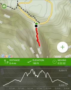
- Elevation Gain: 180 feet.
- Estimated Distance: 0.4 miles (approx 3.5 from the Giant Forest Museum Parking Lot).
- My Actual Distance: 0.4 miles.
- Estimated Time: 30-45 minutes.
- My Time: 22 minutes.
Moro Rock Trail Directions:
Moro Rock Trail Pictures:
-
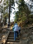
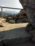
- The beginning of the trailhead.
-
- Leading up the the trail from the shuttle drop off.
-
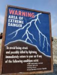
- Use of the trail isn’t recommended with the possibility of lightning in the area.
-
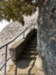
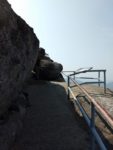
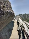
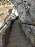
- There are a few narrow staircases along the trail.
-
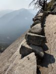
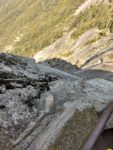
- Looking down the granite dome of Moro Rock. Falls would be fatal.

-
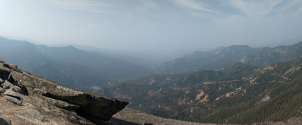
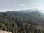
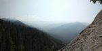
- Looking towards the west. Smokey skies take away from the vast views that are capable from here.
-
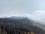
- Looking towards the southeast.
-
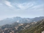
- Panorama of the east. On a clear day the Great Western Divide would be visible.
-
- Overlooking the forest below. Seqoias are visible towering above the rest of the forest. Dozens of dead trees – a byproduct of drought and beetles are visible.
-
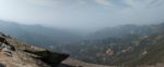
- Mountains obstructed by smoke in the distance.
-
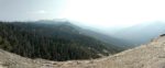
- Panoramic view of the southwest.
Who Moro Rock Trail Is For:
Advanced Hikers: This trail doesn’t provide any short of challenge for advanced or expert hikers. I still recommend taking the short amount of time to walk up to the top to see the views.
Expert Hikers: Same.
It’s always a good idea to be aware of what type of hiking level you’re at.
Best Time Of Year To Hike Moro Rock:
Moro Rock Trail Conditions:
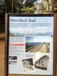
The trail on Moro Rock begins right where the shuttle drop off is. The trail is cut right into the granite rock and features a moderate incline with about three hundred and fifty stairs lined along the trail. There isn’t really anything noteworthy to say about the trail. Some places are narrow and traffic will have to be yielded for one person at a time. Along the way up are several information plaques about the area and surrounding views. There are portions of the trail that do not have a handrail. Small granite rocks line the edge of these portions so use caution to not slip and fall off.
Fire season can limit visibility and unfortunately hinder views of the Great Western Divide and the valleys below. If smoke is something you’re looking to avoid, check with the National Park Service website or call them to inquire about smokey conditions. Likewise for any clouds.
Be aware for the potential for lightning! It’s not recommended to hiker Moro Rock if dark clouds are nearby or overhead, there is thunder, hail, or rain, hissing in the air, or static electricity building up in your hair or finger tips. If this is the case, get to your car immediately. If you suspect lightning is imminent, don’t take shelter near any trees, put your feet close together and crouch down to the ground with your head down. Avoid laying down.
Enjoy the views!

