
Hiking Manzanita Lake Trail
Around the year 1670 a massive rock avalanche fell outward from the northwest slope of some nearby lava domes known as Chaos Crags. This avalanche traveled outward at over one hundred miles an hour to the northwest and destroyed nearly everything in its path. Manzanita Creek which flows to the west became blocked and formed a natural dam. The end result was a serene body of water about a half mile in length called Manzanita Lake.
Manzanita Lake is a hub for visitors at the park’s northern entrance. The site features a large campground, ranger station, and the Loomis Museum/Visitor Center. Activities for day recreation can include fishing, kayaking, hiking, and swimming. The total trail distance is about 1.5 miles with relatively little elevation gain. There are ample amounts of shade from willows and towering Jeffrey Pines. It’s not uncommon to see muskrat or beavers who make their home at this lake. There is the opportunity for larger wildlife here as well such as bears or deer. To the left of Lassen Peak will be the view of Chaos Crags, the lava domes which are responsible for this beautiful area.
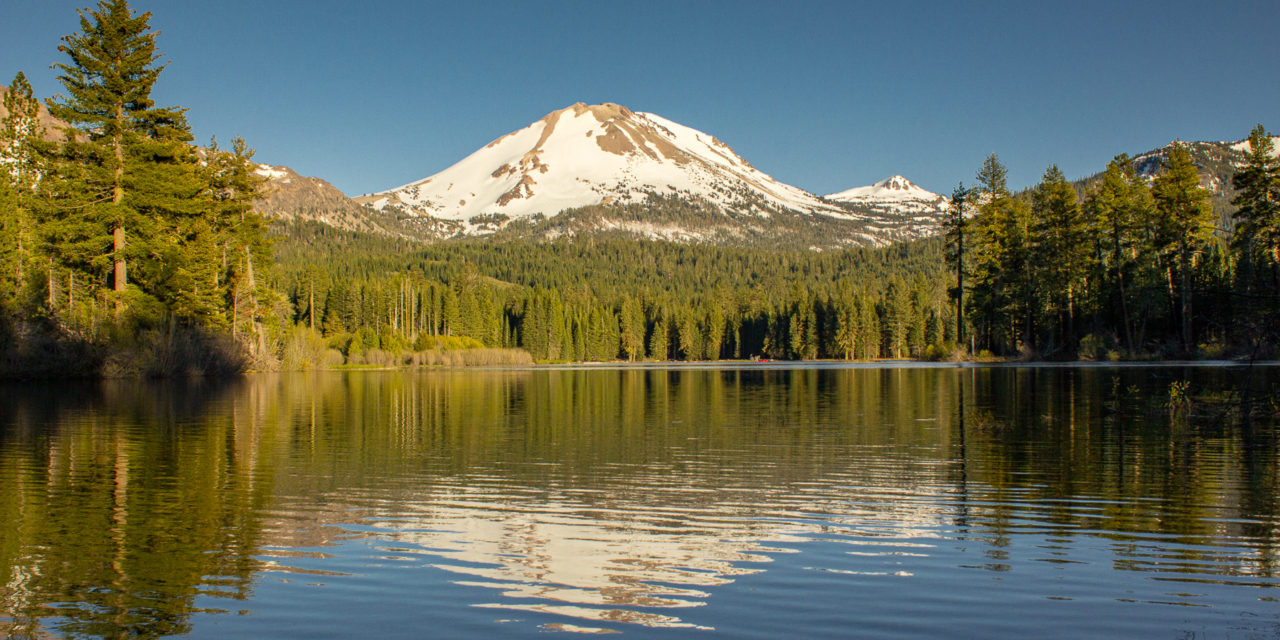
The lake presents one of the best viewing areas of the park’s main attraction: Lassen Peak, The mountain is formed by a lava dome volcano and is the southernmost mountain in the Cascade Range. The volcano towers above the eastern shores of the lake and is still a hotspot for geological activity. The last series of eruptions from 1914 to 1917 ejected ash over 30,000 feet into the air, sent mudflows over ten miles away, and completely destroyed three square miles. Historically the Native American people’s of the Atsugewi, Yana, Yahi, and Maidu have inhabited the area for hunting and gathering during the warmer months.
On A Personal Note:
The views of Manzanita Lake are remarkable. It is a hub for park activity at the northern entrance. I’ve read that one of the best times to see Manzanita Lake is in the morning as the sun comes up from the east. I have to disagree. During the sunset, the soft glow of the sun reflecting off Lassen Peak from Manzanita Lake is quite a picturesque opportunity. Make time to see Manzanita Lake’s smaller neighbor, Reflection Lake. The small lake is on the other side of the park’s main highway and deserves the title of its name.
I have read on several forums that because of the large geese population, sanitary conditions of the lake are questionable for swimmign. It may be best to check with the visitor center about that. What’s not out of question, is that Manzanita Lake is arguably one of the best views of Lassen Peak in the entire park. For camping information, please see the directions tab.
Do you have any updates to the hiking trail or want to share your hike/pictures? Please leave a comment below.
- Overall Difficulty: 40%
- Overall Views: 100%
Manzanita Lake Trail Quick Facts:
- Elevation: 5,834 feet.
- Elevation Gain: 45 feet.
- Estimated Distance: 1.9 miles.
- Estimated Time: 45-90 minutes
Manzanita Lake Trail Directions:
Because of the elevation and northerly location, this area gets an abundant amount of snowfall. Snow can start accumulating as soon as September and end as late as May. Please check with the National Park Service for current road conditions. During the busy season this area may fill up quickly after the morning hours.
There is a large campground at Manzanita Lake and also includes cabins. For reservation information, please see the park’s website.
Manzanita Lake Trail Pictures:
-
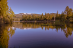
- A view of Manzanita Lake looking to the wet from near the campground.
-
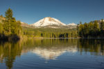
- Lassen Peak as seen from Manzanita Lake’s western shore.
-

- A closeup of Lassen Peak and Manzanita Lake.
Who Manzanita Lake Trail Is For:
Advanced Hikers: This trail is not difficult by any means but the views of Lassen Peak from the lake’s west shore is quite rewarding. It’s a perfect hike to pair with other short trails in the area.
Expert Hikers: Same.
It’s always a good idea to be aware of what type of hiking level you’re at.
Best Time Of Year To Hike Manzanita Lake Trail:
It’s always a good idea to check the weather before heading out on a hike.
