
Hiking Chaos Crags Trail
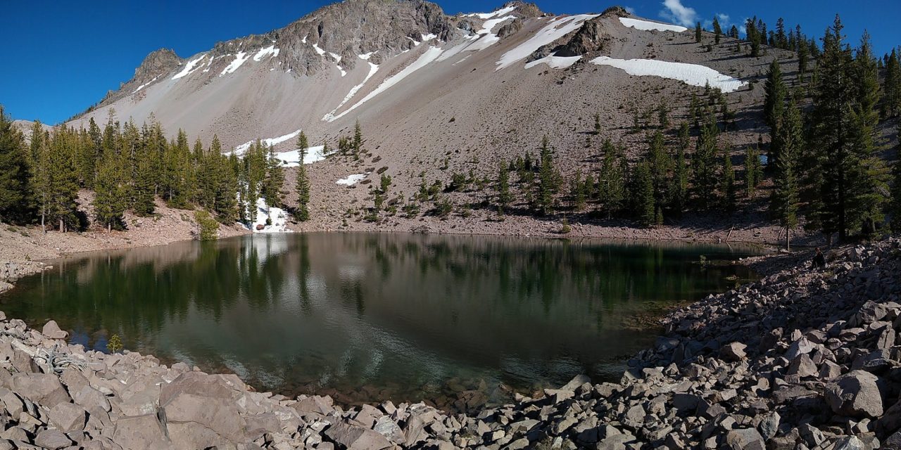
Close to the north entrance to Lassen Volcanic National Park is a short hiking trail that leads up to a set of lava domes. These domes are known as Chaos Crags. They’re the youngest of group of lava domes in the park that formed approximately one thousand years ago. The trail wanders along a portion of Manzanita Creek to the base of Chaos Crags. Along the trail is a series of meadows and alpine forests. Eventually the trail terminates at the base of Chaos Crags where a small alpine lake resides. The lake is seasonal and lasts until late summer at best but can have beautiful reflections of the surrounding peaks with beautiful blue hues.
From some of the higher vantage points along the trail, views of the Hat Creek Valley and Thousand Lakes Wilderness can be seen. About three hundred years ago, a massive rock avalanche fell along the northwest corner of Chaos Crags. The rock avalanche traveled at one hundred miles an hour and destroyed everything in its path. The rock slide can be seen from the end portions of the trail. It’s this very rock slide that ended up damming Manzanita Creek. The blockade of the creek formed the beautiful Manzanita Lake and Reflection Lake from near where the trailhead originates.
On A Personal Note
For such a short trail, this hike has it all: mountain peaks, creeks, an alpine lake, meadows, and conifer forests. This trail is a gem in Lassen Volcanic National Park. I absolutely loved this trail and so did my wife who was about twenty weeks pregnant at the time. We did run into a family of bears in one of the meadows but they were non-threatening and quite beautiful to see. Although the lake dries up towards the end of the summer, the views of this trail will be enjoyable year round.
Do you have any updates to the hiking trail or want to share your hike/pictures? Please leave a comment below.
- Overall Difficulty: 60%
- Overall Views: 100%
Chaos Crags Trail Quick Facts:
- Elevation: 6,671 feet.
- Elevation Gain: 1000 feet.
- Estimated Distance: 4 miles.
- My Actual Distance: 4.43 miles.
- Estimated Time: 90 minutes – 3 hours.
- My Time: 2 hours 41 minutes; 2 hours 22 minutes moving.
Chaos Crags Trail Directions:
During the winter, the Lassen Peak Highway is closed to through traffic to the south end of the park just past the Loomis Visitor Center. Because of the elevation and northerly location, this area gets an abundant amount of snowfall. Snow can start accumulating as soon as September and end as late as May. Please check with the National Park Service for current road conditions. During the busy season this area may fill up quickly after the morning hours.
Chaos Crags Trail Pictures:
-
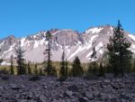
- This is a view of Chaos Crags from the Lassen Peak Highway. The jagged rocks in the foreground are part of the rock avalanche that dammed Manzanita Creek.
-
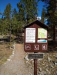
- The start of the trailhead. Out of the picture:: Manzanita Creek to the far right.
-
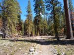
- Much of the first half of the trail wanders through alpine forests.
-
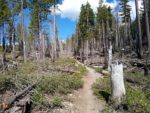
- As the trail gains in elevation, the forest thins. There are some parts of the forest recovering from burn scars.
-
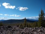
- A look to the northwest with the Thousand Lakes Wilderness stretching out for miles.
-
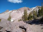
- Nearing Chaos Crags after the trail opens up. This is right before the short scramble down to Chaos Crags Lake.
-
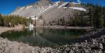
- One of the gems of this hike: Chaos Crags Lake. Please leave this place as beautiful as you found it.
Who The Chaos Crags Trail Is For:
Advanced Hikers: Although the distance is short, this is a beautiful trail. Include this trail with some smaller hikes or points of interest to have a full day of activities.
Expert Hikers: Hikers used to doing longer trails will enjoy the views. I highly recommend it if you don’t have time for some longer trails. I’m sure there’s a route to the top of the Chaos Crags Domes for those that have the desire.
It’s always a good idea to be aware of what type of hiking level you’re at.
Best Time Of Year To Chaos Crags Trail:
It’s always a good idea to check the weather before heading out on a hike.
