
Garnet Peak Trail
If one is looking for short trails with impeccable views, the Mount Laguna area of the Cleveland National Forest is a wonderful place to start. There are a handful of short trails within a short radius that offer beautiful desert and mountain views for little work. This short trail takes hikers up a short distance of 592 feet granite peak at 5,919 feet. The end result is a 360 degree view of the entire Mount Laguna area. From this view, hikers will notice the transition of the conifer wooded San Diego mountains to the Sonoran Desert below. This peak can be accessed from several points in the area including the staging areas for Monument Peak, Foster Point, and the Pioneer Mail Picnic Area. For the purpose of this article, this trail will focus on the Garnet Peak staging area off of Sunrise Highway.
This specific area is managed by the Cleveland National Forest. Therefore an Adventure Pass or an America The Beautiful Pass are required. Parking at the Pioneer Mail Picnic Area is free, however (more on that in the directions tab). Garnet Peak is just a short distance off the ever so popular Pacific Crest Trail. The trail culminates at a rocky peak with a daunting drop-off that descends a few thousand feet below and out into the Anza-Borrego Desert. From here many prominent Southern California peaks are visible including Palomar Mountain, Cuyamaca Peak, Stonewall Peak, San Gorgonio Mountain, and San Jacinto Mountain. On a clear day the sun reflecting off the Pacific Ocean to the west and the Salton Sea to the east can be seen.
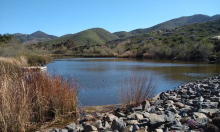
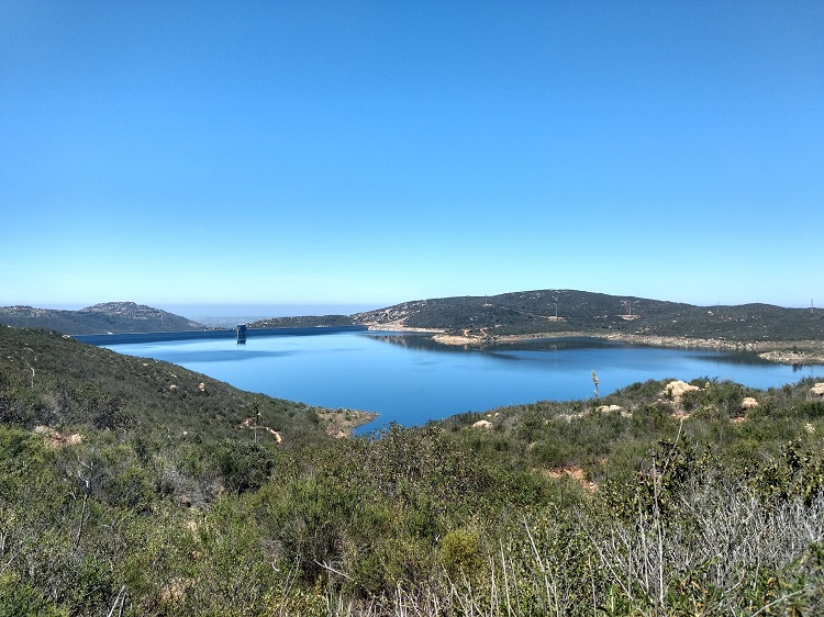
There are several nearby areas for camping. The most popular area is in the Mount Laguna Recreation area near the Laguna Lakes. Camping information can be found here. The Garnet Peak area is a part of the Descanso Ranger District which does offer remote camping outside of campground areas. These spots are limited and a permit is required. Remote camping information can be found here. Camping is the best option for stargazing opportunities.
On A Personal Note:
This is a short and very fun trail to hike. It’s impressive to see how quickly the wooded meadows from the San Diego mountains transition to the desert below. The battle between Mediterranean and desert climates are clearly evident here. What’s also still visible are the burn scars from the 2003 Cedar Creek and the 2012 Chariot Fires. For those that want to make the trek out here early in the morning, seeing the sunrise come up from the desert floor to light up the mountains would be quite the sight.
Camping near here would be better option for sunrise viewing as well as star gazing. Many iconic milky way photographs have been shot around this area from the late spring to early fall months when the core is visible. This trail is a great option for younger family members. My pregnant wife at 37 weeks completed the trail without any sort of difficulty.
Have you recently done this trail? Please share any updates to the trail conditions or post recent pictures in the comments below.
- Overall Difficulty: 50%
- Overall Views: 100%
Garnet Peak Quick Facts:
- Elevation: 5,919 feet.
- Elevation Gain: 492 feet.
- Estimated Distance: 2.2 miles.
- My Distance: 2.2
- Estimated Time: 1-2 hours.
- My Time: 90 minutes
Garnet Peak Trail Directions:
There is a free area to park and this is located at the Pioneer Mail Picnic Site. The trail will be a little bit longer (about four miles) from this access point. To connect with Garnet Peak, follow the Pacific Crest Trail south until the Garnet Peak junction that leads to the east.
Garnet Peak Trail Pictures:
-
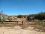
- The small staging area off of the Sunrise Highway. The trail is through the small opening in the gate.
-
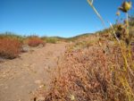
- Follow this old dirt road to the east for a short distance.
-

- Garnet Peak in the far distance.
-
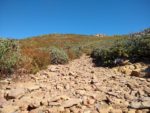
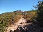
- The dirt trail transitions to be quite rocky after the PCT intersection.
-
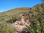
- The trail winding up to the peak.
-
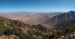
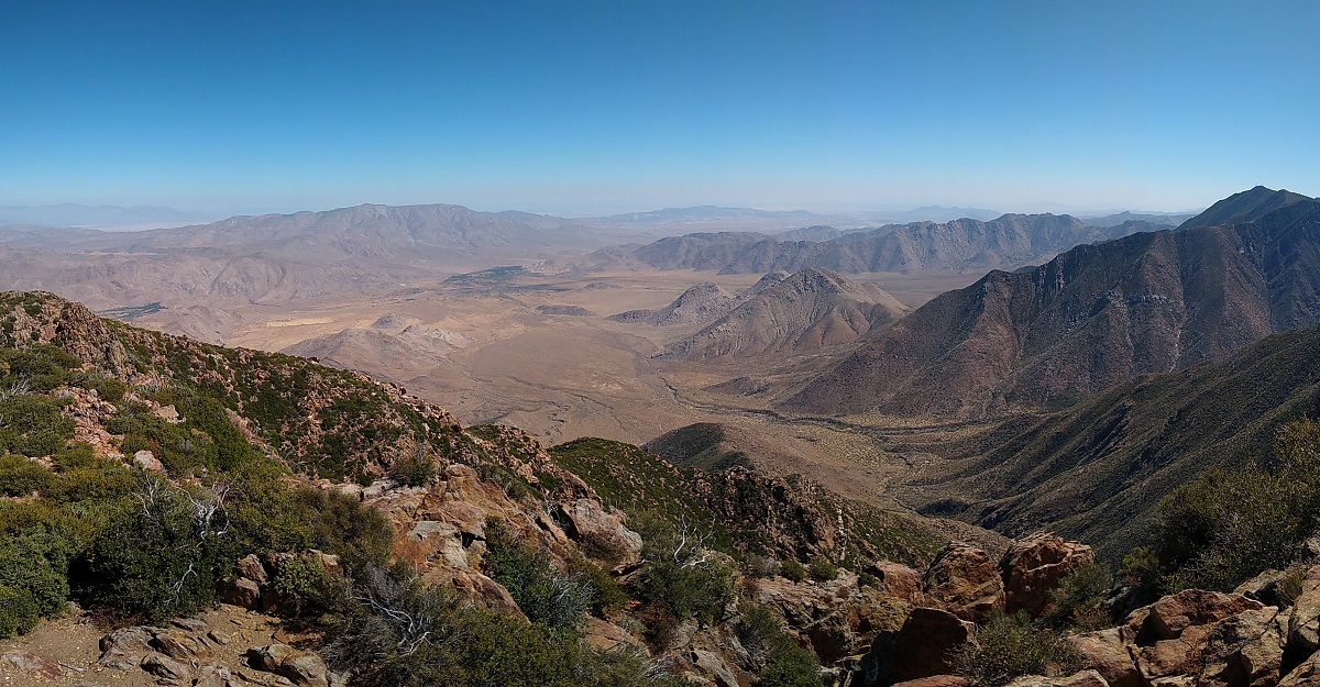
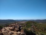
- Views from the top of Garnet Peak looking east towards the Salton Sea and Arizona with the Anza-Borrego desert below.
-
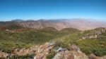
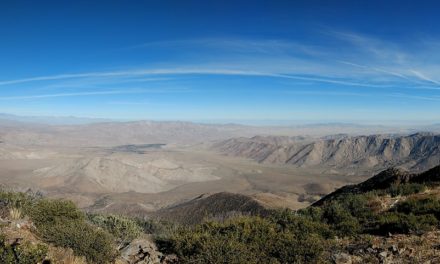
- Looking to the northwest with the prominent peaks of Cuyamaca Peak, Stonewall Peak, Palomar Mountain, and in the far distance, the outlines of the Santa Rosa mountains, San Jacinto, and San Gorgonio.
-
- Looking directly to the west to see the forested Mount Laguna area.
Who Garnet Peak Trail Is For:
Advanced Hikers: It’s a bit short to feel like any sort of work was done. My suggestion is to explore several other short trails in the area such as Foster Point.
Expert Hikers: For expert hikers, Garnet Peak makes a nice addition to hiking the Mount Laguna or San Diego portion of the Pacific Crest Trail.
It’s always a good idea to be aware of what type of hiking level you’re at.
Best Time Of Year To Hike Garnet Peak Trail:
It’s always a good idea to check the weather before heading out.