
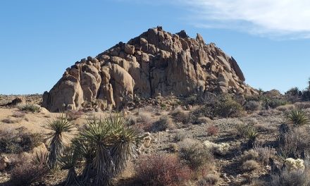
Salt Creek Interpretative Trail – Death Valley National Park
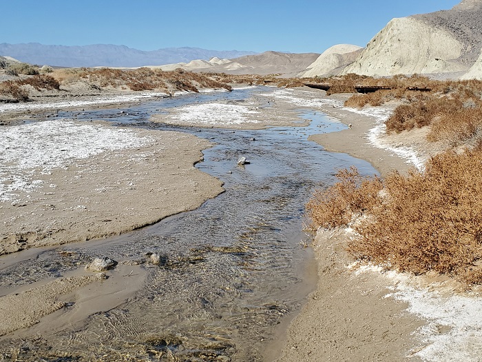
When one thinks of Death Valley National Park one likely thinks of a harsh desert environment void of almost all types of life. After all, what more could you ask from arguably the hottest place on earth? Then there’s Salt Creek – a rare oasis supporting of life in this harsh environment. This short lollipop trail is a mix sand and boardwalk path that travels a short distance along Salt Creek. The creek flows from springs that originate in the higher elevations of the Panamint Range to the lower elevations of Cottonwood Basin in Death Valley.
Salt Creek is a very important source of water for many reptiles, birds, and even fish that call Death Valley their home. The creek gets its start more than a mile upstream from brackish springs and marshes. Winter storms coming off the Sierra Nevada drop much needed snowfall onto the Panamint Range which helps keep these springs replenished each year. As the water flows downhill it becomes incredibly salty from evaporation. Salt content in this creek is higher than ocean water. Over time several species of plants and animals have adapted to the high salinity and have made their home here. The Salt Creek Interpretative trail offers just a short glimpse of Salt Creek as it flows from the mountains to the desert basin. The creek eventually flows about a mile further into the large salt flats of Cottonball Basin before it eventually evaporates into the dry desert air. The trail has several informational placards along the hike. Each one providing information about the unique plants and animals that reside in the area.
Salt Creek Pupfish
One of the most notable species that calls this place its home is the rare Salt Creek Pupfish. This fish is unique to the area and makes an appearance throughout Salt Creek each winter and spring. Despite this incredibly harsh environment it has survived here for thousands of years. The bulk of the pupfish population lives in the higher elevations in the brackish springs. When the cooler temperatures of winter come, they make their way down towards the lower elevations where the temperatures are warmer. Runoff from snowfall and higher elevation rains extends the ranch of the creek into the valley. In peak winter/spring the flow of Salt Creek can extend into the salt flats of Cottonwood Basin. As the creek’s range extends, the pupfish make their way further downstream.
By February the fish can usually seen along the Salt Creek Interpretative Trail. During the spring the creek’s flow is it’s best. It’s throughout this time that the pupfish mate. As the days grow longer and temperatures hotter, the creek quickly begins to evaporate. The pupfish begin to compete for the limited water space. Eventually they either succumb to heat or dry out. All that is left are the pupfish in the higher elevation springs to carry on the species until the cycle begins again next winter.
On A Personal Note:
Salt Creek Interpretative Trail is a great short hike in Death Valley. If you happen to be visiting during the late winter or early spring, the creek is a great reprieve from what looks like a barren and lifeless desert. In addition to the pupfish, there’s a lot of life that can be found here including migrating birds, snakes, small mammals, and adapted plants that are able to survive the high salinity of Salt Creek. There are several placards along the way. Take some time to enjoy them. They are full of information about the pupfish and other types of wildlife found here.
Looking for another short hike nearby? Check out Zabriskie Point. This short trail leads to a colorful overlook of the famous Badwater Basin, Panamint Mountain range, and the vibrant Golden Canyon.
Sources:
1. N.a. “Salt Creek Trail.” Death Valley National Park. National Park Service Placard. Exhibited at Salt Creek Interperative Trail February 2021
- Overall Difficulty: 15%
- Overall Views: 95%
Salt Creek Interpretative Trail Quick Facts:
- Max Elevation: -162 feet.
- Elevation Gain: 33 feet.
- Estimated Distance: 0.8 miles.
- My Actual Distance: 0.9 miles.
- Estimated Time: 15-45 minutes.
- My Time: 27 minutes moving; 37 minutes total.
Salt Creek Interpretative Trail Directions:
Salt Creek Interpretive Trail Pictures:
-
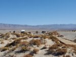
- The small dirt parking lot viewed from the trail.
-
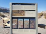
- There are several informational placards located throughout the trail.
-
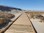
- The trail mostly consists for a boardwalk with a few sandy patches.
-

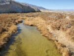
- Salt Creek flowing during February.
-
- Pickleweed is adapted to filter out the high salt content of this water. It is in abundance along Salt Creek.
-
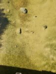
- Look carefully and small pupfish can be spotted.
Who Salt Creek Interpretive Trail Is For:
Novice Hikers: The most difficult thing about this hike will be the heat and that’s dependent on when you visit. This is a pretty accessible trail. It’s great for families and those who are unable to hike longer distances.
Advanced Hikers: This is a great viewpoint and a short trail to pair with several other short hikes nearby.
Expert Hikers: There’s a wealth of information here but if you’re looking for a difficult hike, this isn’t it. Pair it with several other ones nearby.
It’s always a good idea to be aware of what type of hiking level you’re at.
Best Time Of Year To Hike Salt Creek Interpretive Trail:
Mid winter to early mid spring is without a doubt the best time to visit this trail. As soon as the winter storms start coming across the Sierra Nevada and depositing snow and rain on the Panamint Range is when this trail comes to life. The snowmelt and rainfall will filter into to the springs below and transform Salt Creek into its seasonal wetland. The late fall to early spring will have cold morning temperatures with moderate daytime highs. If visiting during spring, the pupfish are in spawn. The creek dries up when late spring comes. Once April-October comes around it is just hot.
The middle of the summer is one of the hottest places on the entire planet and significant outdoor activity isn’t really recommended. Those who are sensitive to heat are advised to be out during the cooler hours of the morning or not at all. Summer can bring about other problems besides just heat. The summer months is the monsoon season for the southwest desert. This season brings about the chance for lightning and thunderstorms. Avoid being out in the open during a thunderstorm to prevent being hit by lightning.
It’s always a good idea to check the weather before heading out on a hike.
Salt Creek Interpretive Trail Conditions:
This trail is in great condition and maintained by the National Park Service. The trail is mostly a wooden boardwalk that allows Salt Creek to naturally flow throughout the basin. There are a few sandy spots along the trail. There are several informational placards throughout the area that are worth a few minutes to learn about. Since this is a water source that brings small mammals, keep an eye out for rattlesnakes.
