
Hiking Oakzanita Peak
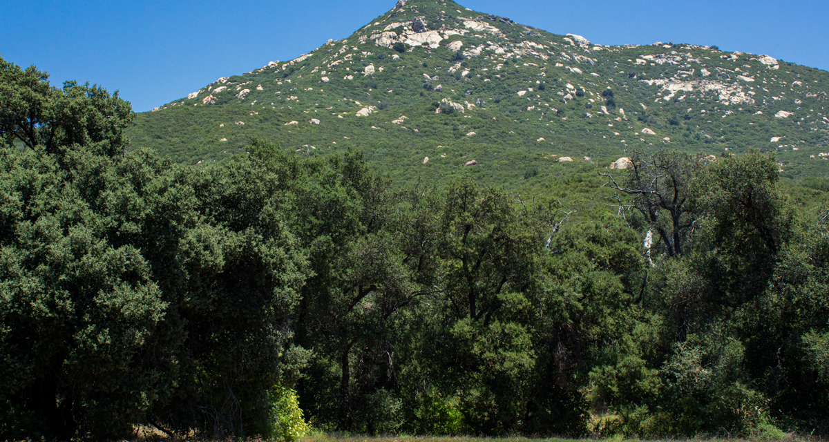
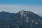
Oakzanita Peak an approximate 5.4 mile out and back trail in Cuyamaca Rancho State Park in the Cuyamaca Mountains. The moderately distanced hike leads up to one of the more prominant peaks in the region. The peak offers some great views of the nearby peaks including San Diego’s second tallest, Cuyamaca Peak. Some of the more distant views include the Palomar and Volcan Mountains to the north as well as Monument Peak in the Laguna Mountains.
Cuyamaca Rancho State Park features some of the highest peaks in San Diego County. The Cuyamaca Mountain Range sits tall above the mountains sprawling suburbs of San Diego County and just south of the town of Julian, California. The prominent range gets an abundance of rainfall that it helps to form some of San Diego’s most popular waterfalls. Three Sister’s and Cedar Creek falls are two such waterfalls that originate from the springs of the Cuyamaca Mountains. The range also gets an occasional snowfall during the winter quickly transforming the region into a winter playground.
The name of Oakzanita Peak is derived from both a blend of oak and manzanita trees which are plentiful as the hike winds towards the top. Throughout the year this hike really does offer a taste of the full four seasons. Shades of brown during fall, spring wild flowers, and an occasional snow dusted trail during the winter. The beginning of the trail even winds along the seasonal Descanso Creek that provide for some peaceful sounds of nature.
Cuyamaca Rancho State Park History
Altogether there are 24,700 acres of land and over one hundred miles of hiking trails in Cuyamaca Rancho State Park. The history of this state park predates any European settlers. For thousands of years the Kumeyaay band of Native American’s utilized the fresh water springs and abundance of food in the area.
It wasn’t until the late 1700’s when the first Spanish Conquistdors started to arrive to the region. For decades native Kumeyaay resisted missionization and were reluctant to give up their independence. By the mid-1800’s land was sold of by the Kumeyaay and few of the native people’s remained in the area.
In 1869 gold was discovered and quickly led to a gold rush in the area. A series of mines were constructed and several the remnants can stili be seen while hiking today. Financial problems eventually led to the closures of the mines by 1906 and the area continued as a mountain resort for several years.
In the 1920’s a capitalist by the name of Ralph Dyar bought the ranch with plans for the development of a resort on Lake Cuyamaca. Luckily for the sake of preservation, The Great Depression ended the bid for a lakeside hotel. Instead, Dyar sold the land to the State of California for its newly developed State Park System. In 1962 the area officially was inducted into the State Park System.
On A Personal Note:
There are a couple forks in this trail and one of them is easy to miss. I made the mistake of following along the East Mesa Fire Road and passing the fork for the Descanso Creek trail which ultimately leads up to Oakzanita Peak. It ended up being a half mile detour before I noticed I had gone to far. Keep an eye out for the thin turn off with a narrow trail marker for the Descanso Creek Trail on the right side of the fire road.
Overall, Oakzanita is a peaceful hike. The trailhead sits away from the main campgrounds of the State Park and as a result it draws less traffic. The views from the top are hard to beat and it provides an excellent vantage point of many of the mesas, peaks, and valleys that make up the Cuyamaca and Laguna Mountains.
Looking for other fun hikes in Cuyamaca Rancho State Park? Try San Diego’s second tallest viewpoint, Cuyamaca Peak or the always fun, Stonewall Peak.
Sources:
1. N.a. Cuyamaca Rancho State Park. State Of California. https://www.parks.ca.gov/pages/667/files/CuyamacaRanchoFinalWebLayout060917.pdf. 2020. Web. Accessed 15 August 2020.
Do you have any updates to the hiking trail or want to share your hike/pictures? Please leave a comment below.
- Overall Difficulty: 60%
- Overall Views: 90%
Oakzanita Peak Trail Quick Facts:
- Max Elevation: 5,121 feet.
- Elevation Gain: 1,230 feet.
- Estimated Distance: 5.8 miles.
- My Actual Distance: 6.7 miles.
- Estimated Time: 2-4.5 hours.
- My Time: 2 hours 30 minutes moving, 2 hours 58 minutes total.
Oakzanita Peak Trail Directions:
For more information, check out the state reserve’s website.
Oakzanita Peak Pictures:
-
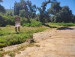
- The small dirt parking lot at the beginning of this site.
-
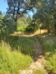
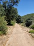
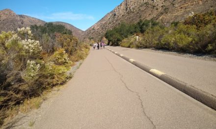
- Heading straight out of the gates from the parking lot through peaceful meadows.
-
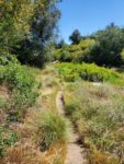
- There is some slight overgrowth of grass in the meadow.
-
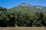
- Black oak trees, grassy meadows, and Oakzanita Peak in the distance.
-
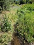
- The first quarter of the trail runs parallel along Desanso Creek.
-
- Growth along the creek.
-
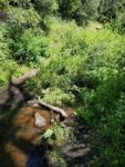
- The waters are cool but it does bring with it poison oak and stinging nettle.
-
- East Mesa Fire Road.
-
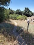
- Don’t miss the right sided fork onto Upper Descanse Creek Trail.
-
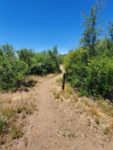
- The trail starts to wind along the north flank of Oakzanita Peak .
-
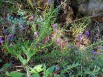
- Wildflowers along the way.
-
- Crossing onto Oakzanita Peak Trail.
-
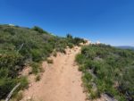
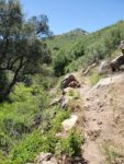
- Nearing the peak.
-
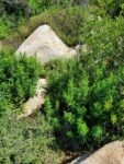
- The rocky cap of Oakzanita Peak.
-
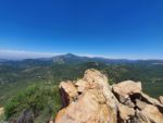
- Cuyamaca Peak on the left.
-
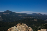
- A close up of stonewall peak.
Who Hiking Oakzanita Peak Is For:
Advanced Hikers: While a little short to be considered a challenge, the hike has a lot to offer with great views.
Expert Hikers: This is a simple hike with above average views. There is a 7.3 mile loop trail that follows the length of the Upper Descanseo Creek Trail if you’re looking for more distance.
It’s always a good idea to be aware of what type of hiking level you’re at.
Best Time Of Year To Hike Oakzanita Peak:
Winter can be cool to downright cold on some days. Occasional winter storms will bring several inches of snow to the area which make for a delightful winter wonderland. By spring the hills come alive with fresh green growth and wildflowers throughout the area. On a good rain year Descanso Creek can flow well into mid-summer.
Summer can be the hottest time of year. The trail is short enough that the hike could be done before the hottest part of the day. The western edges of the North American Monsoon can bring thunderstorms to the mountains. With thunderstorms come the threat of lightning. It’s best not to be out on the trail or close to the peak with the threat of lightning in the area.
As with any trail, it’s always a good idea to check the weather before heading out.
Oakzanita Peak Trail Conditions:
The trail briefly takes a route along the East Mesa Fire Road. The time on the fire road is brief before a thin fork leads south marked the Upper Descanso Creek trail. I made the mistake of missing this fork in the road and continued along the fire road for about half a mile.
The Upper Descanso Creek trail winds south and up along the northern flank of Oakzanita Peak. Eventually the trail will have another fork for the Oakzanita Peak trail. As the trail nears its completion an abundance of oak and manzanita will become strikingly obvious. There is a small outcrop of granite rocks that make the peak.
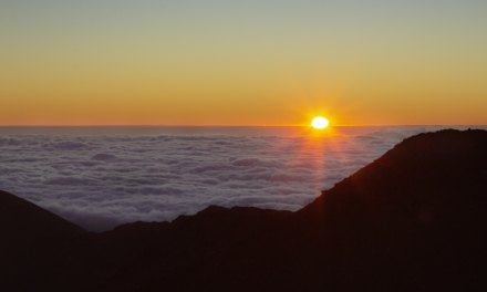
The coastal seabreezes from the Pacific Ocean will greet you at the top of the peak. On a clear day views of the San Diego coast as well as the Coronado Islands off Baja California will be visible. A panoramic view of the peaks and valleys of the Cuyamaca and Laguna mountains will be seen. Other notable views include Palomar Mountain and Volcan Mountain to the north. Poison oak and stinging nettle are common throughout Descanso Creek. Rattlesnakes are common during the warmer months.
