
Lembert Dome Hiking Trail Guide
Yosemite Valley tends to hog most of the glory in Yosemite National Park and it’s easy to understand why. However, the high country off Tioga Pass should be on everyone’s Yosemite bucket list. Lembert Dome is just one of many large granite domes inside of this national park. These large domes were formed by molten rock beneath the surface of the ground over sixty million years ago. The molten igneous rock bubbled up from the surface and as it cooled, large dome like rocks were formed.
The hike to Lembert Dome can be done as either a loop trail or an out and back trail (see details in trail description). From the top of the dome, some of the beautiful viewpoints in the area can be seen including Mount Dana, Cathedral Peak, and the meadows that are formed by the beautiful Tuolumne River.
The dome was named after Jean Baptiste Lembert who lived in a homestead in Tuolumne Meadows. Unfortunately he was murdered during the winter of 1895-1896. Lembert was a well known figure in the area during the time who did a fair amount of exploring throughout the upper elevations of Yosemite. The exact motive of his murder is unknown. One school of thought was that it was done by thiefs looking to steal some wealth he had amassed by selling plant and insect specimens. Others thought it was some Native Americans that he had grown out of favor with after digging up some graves in order to collect personal belongings (1,2).
On A Personal Note:
Lembert dome is one of the tallest vantage points in the Tuolumne Meadows area. The views from here are remarkable. From the top one can easily have a panoramic view all the surrounding high country peaks as well as Tuolumne Meadows. This is a short yet fun and thrilling trail. The actual peak of the dome is at a fairly steep grade to get to. There’s a sheer drop off on the west side and a moderate slope on the southeast side. It was a bit much for me to venture out to but if you’re inclined for the heights, give it a go.
Looking for another dome with views overlooking the entire Yosemite Valley? Check out Sentinel Dome near Taft Point.
Sources:
1. N.a. “Feature Detail Report for: Lembert Dome.” United States Geological Service. United States Department of the Interior. https://geonames.usgs.gov/apex/f?p=GNISPQ:3:::NO::P3_FID:254907 Accessed 1 September 2020.
2. Colby, E. W. “Jean “John” Baptiste Lembert – Personal Memories.” Yosemite Nature Notes. The Yosemite Naturalist Division and The Yosemite Natural History Association, INC. Yosemite Online Library. http://www.yosemite.ca.us/library/yosemite_nature_notes/28/28-9.pdf Accessed. 1 September 2020.
Do you have any updates to the hiking trail or want to share your hike/pictures? Please leave a comment below.
- Overall Difficulty: 55%
- Overall Views: 100%
Lembert Dome Trail Quick Facts:
- Max Elevation: 9,418 feet.
- Elevation Gain: 846 feet.
- Estimated Distance: 3.7 miles.
- My Actual Distance: 4.1 miles.
- Estimated Time: 2-4 hours.
- My Time: 2 hours 6 minutes total; 1 hour 54 minutes moving.
Lembert Dome Trail Directions:
Another option for parking is at the lot to Tuolumne Meadows Lodge (open in maps). This option will put you at the base of the east side of Lembert Dome. From here it’s a straightshot straight up to the trail offshoot that leads to Lembert Dome. The hiking option here would be an out and back. Taking the east route along the dome and continuing north past Lembert Dome will also connect you with the Dog Lake trail.
During the winters Tioga Pass Road is closed due to heavy snowfall. The road can close as early as October in some years and open as late as June. Please check with the park on the current road conditions if you plan on traveling when there may be snowfall.
Lembert Dome Trail Pictures:
-
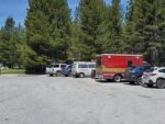
- The parking lot to Lembert Dome.
-
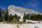
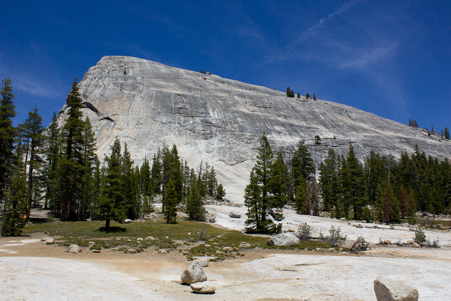
- Lembert Dome as seen from the parking lot.
-
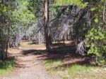
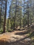
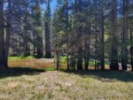
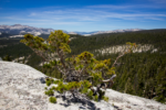
- The trail is mostly through conifer forest throughout the hike.
-

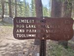
- Informational placcards along the beginning of the trail.
-
- The incline up the north flank of Lembert Dome.
-
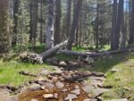
- There is a small creek that runs along the north side of the dome.
-
- If you’re feeling ambitious, Dog Lake is a wonderful addition to this trail.
-
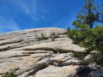
- Looking up the east side of Lembert Dome which requires a scramble to get up.
-
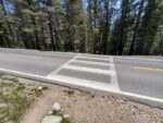
- Crossing Tioga Pass Road.
-
- The Dana Fork of the Tuolumne River.
-
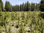
- Some forest rehabilitation in Tuolumne Meadows.
-
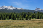
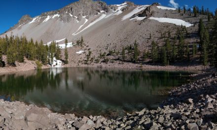
- Looking across Tuolumne Meadows across to Cathedral Peak on the Right and Johnson Peak on the Left.
-

- Looking to the south along the Cathedral Range.
-
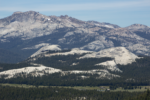
- A closer look at some of the peaks in the Cathedral range.
-
- Looking to the southwest from Lembert Dome. The Cathedral Range to the left. Medicott Dome in the middle. Mount Hoffman to the right.
Who Lembert Dome Trail Is For:
Novice Hikers: This is a great trail for new new hikers. The amount of elevation gain in the short distance will definitely be a challenge. The views from the top of the dome are enough to give some butterflies to the slightest of acrophobes.
Advanced Hikers: While not as challenging as some of Yosemite’s longer trails, this is certainly a fun trail to complete. The views from the top are some of the best in the area without having to do the longer hikes to some of the nearby Sierra peaks. For a longer trail, complete the route to Dog Lake to check out some additional views and log some more distance.
Expert Hikers: This isn’t a difficult trail by any means but the views are rewarding. This hike is a great option for those with limited time or families unable to do longer distances. For a greater adrenaline rush, make the scramble to the highest point of the dome. Those wanting a longer distance can also complete the route to Dog Lake.
It’s always a good idea to be aware of what type of hiking level you’re at.
Best Time Of Year To Hike Lembert Dome:
It’s not uncommon for there to be thunderstorms in the higher elevations of the Sierra’s during summer. Thunderstorms often bring with them the threat of lightning. Do not attempt to be on the dome if there is any chance of lightning. It is a bare surface and you will be the tallest object and a target to be struck by lightning.
During the winter Tioga Road closes at around the first major snowstorms. The road doesn’t open again until late spring or early summer after the road has been plowed and cleared. Please check with the National Park Service for current road conditions around mid-fall or late spring.
Always be prepared by checking the weather conditions before a hike.
Lembert Dome Trail Conditions:
For those starting out at Tuolumne Meadows lodge, the trail will be a steady incline through mostly confier forest. The trail does cross Tioga Pass Road shortly after starting so be alert for traffic. No matter which trailhead is is taken, there will be a branch in the trail that leading west up to the dome. This area is clearly marked by a sign.
Once on the dome there isn’t any distinguished trail. I suggest taking the path of least resistance and it’s almost better to just go straight up. Once at the top you’ll see the long backbone that makes up Lembert Dome. The actual peak of Lembert Dome is at the end of it’s long spine with a near vertical drop on one side. The other has a pretty steep grade. Reaching the peak doesn’t look impossible but it was a little much for me to attempt. The views were still postcard worthy.
The odds of seeing a rattlesnakes along this trail are pretty small given the high altitude and short growing season. However, always keep your eyes open and be alert. There will be an opportunity to see bears and deer here. Where the seasonal creek lies is the best bet for any wildflowers. Keep an eye out for the beautiful snowflower that likes to spring up near pines after the snow is gone. There is no poison oak along the trail.