
Fire Wave Trail Hiking Guide – Valley of Fire State Park
The best thing about going to Las Vegas is not actually spending any time in Las Vegas. One of the sprawling desert city’s best known secrets is actually about an hour north outside of Las Vegas and called Valley of Fire State Park. This 40,000 acre state park is Nevada’s oldest and is popular for its vibrant reddish orange rock formations and twisting valleys, canyons, and washes. The bright red rocks mark a stunning island amidst the typical beige color of the surrounding desert landscape. The rocks are a remnant of Aztek sandstone dated back to the Jurassic Period. As time elapsed, ancient seas, wind, and rising land mass exposed the bright red rocks for us to see and enjoy (1).
Historically the Valley of Fire area has been home to several cultures that have settled the area. The earliest known civilization is the Basketmaker culture with evidence of their settling dating back to around 2,500 years ago. The Basketmaker gave way to the Pueblo and then the Paiute. Eventually the Mormons settled in the area in the mid-1800s. Native American culture can still be seen in the park in the form of petroglyphs that are scattered throughout the area.
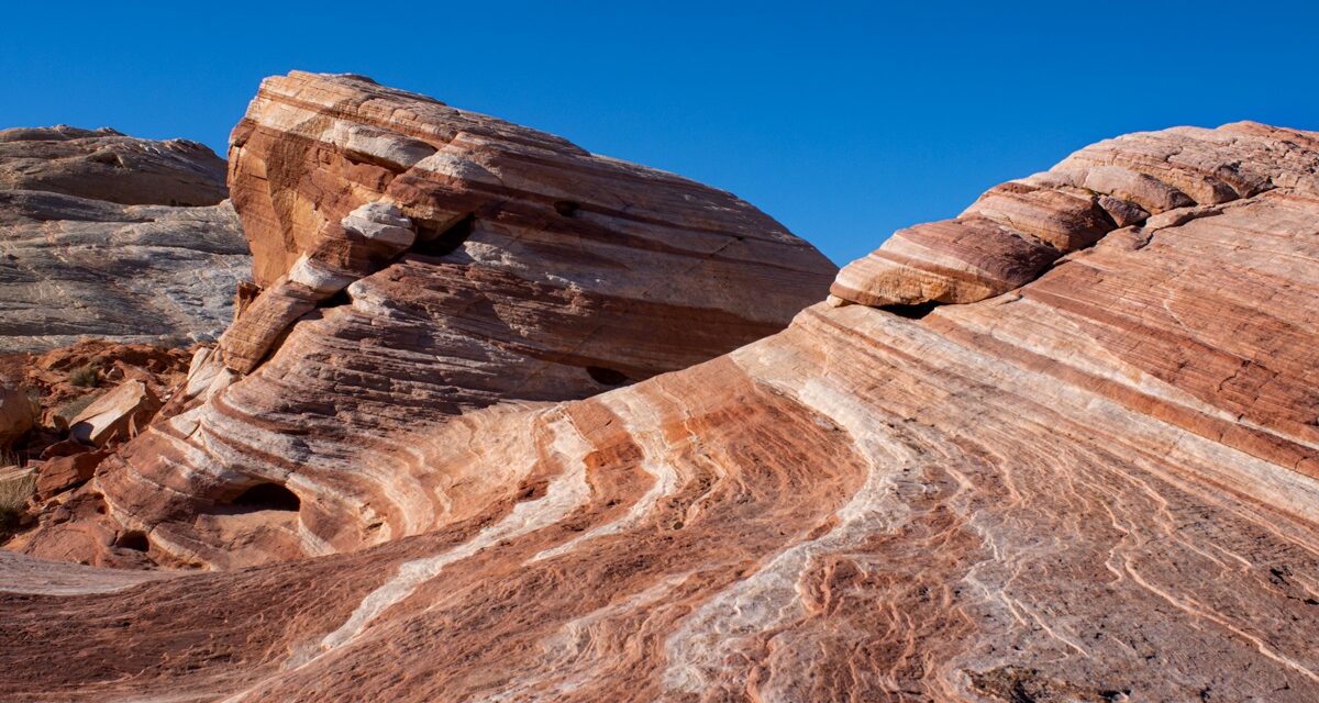
Hikers to the Fire Wave Trail will be rewarded with quite a geological sight. This is one of those trails that for a short distance leads to a large reward. The trail to the Fire Wave is a short out and back hike. The route passes through large sandstone rock formations before coming to a large swath of eroded sandstone. The hike comes to a terminus at Kaolin Wash. Here you’ll have panoramic views looking to the south across the park. Even more impressive will be vibrant red and white sandstone with it’s layers compressed into a wave like formation.
On A Personal Note:
Aside from the incredible views that can be had along this trail, this place is a photographer’s dream. The easiest way to hike this trail is via the route that this write up is about. There is a longer route that combines a loop trail called the Fire Wave, White Domes, and Seven Loops trail; also the Fire Wave and Seven Wonders Loop Trail. These two trails will be approximately 3.2 miles in length. My wife and I wanted to include more activities in our itinerary so we opted for the shorter version.
Valley Of Fire State Park is a great place to visit if you happen to be near the Las Vegas area. There are many short trails and they can all be paired together for more mileage. For a list of other things to do in the park, check out the Guide To Exploring Valley Of Fire.
Sources:1. N.a. “History of Valley of Fire State Park.” Nevada State Parks. http://parks.nv.gov/learn/park-histories/valley-of-fire-history. Accessed 25 March 2022.
- Overall Difficulty: 35%
- Overall Views: 95%
Fire Wave Trail Quick Facts:
- Max Elevation: 2,037 feet.
- Elevation Gain: 177 feet.
- Estimated Distance: 1.5 miles.
- My Actual Distance: 1.4 miles.
- Estimated Time: 30-90 minutes.
- My Time: 33 minutes moving; 43 minutes total.
Fire Wave Trail Directions:
Open in maps. Fire Wave Trail is located off of Mouse’s Tank Road. There is a parking lot on the southwest side of the road. There are a few trails that intersect here. The lot is on the smaller side but the trails are so short that there is ample turnover here. There is a $10 day fee to enter for NV license plates. All other states are $15. For overnight fees please check the Valley of Fire State Park website. Nevada annual state park permits are also accepted.
Fire Wave Trail Pictures:
-
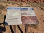
- A small placard marking the beginning of the trail.
-
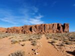
- Headed out along the trail; the trail winds to the right of that large rock formation.
-

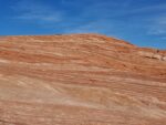
- From here the hike winds across bare sandstone and down into the firewave.
-

- The trail leading down into the firewave.
-
- Looking directly up out of the firewave.
-

- The vibrant colors in the heart of the Fire Wave Trail.
Who The Fire Wave Trail Is For:
Novice Hikers: This is a great trail for new hikers or those with limited hiking experience. The trail is short enough for families as well.
Advanced Hikers: This trail is no challenge. Pair several short hikes together in the area for a full day of hiking. Another option would be to combine this with the longer loop trail, The Seven Wonders.
Expert Hikers: Same as above.
It’s always a good idea to be aware of what type of hiking level you’re at.
Best Time Of Year To Hike The Fire Wave Trail:
The best time to hike this trail is from mid-fall into the winter and towards mid-Spring. Outside of mid-spring the days just get hotter and hotter until summer and eventually cool towards the back half of fall. During the summer it’s not uncommon for summer temperatures to be anywhere from 100-120 degrees F. Annual rainfall tends to be an average of no more than six inches of rain at best. The bulk of the rain comes from rare passing winter storms and monsoonal thunderstorms during the summer.
On a rare winter day it can snow here but it’s usually short lasting. Summer monsoons bring about other problems than just rain: lightning. If dark clouds are approaching and the sound of thunder is in the air seek shelter immediately.This trail is completely exposed and it is never a good idea to be out in the open when lightning is present.
It’s always a good idea to check the weather before heading out on a hike.
Fire Wave Trail Conditions:
The Fire Wave trail is in excellent condition and maintained by the Nevada State Park service. After a heavy thunderstorm it is possible for the trail to become slightly washed out but it will otherwise be fine. The first half of reaching the fire wave is primarily through soft sand. The latter half transitions to solid sandstone before finally reaching the wave. Being that this is a desert environment, keep an eye out for rattlesnakes.
