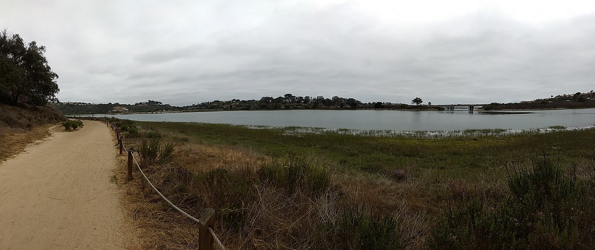
Batiquitos Lagoon Trail is a short and easy hike along Batiquitos Lagoon between the cities of Encinitas and Carlsbad in San Diego County, California. The trail is generally great to hike all year round and features coastal San Diego habitats and views.
Batiquitos Lagoon Trail
Batiquitos Lagoon is located in North Coastal San Diego County a.k.a. “North County.” The lagoon is made up of a watershed basin that drains the cities of Carlsbad, Encinitas, and San Marcos. It’s primary water source is San Marcos and Encinitas Creek. The lagoon is a great way to view some of San Diego’s bird population as well as take in the view of the local estuary.
One of the sad things I learned about Batiquitos Lagoon is that there is so much silt built up that it’s actually expected to eventually fill up. In 1997 a project to dredge the lagoon funded by the Port of Los Angeles was completed and slowed down the progression of the filling of the lagoon.
After the dredging of the lagoon, fish species dramatically increased from just five to over sixty-five different species of fish including halibut, sardines, anchovies, striped mullet, and sting rays. The lagoon gives shelter to species of fish to lay their eggs and for young fish to grow sheltered in the plants that line the shore. The small fish also give an opportunity for many species of birds to feed on. Batiquitos Lagoon is a great place to take in views of birds that also include different migratory species.
One great thing about Batiquitos Lagoon is it’s close proximity to the ocean. Summers in San Diego can be quite hot and can make many of the popular inland hikes quite unbearable. The lack of elevation and close proximity to the ocean generally keep this trail tolerable and cool throughout the year. There’s also a learning center at this trail which features wildlife specialty speakers throughout the year. Fishing is allowed at one end as long as you have a permit. Bikes and horses are not allowed on the trail. Dogs must be kept on a leash.
For detailed information, please visit the Batiquitos Lagoon Foundation website.
On A Personal Note:
If you’re aching to get outside during the hot summer months when other places in San Diego are unbearable, this short and easy trail can offer some relief to those in need of fresh air.
Do you have any updates to the hiking trail or want to share your hike/pictures? Please leave a comment below.
- Overall Difficulty: 5%
- Overall Views: 40%
Batiquitos Lagoon Trail Quick Facts:
- Elevation: 112 feet.
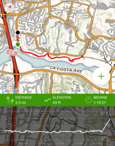
- Elevation Gain: 12 feet.
- Estimated Distance: 1 mile.
- My Actual Distance: 0.9 miles.
- Estimated Time: 30-90 minutes.
- My Time: 25 minutes.
Batiquitos Lagoon Trail Directions:
Open in maps. The directions to Batiquitos Lagoon are very simple. The lagoon is located directly off of Interstate 5 within a neighborhood. The directions I posted here are to one entrance – there are multiple. For further trailheads, check out the foundation’s website directly. At this location there is a small parking lot. It’s located within a neighborhood, as are all the trailheads, so please be respectful of the people who live there. If the lot is full, park along the street.
Batiquitos Lagoon Trial Pictures:
- Near the trailhead.
- The view of the lagoon a short distance from the parking lot.
- Most of the trail is flat.
Who Batiquitos Lagoon Trail Is For:
Novice Hikers: This hike is perfect for new hikers. There is very little elevation gain and although the trail distance is about three miles, you can really make the trail as long as you’d like to.
Advanced Hikers: If you’re needing a quick fix to get outside but don’t have a lot of time, it’s a great hike.
Expert Hikers: Same.
It’s always a good idea to be aware of what type of hiking level you’re at.
Best Time Of Year To Hike Batiquios Lagoon:
Batiquitos Lagoon is generally a great hike all year long. While the trail doesn’t offer up much in terms of elevation or length, it’s a great trail to see the native California estuary habitat. Because of the close proximity to the ocean and the effect of the ocean breeze, the relative temperature generally reflects that of the Pacific Ocean throughout the year. Summer and Fall months can be hot, especially during Santa Ana events so people sensitive to heat should use caution. That being said, even during the hottest times of the year, this trail is still an option.
Batiquitos Lagoon Trail Conditions:
Batiquitos Lagoon Trail is in excellent condition. It’s maintained by the Batiquitos Lagoon Foundation which holds lagoon clean-ups a few times throughout the year. The trail is mostly flat on soft sand/dirt with very little elevation gain. The main trail sticks to the edges of the lagoon with a few different trailheads and variations off the trail. If you find yourself going up any elevation you’re likely venturing off the path and heading up into the neighborhood. The trail is for pedestrian traffic and dogs that are only on a leash. Bikes and horses are not allowed.
Because the trail is very well maintained, odds of finding any poison oak are very unlikely and it’s not the plant’s ideal envrionment. However, as most valley communities are in Southern California, be on the alert for rattlesnakes. The lagoon offers a great habitat for them to feed on small wildlife and bird eggs. The edge of the trail nearest the lagoon is roped off to help maintain the integrity of the lagoon. Approximately forty percent of the park is shaded from the sun. The close proximity to the Pacific Ocean keeps the overall temperatures relatively cool throughout the year.

