
Hiking Signal Hill Trail – Saguaro National Park West
If looking for a short trail that packs a punch, the Signal Hill Trail doesn’t dissapoint. Located in the Tuscon Mountain District of Saguaro National Park, this trail features petroglphys atop a short hill from the prehistoric culture of the Hokokam people. The trail itself is about a quarter mile out and back hike with little elevation gain.
Saguaro National Park lies split with two distinct disctricts with the City of Tucson, Arizona in the middle. Covering over 24,818 acres, the Tucson Mountain District sits on the park’s west boundaries. The main difference between the park’s two sides is that the western portion receives slightly less rainfall and sits at a lower elevation than the eastern Rincon Mountain District.
The particular trail will leave a good taste of what Saguaro National Park has to offer. The trail’s east views look out towards Wassen and Amole Peak of the Tucson Mountains. To the west will be sprawling desert views as far as the eyes can see: Avra Valley, the Silver Bell, Roskruge, and Waterman Mountains, and the Tohono O’odham Indian Reservation.
Historical Context of Signal Hill Trail
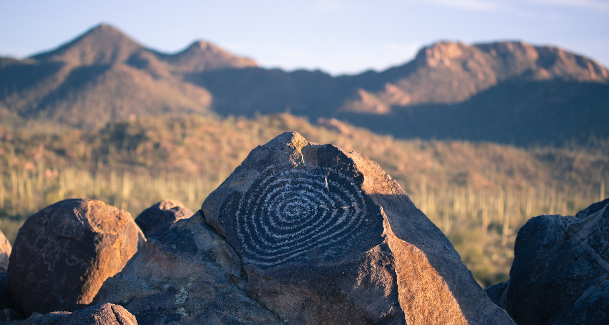
Not only does this short hike offer a plethora of saguaro cactus and panoramic views, it also casts a glimpse at some of the rich culture that inhabited this region. The trail leading up to Signal Hill winds a short distance up to a boulder covered outcrop. The rocks at the trail’s end are scattered with rock etchings known as petroglphys.
These petroglphys are from a prehistoric Native American group of people called the Hohokam. These people lived in the southwest region from Flagstaff, Arizona extending south into Sonora, Mexico. Arguments on the reasoning of this art include communication vs decoration. Or perhaps it was both? The people lived in the region from around 200 A.D. to about 1450 A.D. The exact reasoning as to what happened to these people remains unclear.
On A Personal Note:
If you only have a short time in Saguaro National Park – West, I recommend this short trail. The time requirement to do this short hike is minimal but it offers a neat historical perspective. It’s hard to envision living in this land for such a prolonged period of time without modern conveniences and it’s amazing that groups of people did it so well. I highly recommend doing this hike during dawn and dusk for some amazing and iconic Southwest colors.
Have you done this trail recently? Please leave a comment about updates to the trail descriptions or trail pictures below.
- Overall Difficulty: 5%
- Overall Views: 85%
Signal Hill Trail Quick Facts:
- Elevation: 2,474 feet.
- Elevation Gain: 26 feet.
- Estimated Distance: 0.3 miles.
- My Actual Distance: 0.3 miles.
- Estimated Time: 15-45 minutes.
- My Time: 20 minutes.
Signal Hill Trail Directions:
Overall the road is in generally good condition and passable even for most cars. The exception would be for those that aren’t lowered. I’ve read some Things across the internet saying that you must have a four wheel drive in order to navigate these roads. I disagree with those statements. Use caution during flash flooding events that could make the road difficult to travel through.
Cost is the price of admission to the park. An America The Beautiful Pass will also work.
Signal Hill Trail Pictures:
-

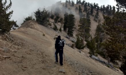
- Much of the path leading up to Signal Hill winds through the desert landscape on a trail like this.
-

- The rocky outcrop of SIgnal Hill leading up to the top. Watch for snakes.
-
- Some of the petroglyphs at the top of Signal Hill with the Tuscon mountains in the background.
-

- Sensets bring out a nice glow on the towering saguaro.
-

- Saguaro shadows during sunset.
Who Signal Hill Trail Is For:
Advanced Hikers: This is not a challenging trail whatsoever. However, as an advanced hiker myself, I caught a beautiful sunset here. There is a longer trail that loops through this area known as the Cactus Wren trail if you’re looking for something longer. That hike is approximately four miles in length.
Expert Hikers: This trail is not challenging but it’s a great place to stop for a picnic and perhaps enjoy the sunset.
It’s always a good idea to be aware of what type of hiking level you’re at.
Best Time Of Year To Hike Signal Hill Trail:
Starting in May the days get hotter and hotter and the heat lasts until mid fall. During the summer months it’s not uncommon for temperatures to reach well over 110 degrees during the day with low temperatures in the 70’s at night. Sun protection and adequate hydration is a must during the summer. This trail is short but the sun and heat could still be a factor.
The summer is also Saguaro National Park’s rainy season. This time of year is the monsoon season where over half the annual rainfall occurs. Afternoons are greeted with unpredictable and regular occuring thunderstorms. Flash floods and lightning strikes can occur at any time. If you hear thunder, it’s best not to be out on the open trail and better to seek shelter.
It’s always a good idea to check the weather before heading out on a hike.
Signal Hill Trail Conditions:
Stay on the path as much as possible to prevent native vegetation that grows off the trail from getting disrupted. The desert southwest isown for several species of rattlesnakes. Infact, as the outcrop for Signal Hill nears, there are rattlesnake signs posted along the trail. It was the heart of winter when I visited so I did not see any. However, the shady rocks would be the perfect place for a rattlesnake to seek shelter. Keep your eyes open.
