
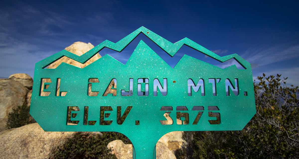
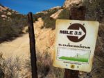
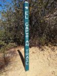
Hiking El Cajon Mountain and El Capitan Peak
Sitting in the hills dividing the small town of Ramona and the small city of El Cajon sits one of San Diego’s tougher hikes: El Cajon Mountain. The peak of El Cajon rests 3,675 feet above the sprawling suburbs of San Diego. The trail which leads to the top lies within the boundary of the El Capitan Open Space Preserve. This preserve is managed by the County of San Diego Parks and Recreation. The area is primarily known for it’s hiking trails and wildlife viewing. Directly to the west of El Cajon Mountain is another popular peak, El Capitan. It is the peak for which the preserve gets its name. For the purpose of this article, the trail guide will include visiting both peaks.
El Capitan Open Space Preserve
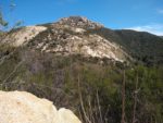
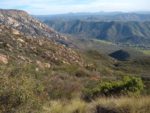
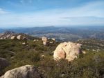
The El Capitan Open Space Preserve holds approximately 2,611 acres of open land. The open space is typical to that of most of Southern California in that it is full of large granite rocks, numerous canyons, and rolling hills. This preserve is unique in that on the southwest side there is a large granite ridgeline that rises from the depths of El Cajon. This ridge contains sheer cliffs that drop nearly 1,000 vertical feet. Below it lies the San Diego River which flows through to Mission Bay. These sheer cliffs are popular among rock climbers.
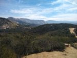
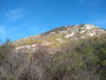
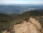
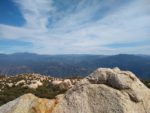
For those who don’t rock climb, the trail leading up to the peak of El Cajon peak is full of challenging rolling hills with steep inclines. However, the views at the top are worth the painful reward at the end. During the winter months a snow capped San Jacinto Peak can be seen far to the north, followed by Palomar Mountain in the foreground. One of San Diego’s waterfalls, Mildred Falls, can be seen in the far distance below Julian as well. To the direct east, Cuyamaca Peak can be seen. To the south, the San Diego River and rolling hills into Northern Baja California are visible. The views to the west are numerous including the peaks of Mission Trails Regional Park, San Vicente Dam, Iron Mountain, Mount Woodson, downtown San Diego, and the Coronado Islands in the distance of the Pacific Ocean.
For those seeking wildlife, the eleven mile trek through the preserve will provide abundant opportunities. In the spring wildflowers will light up the hills after a year with decent rain. Birds of all types including golden eagles (which nest in the cliffs of El Cajon Mountain) and hawks are known to be seen. Snakes are common and there will be opportunities for deer, coyotes, bobcats, mountain lions, and nearly all of San Diego’s mammals.
On A Personal Note:
Hiking El Cajon Mountain is no easy feat. I’ve done this trail twice and after each time I’ve questioned whether or not I’ll ever do this trail again. This is one of the only hikes I’ve been on that going down is just as bad if not worse as going up. The hills are steep and the soil is full of loose granite sand. Only those that are in good physical condition should attempt the full duration of the hike. El Cajon Mountain is a hike that will help prepare hikers for more difficult hikes elsewhere and set you apart from other hikers. For more trail on the trails conditions, see the tabs below.
The first time I hiked El Cajon Mountain I did so with 2 liters of water, a cliff bar, and an apple. I ran out of water on the way back down and was completely gassed from not having enough food. The second time I hiked El Cajon Mountain I had 3 liters of water and enough food. My provisions were enough but the up and down nature of the trail was still enough to leave me mentally and physically gassed. I’ve hiked the trail with and without trekking poles and I have to say, it’s better with than without.
Do you have any updates to the hiking trail or want to share your hike/pictures? Please leave a comment below.
- Overall Difficulty: 100%
- Overall Views: 85%
El Cajon Mountain Quick Facts:
- Elevation: 3675 feet.
- Elevation Gain: 3216 feet.
- Estimated Distance: 11-13 miles.
- My Actual Distance: 11.7 miles.
- Estimated Time: 5-8 hours.
- My Time: 6 hours 15 minutes total; 5 hours 12 minutes moving.
El Cajon Mountain/El Capitan Preserve Trail Directions:
While a few people do park in the small parking lot, there are several people who opt to park along Wildcat Canyon Road instead – myself included. Please note, due to the inland nature of this trail and how hot this area gets during the summer, the entire preserve is closed during the month of August. Parking is free.
El Cajon Mountain/El Capitan Preserve Pictures:
-
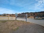
- The small parking lot to El Capital Preserve. Posted signs say it closes at 5 p.m. However, the county website states sunset.
-
- Walking up the private road to the official trailhead.
-
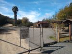
- The official trailhead.
-
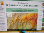
- Billboard information.
-
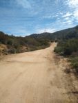
- Headed up from the trailhead. This portion featuers the trail’s only set of switchbacks.
-
- Coming up from the switchbacks with the first look of El Cajon Mountain in the background and the cliffs in the middle right.
-
- Where the switchbacks come out there is a small loop that gives an option to head back to the parking lot to a different way.
-
- As short decline.
-
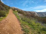
- Blooming California Poppy’s in the distance on a portion of the trail known as silver dome.
-
- The first moderate incline.
-
- Along this incline is a fork in the trail. It heads to a small round rock that overlooks part of the San Diego River below.
-
- Looking up towards the first crest half way.
-
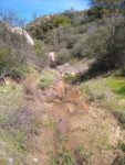
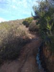
- Coming down from the first incline towards the first small riparian area where there is a small creek.
-
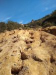
- From here on out it’s up, significantly I might add.
-
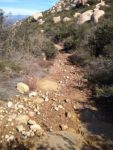
- Loose soil.
-
- Looking down.
-
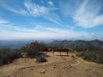
- After the first major incline is a small bench to take a break. The bench looks out west towards the the coastline.
-
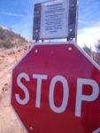
- There are a couple stop signs along the way warning visitors to turn back if they don’t think there’s a chance to make it back to their car by the posted closing time.
-
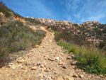
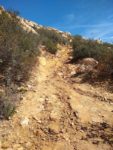
- After the stop sign it’s a push up a forty percent grade.
-
- Looking down from the trail where the San Diego River passes far below.
-
- Looking down the incline.
-
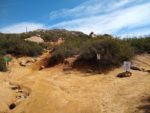
- Just past the half way mark. Near this crest is a fork in the trail. Taking it to the left will take you to an old gold mine.
-
- Headed down from the crest. Palomar Mountain and San Jacinto Peak in the far distance to the northeast.
-
- The second riparian area of the trail.
-
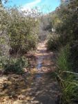
- There is a small creek that runs through a canyon towards Barona Indian Reservation here.
-
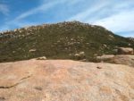
- Heading up out of the riparian canyon. The first look for El Cajon Mountain in the distance.
-
- More steep incline.
-
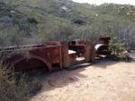
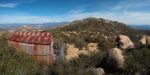
- The infamous rusted jeep.
-
- Finally to the saddle. Going straight used to be an option but the trail has since been closed.
-
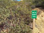
- This saddle marks the end of the county maintained trail
-
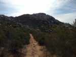
- Heading up the trail to El Cajon Mountain.
-
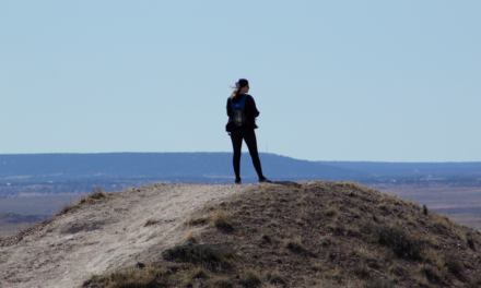
- A view of the peak.
-
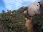
- This portion of the trail is narrow with encroaching manzanita. Keep an eye on the markers and watch out for snakes in the brush.
-
- Looking down towards the coast from near the peak.
-
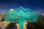
- Finally!
-
- The view towards the east with the Cuyamaca peaks in the background.
-
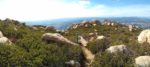
- A view to the north west with Barona Indian Reservation, Iron Mountain, San Vicente Reservoir, and Potato Chip Rock.
-
- Looking below at El Capitan Peak and onward to the Pacific Ocean.
-
- Looking up to El Cajon Mountain with Palomar Mountain in the background.
Who Hiking El Cajon Mountain Is For:
Advanced Hikers: This is a great hike for advanced hikers or for those who have been hiking for a while and are looking to push their hiking levels or increase their physical condition and stamina. This trail is also great for helping to prepare for more mentally exhausting hikes.
Expert Hikers: Expert hikers will delight in how the persistent up and downs of this trail can be used as a training ground for more difficult hikes. If you’re looking to be put to the test, this trail meets that criteria.
It’s always a good idea to be aware of what type of hiking level you’re at.
Best Time Of Year To Hike El Cajon Mountain:
Late winter and early spring aside, it’s best to catch this hike as soon as the weather cools from mid-fall to mid-spring. Although people do set out on this trail during the summer, I wouldn’t even think about it. As I’ve mentioned already, the preserve is closed during the entire month of August. I can personally attest to the extreme heat of this trail and the toll it has taken on hikers. I work in an emergency department a short distance from this trail and have personally witnessed three hikers die while out hiking in excessive heat along this trail.
To get the most out of this hike, the best time of year to hike this th
Any one of San Diego’s cooler days will be the best time to visit this park. The ideal window for visiting this preserve will be through around mid-Fall to near the end of Spring. Don’t even bother with these trails during the hot days or summer months. Because the area gets so hot during the summer, the preserve is closed for the entire month of August. But check the weather before and after that month to avoid the excessively hot days.
The best time to visit this area would be after a good rain to possibly catch the creek flowing. Late winter and early spring would be ideal. The cooler weather will make for a pleasant hiking experience. It’s during that time that blooming chaparral and wildflowers will be at their peak and fresh growth will be attracting more wildlife.
El Cajon Mountain Trail Conditions:
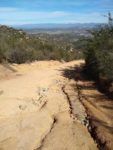
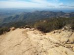
What’s frustrating albeit challenging about this trail is the fact are several sections of ascent and descent. Meaning, you’ll be going down on the way up and the way back to the car will be just as frustrating as the way up. What’s equally as frustrating is the fact that the trail is made up of very loose dirt, sand, and small rocks. There are several steep grades along the way, one even as steep as around forty percent. It doesn’t help that the grades are full sand and sediment from weathered granodiorite rocks along the trail.
The First Half Of El Cajon Mountain
The parking lot is actually located a short distance from the main trailhead within the preserve. This is because the parking lot sits outside of a private road with individual residences. Please be respectful to those who live in the area. At the actual trailhead there is a bulletin board with information about the trail and a bathroom. Here the trail starts up of a series of the only switchbacks along the way.
At about two miles in will be the first significant grade which is followed shortly by a descent into a very small riparian canyon. During the winter months with significant rainfall water can be heard flowing through here. This descent is short lived and then marked by another very significant incline with a steep forty percent grade. This steep grade essentially goes all the way up to the half way point.
Near the crest there is a short trail that springs off to the north. This trail leads to an old gold mine which if there’s time, I’d recommend checking out. Unfortunately, I have not taken this short detour.
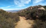
The Second Half Of El Cajon Mountain
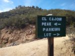
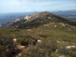
The halfway point is greeted with a steady decline into a small riparian canyon. Like the first creek, this one can have water during the winter months and even more so than the first one. The decline is short lived before another steady incline on slippery worn down granite rocks. Along the way you’ll see the popular old rusted and abandoned jeep that made its way up at some point. The incline eventually reaches a saddle which marks the end of the county maintained trail. At this saddle the trail branches off into three different directions. To the right and about half a mile down is El Capitan Peak. To the left is the peak of El Cajon Mountain. Going straight will be a mile and a half trail that leads to the thousand foot cliffs of El Cajon Mountain.
The trail leading up to the peak of El Cajon mountain is a use trail and not well maintained. However, there are trail markers to help as a guide. This portion of the trail consists of one steep final incline to make it to the top. The use trail is crowded with Manzanita so it does help to wear something covering the legs to help prevent from getting scratched up. I’d also recommend trekking poles to help push the branches away just in case there are any snakes hiding out.
The peak of El Capitan is not nearly as impressive as El Cajon but it’s only a short detour. For the trouble of getting up up this far I think it’s worth it to check off the list. The trail leads to an old metal shed surrounded by barbed wire. I’m not exactly sure of what the use of this shed was for.
The Old El Cajon Mountain Cliffs Trail
Within the last couple of years of the date of this article, it used to be possible to hike to the El Cajon Mountain Cliffs past the saddle. Land which was once owned by San Diego Gas and Electric was given to The San Diego River Park Foundation. The foundation now requests that all hikers refrain from hiking to the cliffs in order to use the area for preservation. Although old trail remnants remain, the trail is clearly blocked with rocks as well as a sign discouraging use.
Generally speaking, the trail is in good condition and is maintained by the County of San Diego and Friends of Hellhole Canyon – a non-profit group who help to maintain the park. The trails nearest to the parking lot are in the best condition. All trails are easily to navigate with trail markers. Trails are composed of dirt and loose granite.
Some portions of the trail can succumb to erosion after heavy rainfall. For this reason, some of the steeper grades can be a little tougher on the knees and ankles with runoff debris. The trail does narrow the further away from the parking lot one gets. The trail is almost completely exposed to the elements with hardly any trail overgrowth. The only chance of shade is near Hell Creek where trees common to Southern California’s canyons grow. At the top of Paradise Mountain there is a small stretch of some head high to overhead Manzanita patches that can offer a small break from the sun.
The only chance of poison oak will be near Hell Creek. Steer clear of any growth hanging out near the bottom of any trees. Otherwise the area gets too much sun and too little water for the plant to grow. Rattlesnakes can be common along the trail. With that said, keep your eyes peeled and if you have Fido with you, make sure they don’t get too curious.