
Hiking the Devastated Area Interpretive Trial
The Cascade Mountains are a beautiful range of peaks that run along the west coast from Northern California to British Columbia. The range consists of twenty prominent mountains. Lassen Peak is the southern most mountain and was formed by a dome volcano. The volcano last erupted during a series of eruptions that took place from 1914 to 1917. The largest of these eruptions occurred during May of 2015.
The May 2015 eruption could be seen as far as 150 miles away as it spewed ash more than 30,000 feet into the air. Ash from the eruption fell as far as 250 miles away. The hot steam and lava melted accumulated snow which resulted in devastating and super-heated mudflows. The large pyroclastic flow traveled northeast along Lost Creek to the isolated towns of Old Station and Hat Creek Valley ten miles away. Near the blast itself, over three square miles were completely destroyed.
The Devastated Area Interpretive Trail takes hikers through a half mile section of the destroyed area near the base of Lassen Peak. Several placards along the trail offer information about the early eruptions. Much of the landscape in the area is still scarred but some pine forests have started to regenerate. However, vegetative ground cover is scant at best. There are many large projectile rocks that are scattered throughout the trail. The most popular of them being the “hot rock.” This rock was photographed by a local settler Benjamin Loomis who captured the eruption through a series of photos. The rock stayed hot to touch for several days after being expelled from Mount Lassen’s belly.
On A Personal Note
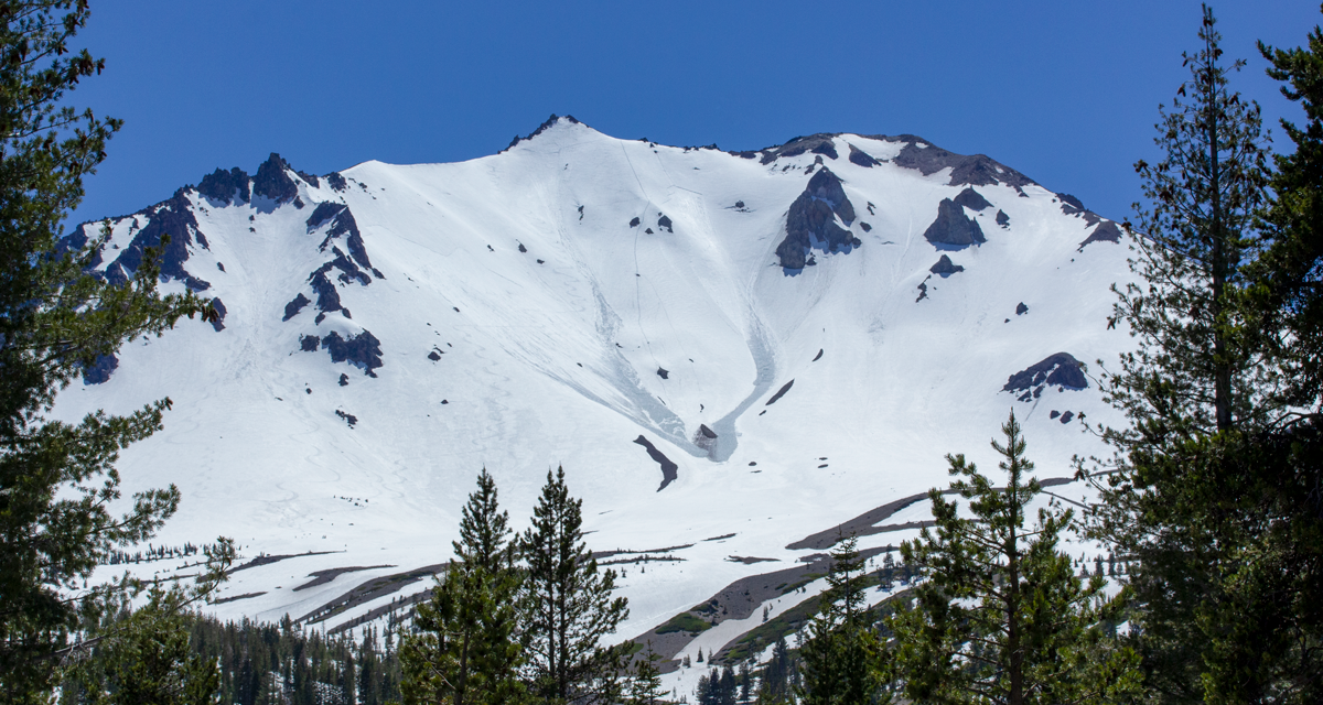
Although being a short trail, this is a nice introduction to some of the history of Lassen Volcanic National Park. I was here during the late spring and there was still a lot of snowfall throughout the park. The view looking at Lassen Peak covered in snow was nice. There was also a deer along the trail.
Do you have any updates to the hiking trail or want to share your hike/pictures? Please leave a comment below.
- Overall Difficulty: 25%
- Overall Views: 80%
Devastated Area Interpretive Trail Quick Facts :
- Elevation: 6,504 feet.
- Elevation Gain: 115 feet.
- Estimated Distance: 0.5 miles.
- My Actual Distance: 0.3 miles.
- Estimated Time: 30 minutes.
- My Time: 19 minutes.
Devastated Area Interpretive Trail Directions:
Devastated Area Interpretive Trail Pictures:
-
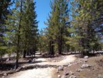
- The Devastated Area Interpretive trail is mostly flat with sparse shade provided by younger pine trees.
-
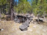
- An example of some of the ballistic rocks fired out by the early 1900’s eruptions.
-
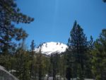
- A snow capped Lassen Peak is seen throughout the trail.
-
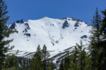
- A closer shot of the beautiful Lassen Peak.
Who The Devastated Area Interpretive Trail Is For:
Advanced Hikers: This is a very short trail but it has a great view of Lassen Peak. Include this trail with some other short trails.
Expert Hikers: Those with a lot of hiking experience will likely not find these views to be that satisfying. However, the history behind the trail is neat.
It’s always a good idea to be aware of what type of hiking level you’re at.
Best Time Of Year To Hike Devastated Area Interpretive Traill:
It’s always a good idea to check the weather before heading out on a hike.
