
Driving Through Valley Of Fire State Park
For those that live close to Valley of Fire, the area makes a great place to visit and enjoy its wonderful sights. The reason I decided to write about it is because of its proximity to Southern California. I decided to drive through here while on a road trip from San Diego, California to Zion National Park in Utah. I highly recommend Valley of Fire State Park for those people who might be on a road trip driving to or from Southern California.
The preserve is a short distance off of Interstate 15 and features some very easy walk up attractions. Visiting Valley of Fire is a great way to break up a longer road trip, which is exactly what we did. There’s no question that in 40,000 acres of state park, one could definitely spend a few days here.
For those who want to explore in one day, as I did, I recommend taking the Valley of Fire exit east and driving through the park. For those that are driving southward, exit off Interstate 15 North Moapa Valley Boulevard and travel through the park in a southbound fashion. Let this map be a guide to hit some of the main highlights of Valley of Fire.
Valley Of Fire Directions and Information
For road-trippers, getting to Valley of Fire State Park is incredibly easy. There are two main roads that intersect the park. Valley of Fire Highway will be for travelers who are headed northbound on Interstate 15. Turn right at this southeast into the park. For southbound travelers, the first exit will be off of Highway 169 – Moapa Valley Road Blvd. Open in maps for directions that will lead to the heart of the park.
See the map below for directions to park highlights. Valley of Fire State Park is open from sunrise to sunset everyday. Campgrounds are open twenty-four hours. There is a $10 entrance fee. For more information call 702-397-2088 or check with the park’s website.
Elephant Rock
Seven Sisters
Visitor Center/Balanced Rock
Mouse's Tank Road
Beehives
Atlatl Rock
Arch Rock
Petroglyph Canyon Trail/Mouse's Tank
Rainbow Vista/Fire Canyon Arch
Fire Canyon/Silica Dome
Pastel Canyon Trail
Fire Wave Trail
White Domes Trail
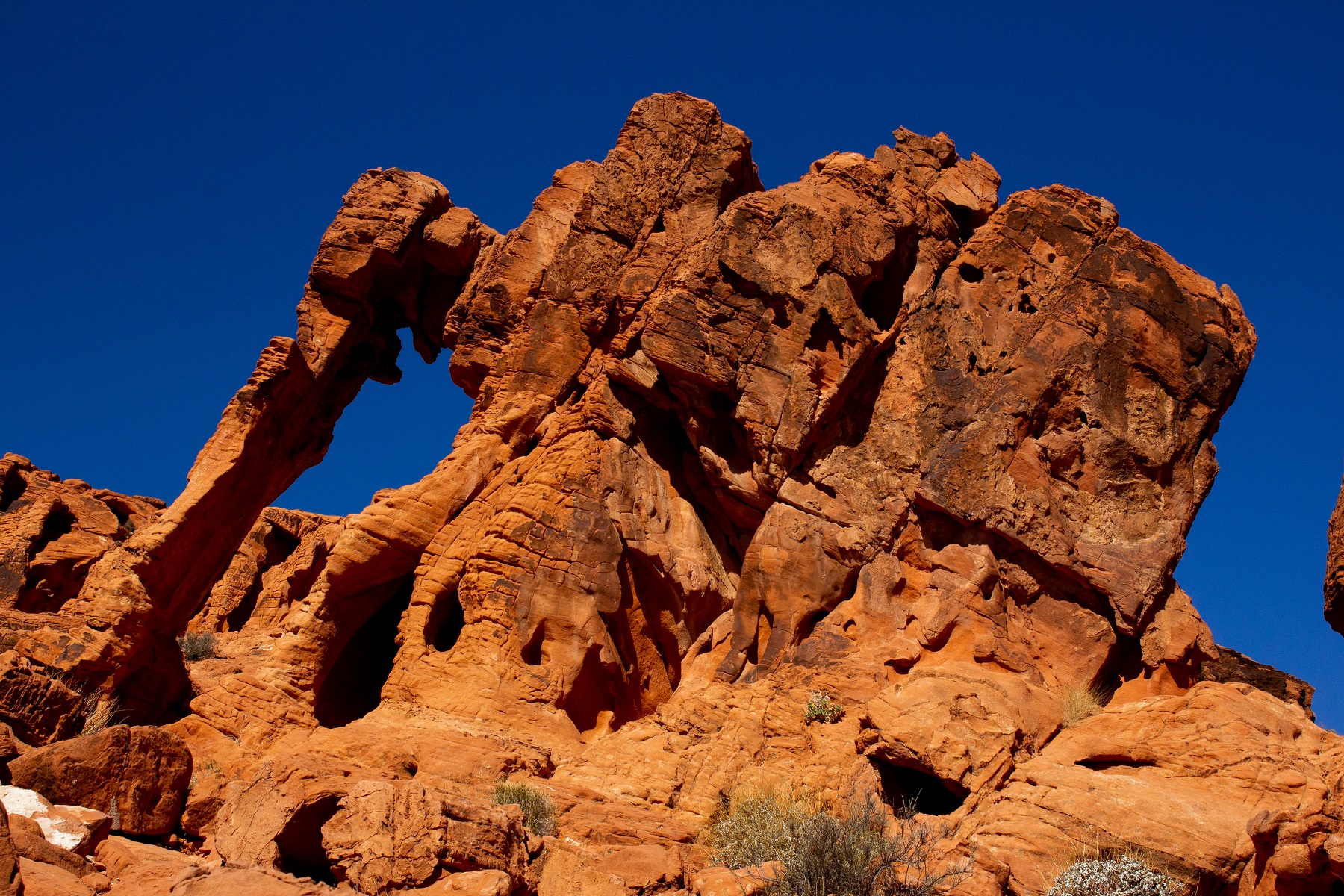
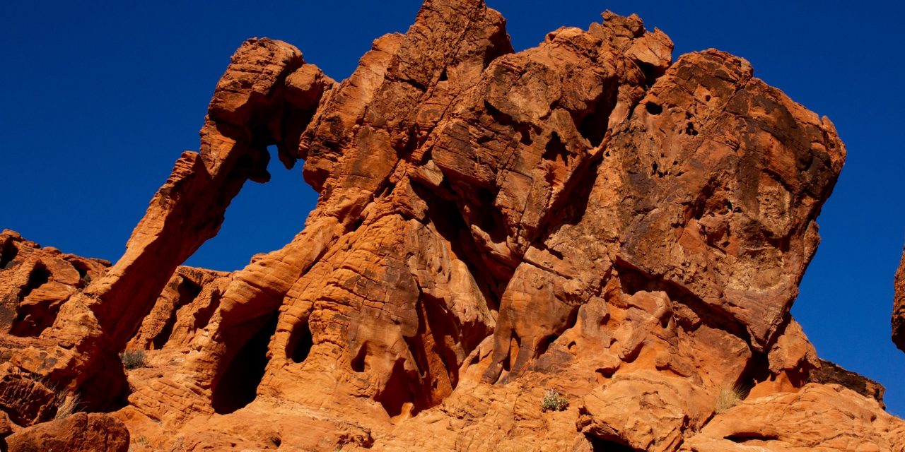
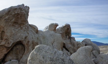
Elephant Rock
Elephant Rock is one of Valley of Fire’s popular destinations. This weather eroded rock formation resembles that of a large elephant. This will be one of the first or last stops in the park depending on your entrance. Elephant Rock is located about 0.3 miles away from the paid entrance station where there is also a small parking lot. Parking is not recommended along the road. Do not climb the rock in order to help preserve it for future generations.
Seven Sisters
The Seven Sisters is a set of large red boulders. This set of seven pillars are tall wind and weather eroded red rocks surrounded by sandy deserts. Being from Southern California where large boulders are everywhere, I thought these are very easy to miss. Keep an eye out for them as the road winds right past them.
Valley Of Fire Visitor Center
The Valley of Fire Visitor Center is located right in the heard of the park. This is a great place to stop and find out detailed information about the area. The park is open from 8:30 a.m. to 4:30 p.m daily. There is some great information here about wildlife that frequents the area, Native Americans that inhabited the area, and geological information about how the park was formed. Park rangers can offer assistance to those with any questions here.

Take A Drive Down Mouses's Tank Road
If there is one thing to do Valley of Fire State Park it’s to take a drive down Mouse’s Tank Road. This iconic road is home to many iconic photos. This road is worth the drive down alone but there are plenty of things to access from here. While I didn’t have time to visit many sights along this road, there are many views to be seen: Balanced Rock, Petroglyph Canyon Trail, Rainbow Vista, Fire Canyon Arch, Silica Dome, Pastel Canyon Trail, Fire Wave, and The White Domes Trail.
Stop By The Beehives
On the south end of Valley Of Fire Highway is a rock formation known as the beehive. It takes little use of the imagination to understand why this attraction got its name. Large rounded boulders that have been wind swept and weather eroded give these rocks special lines that make the rocks look like beehives. Be alert while driving by, these rocks are easy to miss.
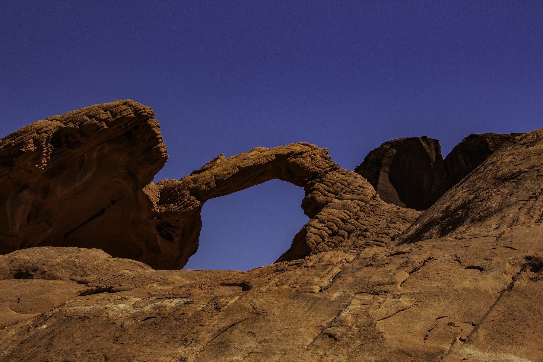
View Arch Rock and Atlatl Rock
Along the short drive of Campground Road are two distinct sites to visit: Arch Rock and Atlatl Rock. Arch Rock is a beautiful windswept red arch. Look to the south while on Campground Road to view Arch Rock. Atlatl Rock is a short path up a set of stairs that highlights Native American rock art. There is a small parking lot at Atlatl Rock.
Check Out One Of The Other Many Valley Of Fire State Park Sites
The sights I mentioned above are some amazing highlights of what Valley of Fire State Park has to offer. My wife and I used the park as a pit stop to break up a road trip back to San Diego from Utah. In a couple of hours I was able to catch a glimpse of the main features of the park.
If you have more time when traveling through the area, feel free to add to your itinerary with the list of sites below. All places can be found on the included map.
- Fire Wave Trail: I highly recommend this short trail 1.5 mile for those that have the time. This trail leads to a series of rocks that have been weathered. The particular weathering gives the appearance that the rocks have been painted with a wave.
- White Domes: A 1.1 miles loop that takes people through white capped domes, an old movie set, and a narrow slot canyon.
- Rainbow Vista: An approximate one and a half mile hike that leads to a sandstone crest with 360-degree views over multi-colored rocks. Access to Fire Rock Arch
- Petroglyph Canyon: A 0.75 mile trail that offers views of Native American petroglyphs. The trail end’s at Mouse’s Tank which is a large natural basin that holds significant portions of water after a rain.
- Balanced Rock: A 1/4 mile trail near the visitor center that leads to large boulder with the appearance that it’s magically balancing.
- Fire Canyon/Silica Dome: A viewpoint located off of Mouses’s Tank Road at the end of Fire Canyon Road. This viewpoint looks down on Fire Canyon with a Silica colored dome. This viewpoint also marks the trail for Fire Canyon Wash which leads to Mouse’s Tank.
If you’ve got more park highlights that you’d like to share, go ahead and mention them in the comments below.