
Stonewall Peak Hiking Trail Guide
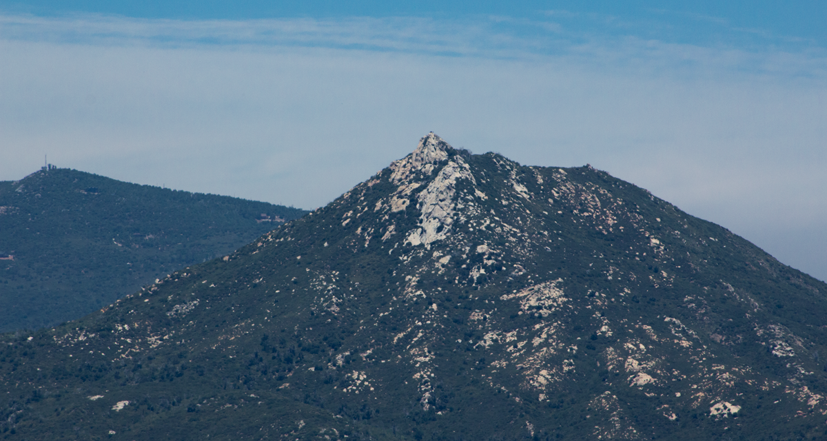
Stonewall Peak is located in East San Diego County within the Cuyamaca Rancho State Park. The peak itself is about 3.4 miles out and back. The elevation gain is about 850 feet to a total elevation of 5,730 feet. Stonewall Peak is great because it’s a short distance that will only take a couple of hours but will still offer some incredible views of the surrounding area. To the west you’re able to see Cuyamaca Peak as well as it’s neighboring peaks and Cuyamaca Peak. On clear days from the top of Stonewall Peak you can see the views of past Palomar Mountain to the San Bernardino Mountain Ranges, Anza-Borrego Desert, and the Salton Sea.
Cuyamaca Rancho State Park History
Altogether there are 24,700 acres of land and over one hundred miles of hiking trails in Cuyamaca Rancho State Park. The history of this state park predates any European settlers. For thousands of years the Kumeyaay band of Native American’s utilized the fresh water springs and abundance of food in the area.
It wasn’t until the late 1700’s when the first Spanish Conquistdors started to arrive to the region. For decades native Kumeyaay resisted missionization and were reluctant to give up their independence. By the mid-1800’s land was sold of by the Kumeyaay and few of the native people’s remained in the area.
In 1869 gold was discovered and quickly led to a gold rush in the area. A series of mines were constructed and several the remnants can stili be seen while hiking today. Financial problems eventually led to the closures of the mines by 1906 and the area continued as a mountain resort for several years.
In the 1920’s a capitalist by the name of Ralph Dyar bought the ranch with plans for the development of a resort on Lake Cuyamaca. Luckily for the sake of preservation, The Great Depression ended the bid for a lakeside hotel. Instead, Dyar sold the land to the State of California for its newly developed State Park System. In 1962 the area officially was inducted into the State Park System.
On A Personal Note:
I did the hike in the month of January. There was a minor winter storm that blew threw the area putting a light dusting of snow, hail, and grauple in the higher elevations of San Diego County. The weather conditions had temperatures in the high 30’s as well as steady moderate wind. It’s not uncommon to have winter storms pass through the area so please be aware of weather conditions and dress appropriately. This trail is also great to hike during the fall. As the fall season gets under way, the days shorten, and the nights cool, the California black oak that is found throughout this trail trail will put on a wonderful display of fall colors.
Looking for a little more challenge in your hike? Oakzanita Peak down the road is just over five miles in length with equally stunning views and a seasonal creek.
Do you have an update to trail conditions? Leave a comment below.
- Overal Difficulty: 75%
- Overall Views: 100%
Stonewall Peak Trail Directions:
Stonewall Peak Trail Pictures:
-
- Stonewall Peak from the trail head near the parking lot.
-
- To the right eye, the trail can offer up some artistic views.
-
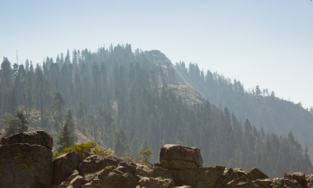
- Looking northeast towards Mount Laguna and Anza-Borrego.

-
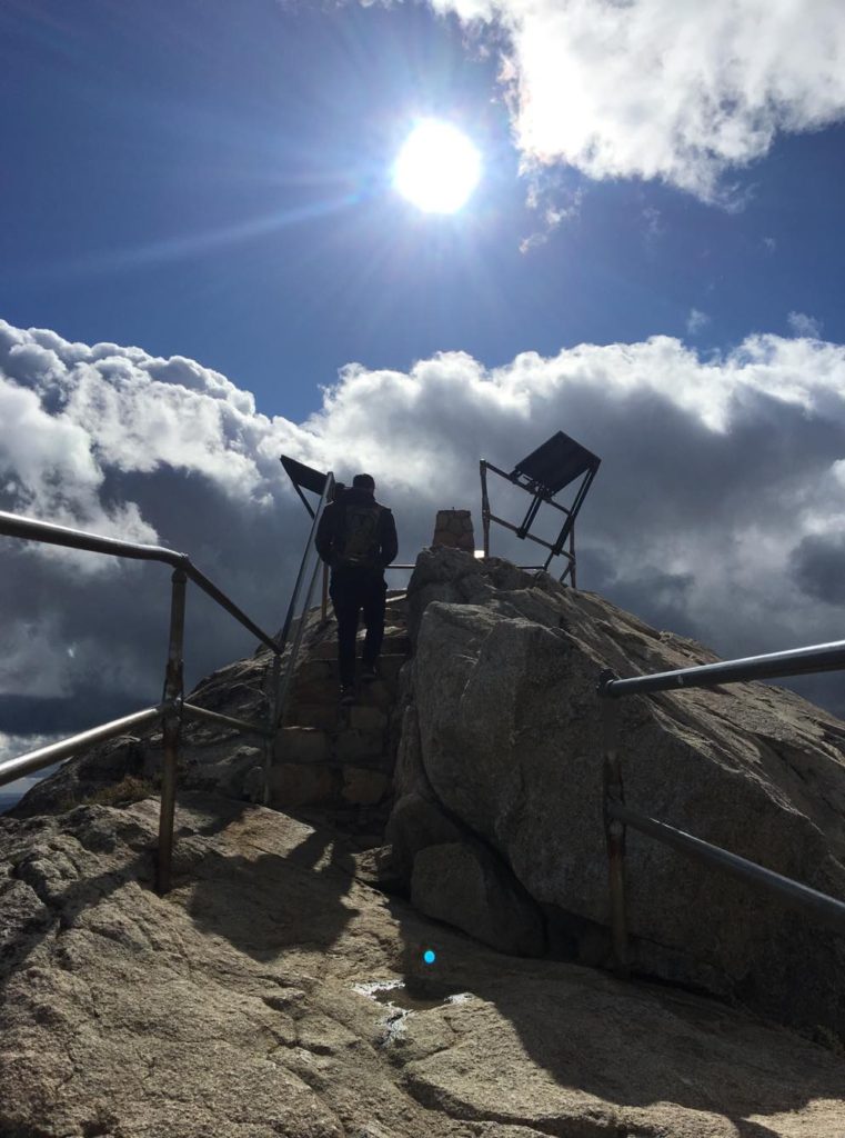
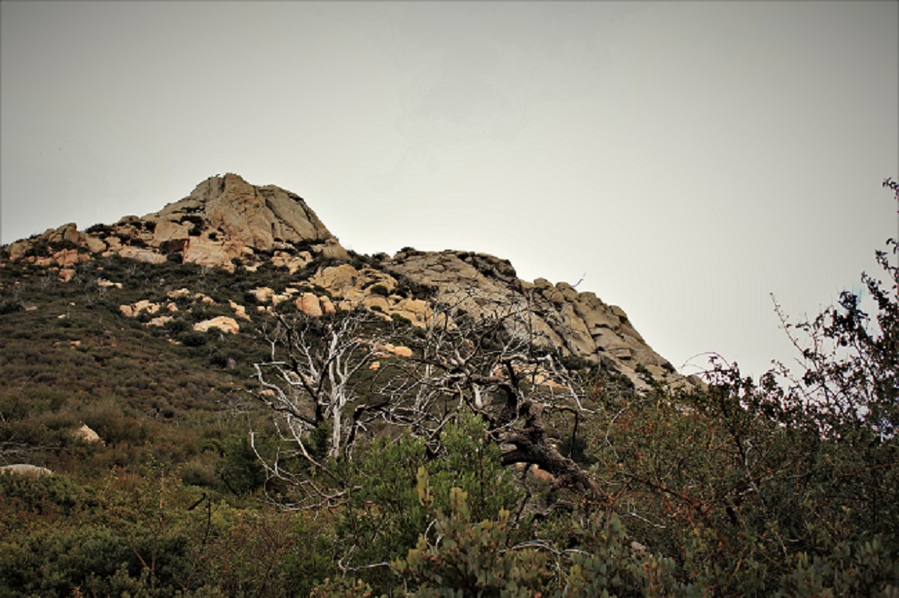
- Getting up towards the top of Stonewall Peak.

-
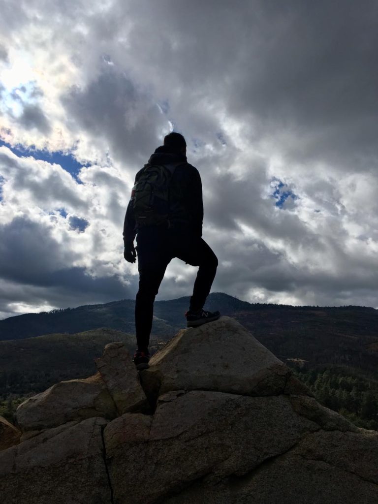
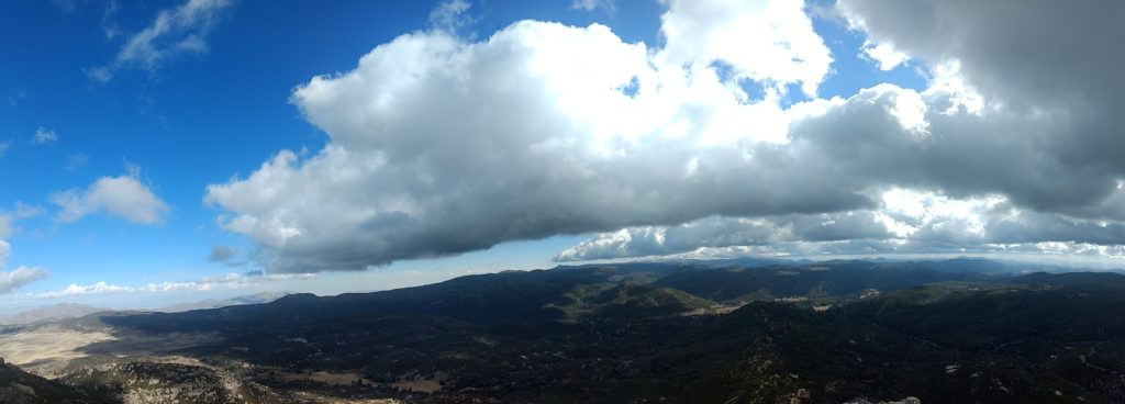
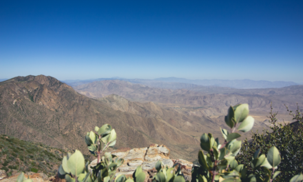
- Reaching the top of Stonewall Peak looking west to Cuyamaca Peak.

-
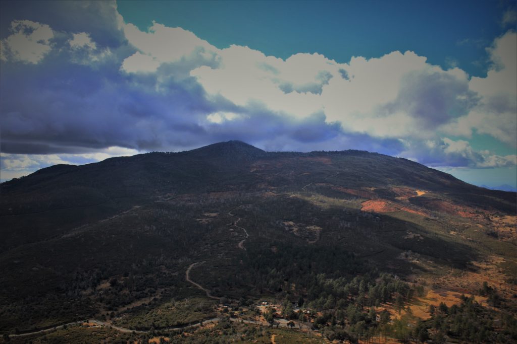
- The view of Cuyamaca Peak from Stonewall Peak.

Who Stonewall Peak Is For:
For novice hikers: This hike is short but sweet. The amount of elevation gain within the first half of the trail leading up to the top will be a fun challenge.
For moderate hikers: The short hike will leave you hungry for more.
For advanced hikers: This hike will be a walk in the park.
It’s always a good idea to be aware of what type of hiking level you’re at.
Best Time Of Year To Hike Stonewall Peak:
Stonewall Peak Trail Conditions:
Generally speaking, the trail is in great condition. It is maintained by the California State Parks system as well as local volunteers. The hike is generally composed of decomposed granite rock with small granite rocks throughout the trail. The trailhead is directly across the street from the Cuyamaca Rancho State Park campground and parking lot. Use caution crossing the street as cars routinely speed down this highway.
From the trailhead the trail gradually climbs two miles to the peak itself and consists of mostly switchbacks that wind around the northwest face. As the elevation climbs higher views of the entire Cuyamaca region will be exposed and become even better towards the top. The top of Stonewall Peak is a granite lined peak with several worn down placcards about views far off in the distance. The steepest portion of the trail is at the peak and the granite can be slippery when wet or for shoes without great grips. There is a handrail to help guide you up the last ten yards of the trail along some carved out granite steps.
From the peak many noteable peaks within the San Diego mountains can be seen including Palomar Mountain, Volcan Mountain, Cuyamaca Peak, Oakzanita Peak, and the Laguna range. On a clear day Mexico and even far away peaks such as San Jacinto Mountain can be seen. Use caution at the top. Although there is a railing, a fall from here would be catastrophic. Rattlesnakes can be common in this area. Keep an eye out for poison oak in shady areas of the trail.