
Hiking Keanakako’i Crater and Lava Tree Trail
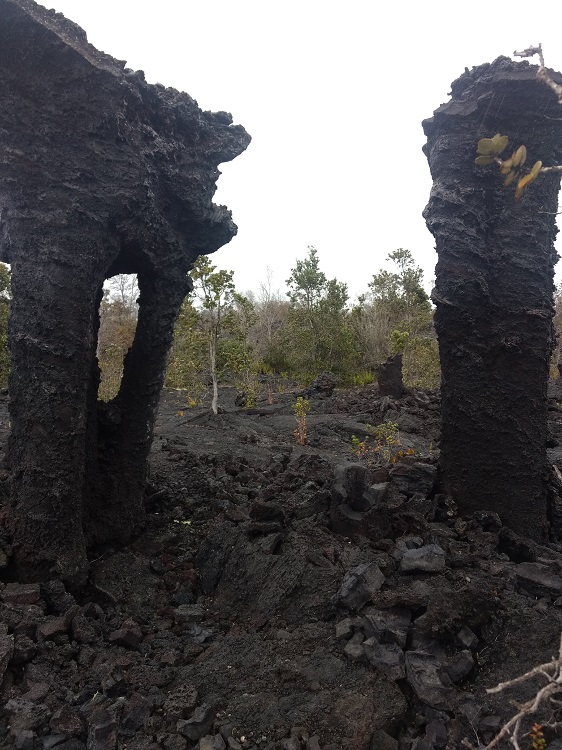
The Keanakako’i Crater is a very lightly trafficked trail within Hawai’i Volcanoes National Park. This trail features in what my opinion are two awesome gems that this park has to offer. The first one is Keanakako’i Crater itself. This crater is from a short eruption that took place in 1982. The eruption left a large lava field behind as well as small patches of a tropical rain forest that were spared. Other portions of forest weren’t so lucky. The lava came out at such a high flow rate that it engulfed the trees at a high velocity. Because of this, the nearby eruption site is littered with dozens of “lava trees.” These trees are lava cast molds of trees that were swallowed up by the lava flow. In some cases the lava clung to the trees bending them to form unique lava tree arches.
Keanakako’i Crater is a very short trail. The trail ends at a steep overlook into the crater several hundred feet below. Disclaimer: there is no fence at the crater site so use caution if standing on the ledge. Rock slides could happen and you could fall to your death if you’re not careful. From the crater’s edge, on a clear day the peaks of Mauna Kea and Mauna Loa are visible. Both peaks are an incredible view if they are snow capped which can be a regular occurrence during the winter.
On A Personal Note:
This trail is one of my favorite short hikes in the park. It’s a great addition to other day hikes such as the Kilauea Iki Crater trail. The lava tree field isn’t listed on the park brochure and it’s a bit off the beaten path of the main trail. One of the park rangers pointed out the quick trail deviation to us and we are forever grateful for that tip. Check out the trail details to find out how to get there and see the pictures below. Keanakako’i Crater makes for a great photo backdrop.
Looking for another hike nearby? Check out the Kilauea Iki or Thurston Lava Tube Trail. THe Kilauea Iki hike drops straight down into the floor of a crater. The Thurston’s hike travels through a tube formed by flowing lava.
Have you done this hike before? Please share your pictures in the comments below and update us with trail conditions.
- Overall Difficulty 40%
- Overall Views 85%
Keanakako'i Crater and Lava Tree Trail Quick Facts:
- Elevation: 3,799 feet
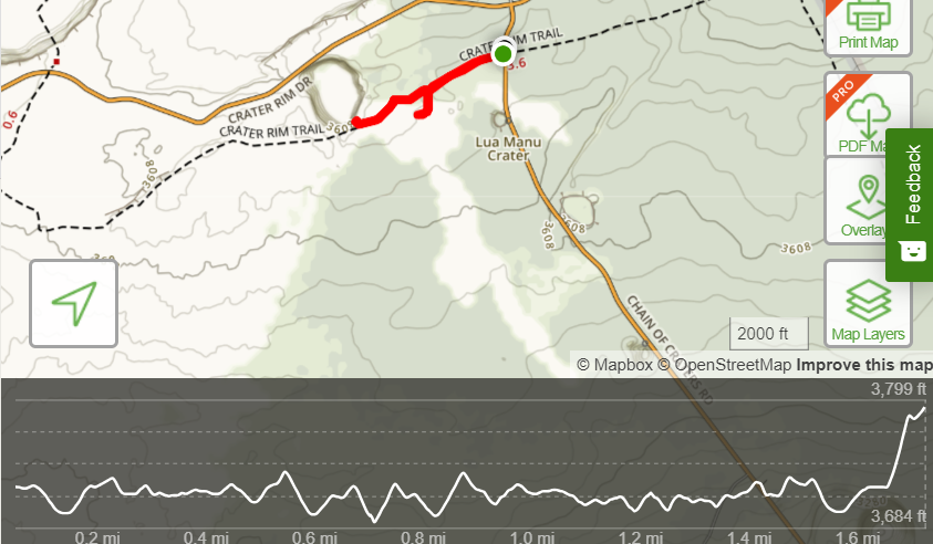
- Elevation Gain: 121 Feet
- Estimated Distance: 1.6 miles
- My Actual Distance: 1.7 miles
- Estimated Time: 1 hour.
- My Time: 45 minutes.
Keanakako'i Crater and Lava Tree Trail Directions:
Keanakako'i and Lava Tree Trail Pictures:
-
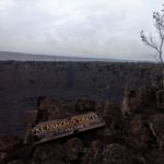
- Keanakakoi Crater near the edge with a drop off. You can get as close to the edge as you want but use caution.
-
- The views are incredible for this short hike.
-
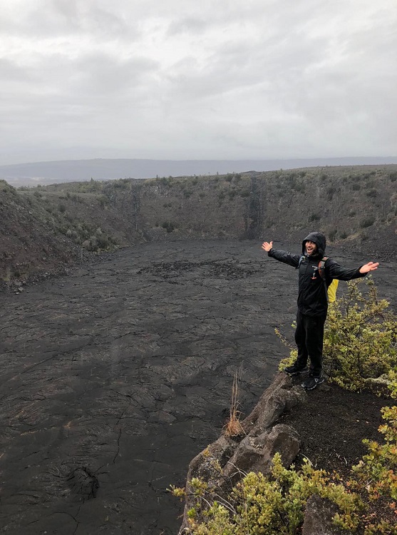
- As described in the trail details, these were the trees we had used as markers when we ventured off the path to find the lava trees.
-
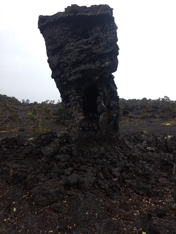
- The lava field is scattered with lava trees.
-
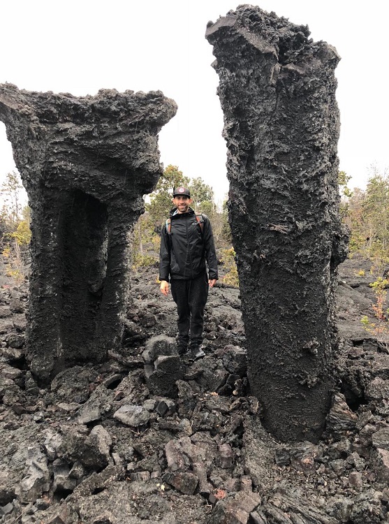
- Standing next to lava trees.
-
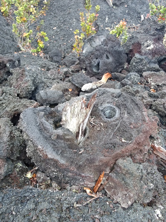
- A cross section of a lava tree showing an old tree in the middle.
-
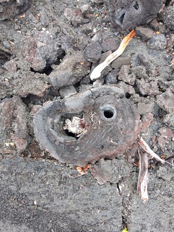
- A cross section of a lava tree that got too heavy and fell over.
Who Keanakako'i Crater and Lava Tree Trail Hike Is For:
Advanced Hikers:This is a perfect hike with incredible views. The hike is short and to the point. Getting off the trail and finding cool views and finding the trail again is also a fun challenge.
Expert Hikers: This is a simple hike with fun and interesting views.
It’s always a good idea to be aware of what type of hiking level you’re at.
Best Time Of Year To Hike Keanakako'i Crater and The Lava Tree:
Keanakako'i and Lava Tree Trail Conditions:
Locating The Lava Tree Field
The tricky part is locating the lava trees. There is no defined trail to this portion of the park and the only information we got was form one of the park rangers. Follow these directions but I highly recommend also asking the park ranger at the visitor center about the trail. Once on Crater Rim Trail there will be a point about half way in where the trail takes about a 45 degree turn to the right. At this point, take a 90 degree turn to the left and get off the trail and walk about one to two hundred yards out. Before getting off the trail, pick a marker alongside the trail like two trees so that you can locate the trail once again.
About one to two hundred yards off the trail there will be a large field with a plethora of lava trees and also lava arches. Once you’re done looking through the field of lava trees, find your trail markers that you had initially picked out and walk straight back to them to get back on Crater Rim Trail. Follow the trail to the east to get back to where you parked.
