
Corte Madera Peak Trail
Yosemite National Park isn’t something that necessarily comes to one’s mind when hiking in San Diego. Yet this trail has earned the nickname of “San Diego’s Yosemite.” On the southern end of Pine Valley and near the town of Descanso, this trail will take hikers through the rolling foothills of the southern San Diego County. As for the name, Corte Madera translates to “cut wood” in Spanish.
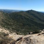
As for the nickname of San Diego’s Yosemite, this trail resembles nothing of the sort. Most people who have visited Yosemite Valley would likely agree. The name is given for a very large exposed group of granite rocks where the trail ends. Nonetheless, this area is a great spot to enjoy the views below. On a clear day the glistening Pacific Ocean and Coronado Islands will be a backdrop of downtown San Diego. To the south will be the rolling foothills of Baja California. To the northeast will be the Laguna Mountains and Cuyamaca Peak.
On A Personal Note:
My wife introduced me to this trail when we were dating and it has remained one of my top hikes in San Diego since then. As the trail gains in elevation it soon becomes lined with an abundance of manzanita trees. These trees are known for it’s colorful red bark and twisting branches. During the winter these trees put on a wonderful display of pink flowers. Occasionally, the snow levels can get low enough to dust the peak, which I would imagine the large granite rocks would look quite beautiful.Have you done this hike recently? Please share your pictures in the comments or leave an update about the trail.
Looking for a similar hike nearby? Check out the amazing looking Kithcen Creek Falls.
- Corte Madera Trail Overall Difficulty: 40 %
Corte Madera Peak Quick Facts:
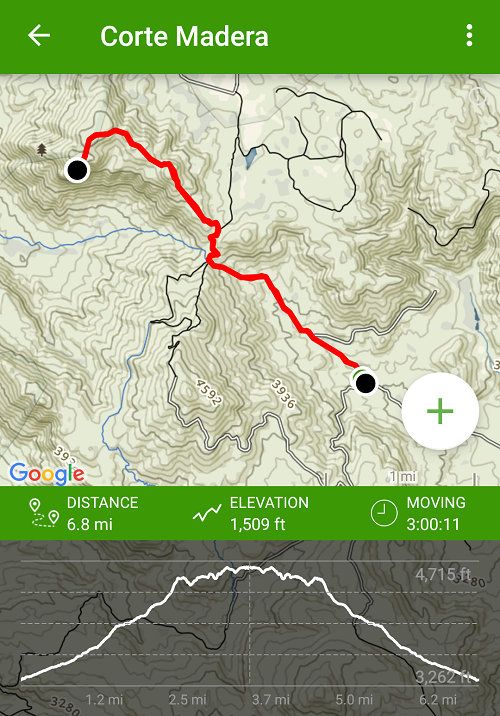 Elevation: 4,715 feet
- Elevation Gain: 1,509 feet.
- Estimated Distance: 7 miles.
- My Actual Distance: 6.8 miles.
- Estimated Time: 4 hours.
- My Time: 3 hours.
Directions:
Open in maps. Exit at Buckman Spring Road and turn right. Turn right onto Corral Canyon, and follow the rough, single-lane road for 4.8 miles until it makes a sharp hairpin turn. Parking is basically wherever you can near the gate on a small private road. Park off the road in a small dirt lot big enough for a few cars.
Corte Madera Peak Trail Pictures:
-
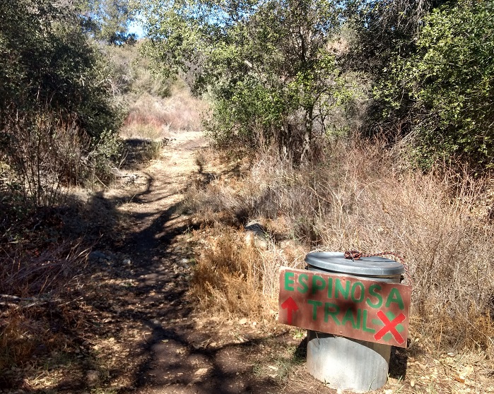
- Parking is right outside this gate which also marks the trailhead.
-
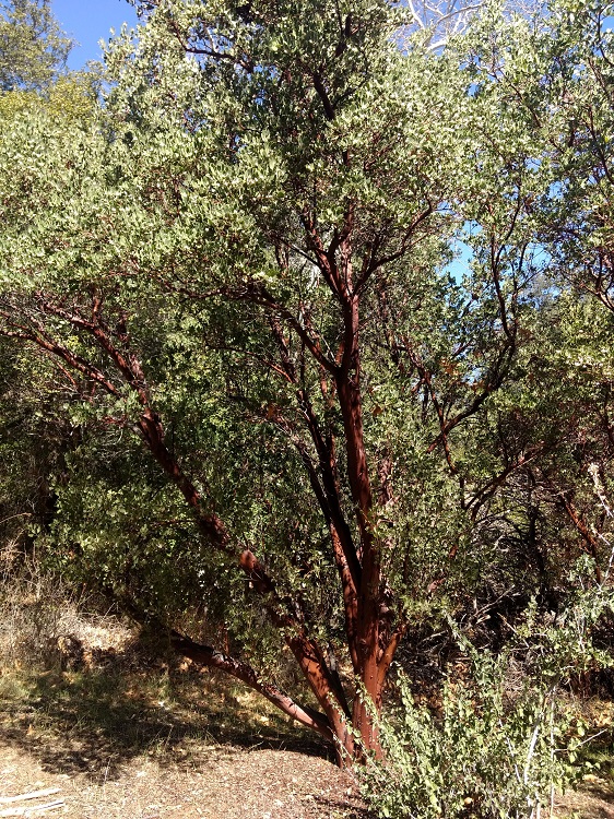
- The trail is known for this type of plant which grows throughout the trail.
-
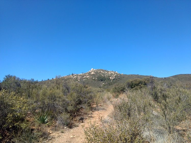
- Most of the trail is exposed to the sun.
-

- Corte Madera Peak in the background with its well known granite rock formations.
-
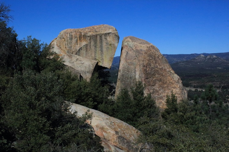
- These rocks are much bigger than they look.
-
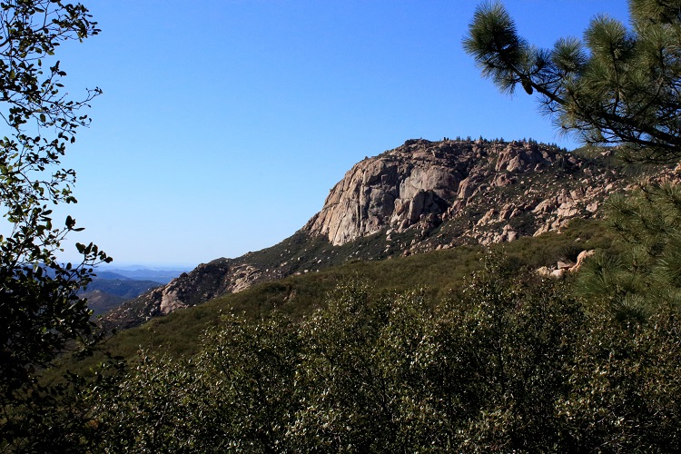
- Corte Madera Peak
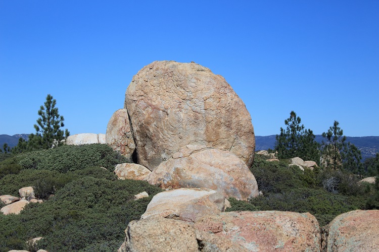
-
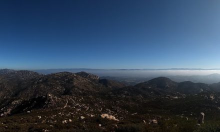
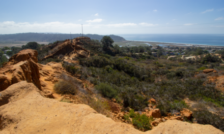
- The view to the south on the top of Corte Madera
Who Corte Madera Trail Is For:
Advanced Hikers: For people who are in decent shape and/or regular hikers, this hike will be a fun way to spend a few hours of the day.
Expert Hikers: This hike will be fun with rewarding views.
It’s always a good idea to be aware of what type of hiking level you’re at.
Best Time Of Year To Hike Corte Madera Peak:
I’ll tell you the worst time: hot summer days and hot Santa Ana wind conditions. Other than that, mild spring and fall days will be a great time. If it’s on the warmer spectrum, bring more water. The trail doesn’t have much cover and is exposed to the sun most of the time. Winter months can have occasional snow if the levels are low enough but it’s usually short lasting. Bring warmth for the colder days. The inland mountains and valleys can be wind prone as well so always check the weather conditions before you go.
Corte Madera Peak Trail Conditions:
Crowds can be a factor as weather improves. When I did Corte Madera Peak the temperature was in the 50’s and the group that I was with only saw about five people. There’s not much shade from the trees especially as you get higher up towards the peak. If sun is something you’re concerned about, prepare accordingly. The trail is out and back and the first half is on a private utility road that eventually branches off to the left and to the right. When it branches off to the right the trail transitions from a road into a trail. The trail gets enough use as to be well defined. In the lower and shadier part of the trail, keep an eye out for poison oak. Outside of the cooler winter months, definitely be alert for rattlesnakes.