
Bayside Trail – Cabrillo National Monument
If one is looking for a short trail near the City of San Diego that’s rich in history, the Bayside Trail in Cabrillo National monument should be of high priority. This short two mile trail winds down the sandstone cliffs of Point Loma providing panomarmic views looking out across San Diego Bay to the southeast parts of the county, the Coronado Islands, and down the coast to northern Baja California. While taking in the views, visitors to this area can also indulge in some history which includes World War II and the landing of the Spanish explores who were the first non-natives to discover San Diego.
The trail begins near the bread and butter of Cabrillo National Monument: the now non-operational Old Point Loma Lighthouse. The lighthouse stands as a reminder of what stood as a beacon of light that guided ships into the Bay of San Diego. About half way down the trail is another piece of history, this one belonging to the World Wars. It’s at this place where during the United States involvement in World War I and II soldiers manned a small site on the sandstone cliffs. The soldiers operated a watchlight that was five feet in diameter and could be seen as far as thirty-five miles away. Strong enough to blind someone, the soldiers kept a watch over perceived threats entering the city by water.
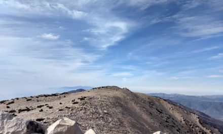
The trail concludes at an elevation of about three hundred feet lower than where it began. Those who made it this far will have a birds eye view of Ballast Point where the Spanish explorer, Juan Rodriguez Cabrillo landed. Cabrillo had set sail from Mexico looking for a travel route to Asia but had “discovered” San Diego instead. At this landing in 1542 where Cabrillo landed and claimed this area for Spain. It’s important to remember that several different tribes of Native Americans such as the Kumeyaay had been inhabiting the region for thounsands of years before any European discoverers populated this region.
On A Personal Note:
It’s my thought that the Cabrillo National Monument is an area that’s usually not on many hiker’s first choice of hiking destinations in San Diego. It’s pretty unfortunate because this area has a lot to offer including a pair of short hiking trails that are suitable for San Diego’s hotter days. Keep your eyes peeled along the water. It’s not uncommon for sea lions, seals, or pods of dolphins to be seen. During the Gray Whale migration from early winter to spring it is possible to see these mammals off the coast as they make their journey to and from the waters of Alaska.
Looking for another trail within the monument? There’s the Cabrillo Coastal Trail. This short hike on the opposite side of the monument features beautiful coastal views of Point Loma’s tide pools along the Pacific Ocean.
Do you have any updates to the hiking trail or want to share your hike/pictures? Please leave a comment below.
- Overall Difficulty: 20%
- Overall views: 60%
Bayside Trail Quick Facts:
- Elevation: 413 feet.
- Elevation Gain: 290 feet.
- Estimated Distance: 2 miles.
- My Actual Distance: 2.06 miles.
- Estimated Time: 30-90 minutes.
- My Time: 1 hour 4 minutes moving; 1 hour 14 minutes total.
Bayside Trail Directions:
Bayside Trail Pictures:
-
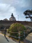
- A view of the Old Point Loma Lighthouse.
-
- Walking down the maintenance road marked for authorized vehicles only.
-
- A look up the road where the actual trail begins.
-
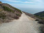
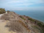
- Looking down the Bayside Trail.
-

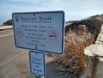
- Informational placards along the way.
-

- A nice look down to a great point break only accessible by water craft.
-

- The end of the trail looking towards Ballast Point.
-
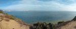
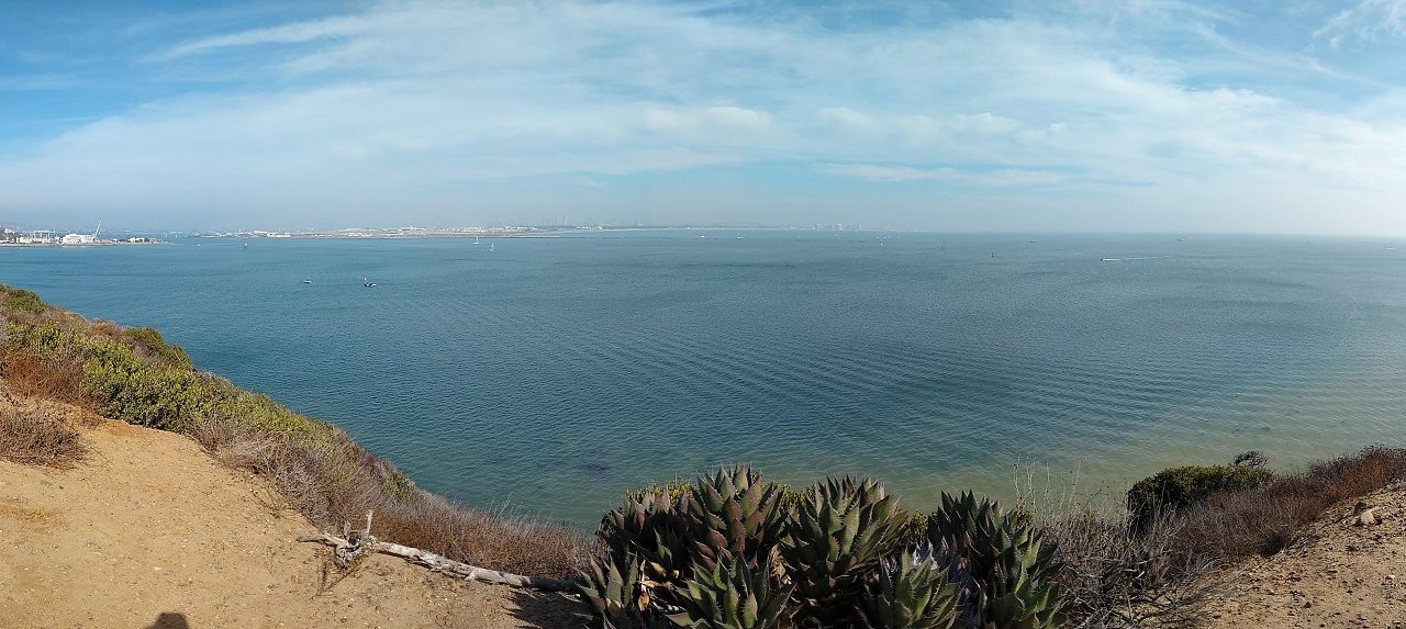
- A culmination of the views looking across San Diego Bay to downtown San Diego,Coronado, and further across southeast San Diego County and into Baja California.
Who The Bayside Trail Is For:
Advanced Hikers: This trail isn’t challenging by any means but this is a wonderful monument with a lot to learn here. If there’s time, check out the Coastal Trail on the opposite side of the monument.
Expert Hikers: Same as for advanced hikers.
It’s always a good idea to be aware of what type of hiking level you’re at.
Best Time Of Year To Hike The Bayside Trail:
During the late fall to early summer, the Pacific Ocean can make the ocean breeze a bit cool. For that reason it’s best to dress in layers. The hillsides of the trail are at their most vibrant during the spring. Rainfall revitalizes the native plant species and brings about colorful wildflowers.
Bayside Trail Conditions:
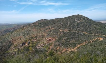
The trail will wind down one mile to halfway down the sandstone cliffs. On a clear day there will be an incredile view of the downtown San Diego and Coronado Island skylines. If it’s an active day, there will be no shortage of boats coming in and out of the bay as well as military craft coming out of the Navy Base on Coronado Island. During the winter, a rare storm can make a nice backdrop in the mountains to the sprawling suburbs of San Diego.
As for the trail itself, experienced hikers might laugh at this being called an actual trail. It is more of an old gravel road. It is however, clearly marked and full of interesting historical placards along the way down. Keep an eye out for rattlesnakes. They can cross the trail or hide in the shade along the trails edges.