
Hiking Kitchen Creek Falls Trail
There’s a very short season for waterfall viewing in San Diego County, but if one knows where to look, waterfalls can easily be found. Kitchen Creek falls is one such hike where people can view a moderately sized waterfall. This waterfall lies in the canyon of Kitchen Creek which is just north of the small town of Boulder in Pine Valley, California. Kitchen Creek is responsible for water drainage of a significant portion of the south-eastern foothills of the Laguna Mountains within the Cleveland National Forest. The beauty of Kitchen Creek is that the majority of the trail is on about two and a half miles of the famous Pacific Crest Trail (PCT).
The majority of the trail takes in the views of the foothills and canyons that surround the area. Meaning, there are no coastal or desert views from the top of a peak here. A good portion of the trail also looks down on the town of Boulder where Interstate-8 cuts through the mountains in an east to west fashion and to the south where the hills eventually run into another one of San Diego’s beautiful hikes, Corte Madera.
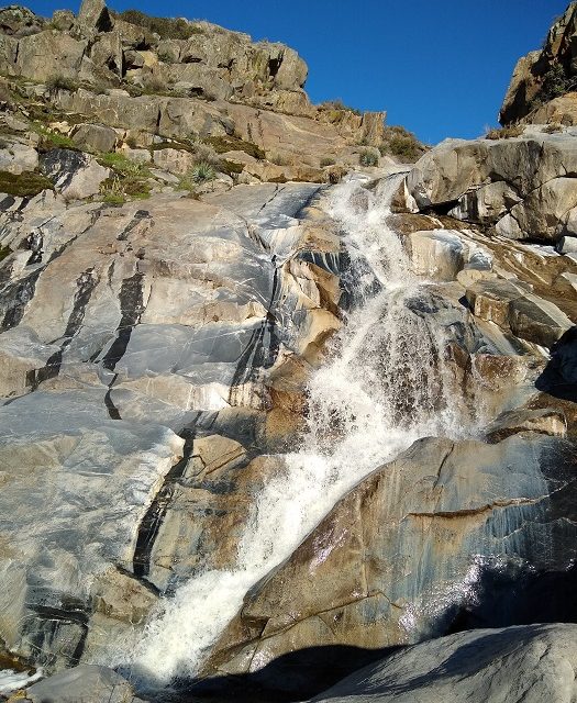
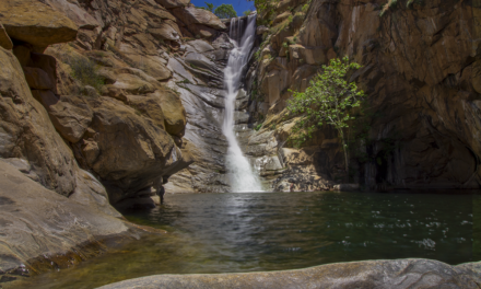
The falls themselves are a series of cascades that tumble down nearly one hundred and fifty feet. From most of my research on this trail, many people seem to go just to the small cascades rather than make the steep trek and boulder hopping to the larger waterfall that tumbles a significant distance down the plateau. There is a small yearly window to catch this waterfall at its best. For those that make the long drive from the city, the views are definitely worth it.
On A Personal Note:
The difficulty of this hike lies on the short use trail down to the falls from the PCT. The trail has an elevation loss of about two hundred feet down the side of the canyon into the creek in 0.2 miles. This decline can be slippery and difficult for some. In order to see the larger fall, there is short yet even steeper path that follows the creek to the south. This portion of the trail will require boulder hopping and is not suitable for all people.
Some people may be bothered that the southern view of this trail has a nearly constant view of Interstate-8 that runs through Pine Valley. For those looking for a trail with more views, just keep in mind that the star of this trail is the waterfall and not the surrounding area. I rated this trail as 85% difficulty strictly because of the boulder hopping required to view this waterfall. However, the majority of this hike is very simple. The views are strictly rated for the waterfall.
Looking for another hike nearby? Definitely check out the fun and slightly more challenging, Corete Madera Peak.
Do you have any updates to the hiking trail or want to share your hike/pictures? Please leave a comment below.
- Overall Difficulty: 85%
- Overall Views: 100%
Kitchen Creek Falls Trail Quick Facts:
- Elevation: 3,758 feet.
- Elevation Gain: 741 feet.
- Estimated Distance: 4.6 miles.
- My Actual Distance: 5 miles.
- Estimated Time: 2-3 hours.
- My Time: 2 hours 28 minutes moving. 3 hours 6 minutes total.
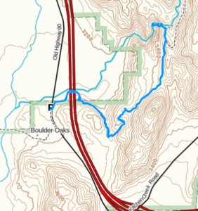
Kithcen Creek Falls Trail Directions:
Kitchen Creek Falls From The Bottom Up
Open in maps. Parking is in a small parking lot off of Old Highway 80 near Boulder Oaks Campground. If getting here involves a drive from San Diego, be aware that there is a major Border Patrol checkpoint just before exiting off the freeway. The checkpoint usually has drug sniffing dogs so nix the contraband.
Kitchen Creek Falls From The Top Down
Open in maps. These waterfalls are accessible from a top down route off of Kitchen Creek Road. The PCT runs directly through Kitchen Creek Road which is where the hike will begin. Park near the trail intersection and follow the PCT south to the falls. The only caveat is that the trail on the way out involves elevation gain.
Kitchen Creek Falls Trail Pictures:
-
- The start of Kitchen Creek Falls across from the parking lot.
-
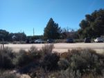
- The parking lot off of Old Highway 80
-
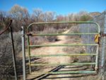
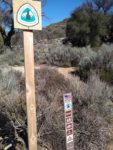
- The first gate along the PCT.
-
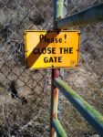
- As a reminder.
-
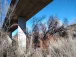
- Crossing under Interstate-8.
-
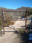
- The second gate shortly after crossing under the freeway.
-
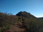
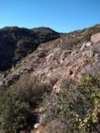
- Looking to the northeast towards the foothills of Mount Laguna.
-
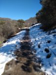
- The trail is low enough to get occasional snow.
-
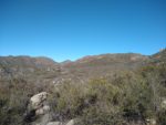
- A full view of looking to the northeast.
-
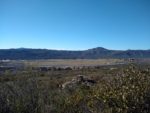
- Looking to the south towards Corte Madera. Here you can see interstate-8 and the small town of Boulder.
-
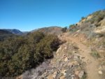
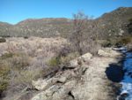
- Most of the trail is open surrounded by a mix of chaparral and some higher elevation cactus.
-
- The view of the trail the south. Just past here is the use trail to Kitchen Creek Falls.
-
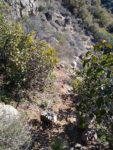
- Look for a small use trail off the PCT. It leads down a steep patch directly to Kitchen Creek.
-
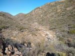
- After a short distance, Kitchen Creek comes into view.
-

- The steep path leading down to the falls. This is without a doubt the toughest part of the hike.
-
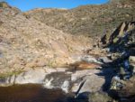
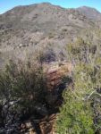
- The cascades of Kitchen Creek.
-
- Getting down to the main waterfall requires some boulder hopping and a short trail about thirty yards down Kitchen Creek.
-
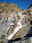
- Kitchen Creek Falls in its entirety.
-
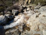
- More of the cascades.
Who Kitchen Creek Falls Trail Is For:
Advanced Hikers: This is a beautiful hike for advanced hikers. The trail is hardly taxing and the views are rewarding.
Expert Hikers: Same.
It’s always a good idea to be aware of what type of hiking level you’re at.
Best Time Of Year To Hike Kitchen Creek Falls:
This region lies along the boundary of the Sonoran desert and coastal-Mediterranean climate. The temperatures can get extremely hot during the summer and the trail should be avoided during that time. The trail is also completely exposed to the sun so wear appropriate clothing.
Kitchen Creek Falls Trail Conditions:
The trail leading to Kitchen Creek Falls is in extremely good condition with the only exception being the short 0.2 mile trek to get down into Kitchen Creek itself. The trail starts off of Old Highway 80 near the Boulder Oaks Camp Ground. The famous Pacific Crest Trail runs directly through this road where you’ll see PCT trailmakers. Head north along the PCT and under Interstate 8. You’ll pass through a duo of gates as you pass under the freeway. Remember to keep them closed after passing through.
The next two miles of trail will consist of passing north along the PCT surrounded by patches of manzanita, higher elevation cactus, and other chaparral. At around the 2.4 mile mark the PCT will make a bend around a hillside and the canyon of Kitchen Creek will come into view. Look for a diverting use trail that shoots to the west of the PCT. Follow this trail down into Kitchen Creek.
The trail down into Kitchen Creek is very steep with many lose rocks and soil. Good shoes are a must but trekking poles are optional. Once down the canyon you’ll have a full view of the cascades of Kitchen Creek Falls. Many stop at this point and take in the views and enjoy a picnic. The true gem of the falls will be about one fifty yards to the south along Kitchen Creek. This view will require navigating a steep embankment and some boulder hopping to get to the prize.Be cautious for loose and slippery rocks. Any water makes granite rather slick. This area is too dry for any poison oak. It is however the prime habitat for rattlesnakes so keep your eyes peeled for them.